Cuchilla del Caraguatá

32°05′00″S 54°54′00″W / 32.08333°S 54.9°W / -32.08333; -54.9

Cuchilla del Caraguatá maoy mga bungtod sa Urugway.[1] Nahimutang ni sa sentro nga bahin sa nasod, 300 km sa amihanan sa Montevideo ang ulohan sa nasod.

Cuchilla del Caraguatá
Cuchilla de Pereira, Cuchilla de Caraguatá, Cuchilla Caraguatá, Cuchilla Coronilla, Cuchilla de Coronilla
Mga bungtod
Nasod Flag of Uruguay Urugway
Gitas-on 136 m (446 ft)
Tiganos 32°05′00″S 54°54′00″W / 32.08333°S 54.9°W / -32.08333; -54.9
Timezone FNT (UTC-2)
 - summer (DST) ADT (UTC-3)
GeoNames 3443362

Ang klima umogon ug subtropikal.[2] Ang kasarangang giiniton 17 °C. Ang kinainitan nga bulan Enero, sa 24 °C, ug ang kinabugnawan Hulyo, sa 8 °C.[3] Ang kasarangang pag-ulan 1,881 milimetro matag tuig. Ang kinabasaan nga bulan Pebrero, sa 276 milimetro nga ulan, ug ang kinaugahan Hunyo, sa 86 milimetro.[4]

Cuchilla del Caraguatá
GRAP SA KLIMA (Giya)
JFMAMJJASOND
 
 
163
 
 
31
18
 
 
276
 
 
31
17
 
 
143
 
 
27
18
 
 
121
 
 
23
12
 
 
103
 
 
17
8
 
 
86
 
 
14
6
 
 
155
 
 
13
4
 
 
112
 
 
15
9
 
 
228
 
 
19
10
 
 
203
 
 
24
12
 
 
141
 
 
29
14
 
 
151
 
 
32
16
Kasarangang talay sa kainiton (°C)
Kadaghanon sa ulan (mm)
Tinubdan: [3]
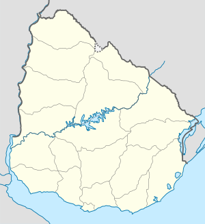
Cuchilla del Caraguatá is located in Uruguay
Cuchilla del Caraguatá
Nahimutangan sa Cuchilla del Caraguatá sa Urugway.

Ang mga gi basihan niini usba
  1. Cuchilla del Caraguatá sa Geonames.org (cc-by); post updated 2012-01-18; database download sa 2017-02-28
  2. Peel, M C; Finlayson, B L. "Updated world map of the Köppen-Geiger climate classification". Hydrology and Earth System Sciences. 11: 1633–1644. doi:10.5194/hess-11-1633-2007. Retrieved 30 Enero 2016.{{cite journal}}: CS1 maint: unflagged free DOI (link)
  3. 3.0 3.1 "NASA Earth Observations Data Set Index". NASA. Retrieved 30 Enero 2016.
  4. "NASA Earth Observations: Rainfall (1 month - TRMM)". NASA/Tropical Rainfall Monitoring Mission. Retrieved 30 Enero 2016.