Payl:Chad location map.svg

Size of this PNG preview of this SVG file: 399 x 599 ka mga piksel. Uban pang mga resoluyon: 160 x 240 ka mga piksel | 320 x 480 ka mga piksel | 512 x 768 ka mga piksel | 682 x 1,024 ka mga piksel | 1,365 x 2,048 ka mga piksel | 899 x 1,349 ka mga piksel.
Tibuok resolusyon (SVG nga payl, nominally 899 × 1,349 pixels, size sa payl: 294 KB)
Mubong sugid:
| Camera location | | View this and other nearby images on: OpenStreetMap |
|---|
| Deskripsyon |
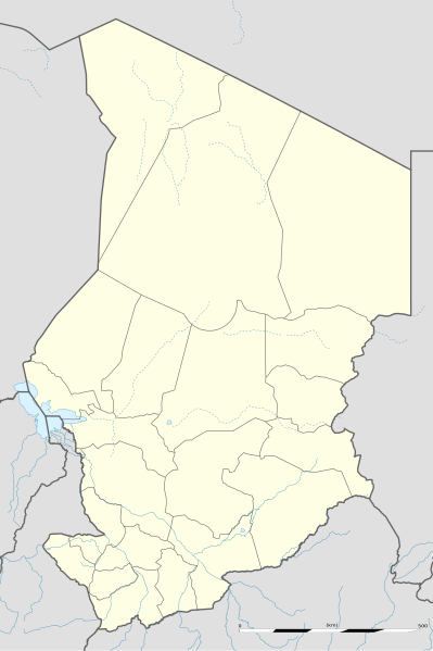
English: Blank administrative map of Chad as since the 2008-02 reform of the Regions, for geo-location purposes.
Français : Carte administrative vierge du Tchad telle que depuis la réforme des Régions de février 2008, destinée à la géolocalisation. Scale: 1:5,600,000 (precision: 1,400 m)
Geographic limits of the map:
|
||
| Petsa | 2009-11, updated 2011-07 | ||
| Gigikanan |
Kaugalingong trabaho
|
||
| Tagsulat | Eric Gaba (Sting - fr:Sting) | ||
| Pagtugot (Paggamit pag-usab niini nga file) |
|
||
| Other versions |
|

Pagtugot
I, the copyright holder of this work, hereby publish it under the following licenses:
This file is licensed under the Creative Commons Attribution-Share Alike 3.0 Unported license.
- Libre ka:
- sa pagsabwag – sa pagkopya, pag-apod-apod ug pagsabwag sa hinimo
- sa pag-remix – sa pag-adap sa binuhat
- Ubos sa mosunod nga mga kondisyon:
- atribusyon – Kinahanglan nimo nga hatagan ang angay nga kredito, maghatag usa ka link sa lisensya, ug ipakita kung adunay mga pagbag-o. Mahimo nimo kini buhaton sa bisan unsang makatarunganon nga paagi, apan dili sa bisan unsang paagi nga nagsugyot nga gi-endorso ka sa licensor o ang imong paggamit.
- share parehas – Kung imong gi-remix, gibag-o, o gibase sa materyal, kinahanglan nimo nga iapod-apod ang imong mga kontribusyon sa ilawom sa parehas o katugma nga lisensya sama sa orihinal.

|
Gitugot ang pagkopya, pag-apud-apod o/ug pag-usab ning maong dokumento ubos sa mga termino sa GNU Free Documentation License, Version 1.2 o mas bag-ong bersiyon nga gimantala sa Free Software Foundation; nga walay Invariant Sections, walay Front-Cover Texts, ug walay Back-Cover Texts. Ang kopya sa lisensiya gilakip sa bahin nga giulohang GNU Free Documentation License. |
You may select the license of your choice.
Kaagi sa payl
I-klik ang petsa/oras aron makit-an ang hulagway sa payl niadtong panahona.
| Petsa/Takna | Thumbnail | Mga dimensyon | Tiggamit | Komento | |
|---|---|---|---|---|---|
| kasamtangan | 22:26, 14 Hulyo 2011 | | 899 × 1,349 (294 KB) | Sting | Sudan/South Sudan 2011-07 border update |
| 23:28, 23 Nobiyembre 2009 |  | 899 × 1,349 (268 KB) | Sting | == {{int:filedesc}} == {{Location|15|27|00|N|18|43|30|E|scale:7000000}} <br/> {{Information |Description={{en|Blank administrative map of Chad as after the 2008-02 reform of the Regions, for geo-location purposes.}} {{fr|Carte administrative |
Mga paggamit sa payl
More than 100 pages use this file. The following list shows the first 100 pages that use this file only. A full list is available.
- Are (pagklaro)
- Ayo
- Ba (pagklaro)
- Baba
- Bahr el Ghazal
- Bala
- Bara (pagklaro)
- Baza
- Bech
- Bele
- Biti
- Bobo
- Bolo
- Bongo
- Bota
- Dagana
- Dala
- Danga
- Dembe
- Dengue
- Dim
- Dinga
- Ebe
- Gama (pagklaro)
- Ganga
- Gara
- Gimri
- Golo
- Gongo
- Grindi
- Gue
- Guele
- Gundi
- Gué
- Haa
- Howar
- Iera
- Ila
- Iro (pagklaro)
- Kabala
- Kagara
- Kala
- Kana (pagklaro)
- Kanga
- Karma
- Kassar
- Kaya
- Ke
- Kei
- Kelo
- Keri
- Khara
- Kinda
- Kiriba
- Kobo
- Koo
- Kori
- Kos
- Kose
- Lala
- Lia
- Loka (pagklaro)
- Lolo (pagklaro)
- Lom
- Mabo
- Mahama
- Malange (pagklaro)
- Manda (pagklaro)
- Mandi
- Mari
- Maria (pagklaro)
- Matari
- Mbali
- Mbango
- Mela (pagklaro)
- Molo (pagklaro)
- Mongo
- Moya (pagklaro)
- N'Djamena
- Neo
- Ngara
- Ngolo
- Noi
- Nzari
- Pala
- Pombo
- Rama (pagklaro)
- Safi
- Salama
- Saya
- Tabe
- Tabi
- Tago
- Tala
- Tama (pagklaro)
- Tari
- Tili
- Toh
- Tongo
- Tongola
View more links to this file.
Global nga paggamit sa payl
Kining ubang wiki naggamit ning maong payl:
- Paggamit sa af.wikipedia.org
- Paggamit sa am.wikipedia.org
- Paggamit sa ar.wikipedia.org
- Paggamit sa az.wikipedia.org
- Paggamit sa ba.wikipedia.org
- Paggamit sa be-tarask.wikipedia.org
- Paggamit sa be.wikipedia.org
- Paggamit sa bg.wikipedia.org
- Paggamit sa bn.wikipedia.org
- Paggamit sa bs.wikipedia.org
- Paggamit sa ce.wikipedia.org
- Paggamit sa ckb.wikipedia.org
- Paggamit sa cs.wikipedia.org
- Paggamit sa da.wikipedia.org
- Paggamit sa de.wikipedia.org
- Paggamit sa de.wikivoyage.org
- Paggamit sa el.wikipedia.org
- Paggamit sa eo.wikipedia.org
View more global usage of this file.