Payl:Cuba location map.svg

Size of this PNG preview of this SVG file: 800 x 339 ka mga piksel. Uban pang mga resoluyon: 320 x 136 ka mga piksel | 640 x 271 ka mga piksel | 1,024 x 434 ka mga piksel | 1,280 x 543 ka mga piksel | 2,560 x 1,085 ka mga piksel | 1,795 x 761 ka mga piksel.
Tibuok resolusyon (SVG nga payl, nominally 1,795 × 761 pixels, size sa payl: 310 KB)
Mubong sugid:
| Deskripsyon |
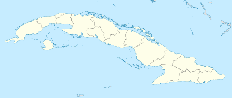
Deutsch: Positionskarte von Kuba
Quadratische Plattkarte, N-S-Streckung 105 %. Geographische Begrenzung der Karte:
English: Location map of Cuba
Equirectangular projection, N/S stretching 105 %. Geographic limits of the map:
|
||
| Petsa | |||
| Gigikanan | Kaugalingong trabaho, using United States National Imagery and Mapping Agency data | ||
| Tagsulat | NordNordWest | ||
| SVG genesis | This map was created with unknown tool.
|

Pagtugot
I, the copyright holder of this work, hereby publish it under the following licenses:

|
Gitugot ang pagkopya, pag-apud-apod o/ug pag-usab ning maong dokumento ubos sa mga termino sa GNU Free Documentation License, Version 1.2 o mas bag-ong bersiyon nga gimantala sa Free Software Foundation; nga walay Invariant Sections, walay Front-Cover Texts, ug walay Back-Cover Texts. Ang kopya sa lisensiya gilakip sa bahin nga giulohang GNU Free Documentation License. |
This file is licensed under the Creative Commons Attribution-Share Alike 3.0 Unported license.
- Libre ka:
- sa pagsabwag – sa pagkopya, pag-apod-apod ug pagsabwag sa hinimo
- sa pag-remix – sa pag-adap sa binuhat
- Ubos sa mosunod nga mga kondisyon:
- atribusyon – Kinahanglan nimo nga hatagan ang angay nga kredito, maghatag usa ka link sa lisensya, ug ipakita kung adunay mga pagbag-o. Mahimo nimo kini buhaton sa bisan unsang makatarunganon nga paagi, apan dili sa bisan unsang paagi nga nagsugyot nga gi-endorso ka sa licensor o ang imong paggamit.
- share parehas – Kung imong gi-remix, gibag-o, o gibase sa materyal, kinahanglan nimo nga iapod-apod ang imong mga kontribusyon sa ilawom sa parehas o katugma nga lisensya sama sa orihinal.
You may select the license of your choice.
Kaagi sa payl
I-klik ang petsa/oras aron makit-an ang hulagway sa payl niadtong panahona.
| Petsa/Takna | Thumbnail | Mga dimensyon | Tiggamit | Komento | |
|---|---|---|---|---|---|
| kasamtangan | 11:47, 31 Disyembre 2010 | | 1,795 × 761 (310 KB) | NordNordWest | upd |
| 19:33, 4 Septiyembre 2008 |  | 1,796 × 761 (458 KB) | NordNordWest | minor corrections at contents and graphics | |
| 20:37, 3 Septiyembre 2008 |  | 1,796 × 761 (461 KB) | NordNordWest | {{Information |Description= {{de|Positionskarte von Kuba}} Quadratische Plattkarte, N-S-Streckung 105 %. Geographische Begrenzung der Karte: * N: 23.8° N * S: 19.2° N * W: 85.2° W * O: 73.8° W {{en|Location map of Cuba}} Equi |
Mga paggamit sa payl
More than 100 pages use this file. The following list shows the first 100 pages that use this file only. A full list is available.
- Baracoa
- Cable Beach
- Cayo Puerco
- Cayos Mosquito
- Cayos Paloma
- Cerro Colorado
- Cerro La Mina
- Ciudad Sandino
- Concepción
- Concordia
- Deer Point
- Dolores
- Flamingo Cay
- Flora
- Inagua
- La Cruz
- Laguna Grande
- Laguna Seca
- Las Cuevas
- Loma
- Loma La Vigia
- Loma San Juan
- Loma San Ramón
- Loma Santa Rita
- Mariel
- Municipio de San Nicolás
- Nicholas Channel
- Playa Santo Domingo
- Punta Barranca
- Punta Colorado
- Punta Gorda
- Punta Morales
- Punta Mosquito
- Punta Rosario
- Punta San Pedro
- Punta Sardinas
- Punta Sucia
- Punta de Piedra
- Rio Aguacate
- Rio Blanco
- Rio Bongo
- Rio Canas
- Rio Chiquito
- Rio Frio
- Rio Grande
- Rio Las Mercedes
- Rio Munoz
- Rio Negro
- Rio Piedra
- Rio Piedras
- Rio San Antonio
- Rio San Jose
- Rio San Juan
- Rio Santa Cruz
- Rio Santa Rita
- Rio Seco
- Rio Soledad
- Rio Viejo
- Río Aguacate
- Río Arenas
- Río Blanco
- Río Bongo
- Río Cañas
- Río Chiquito
- Río Frío
- Río Grande
- Río Hondo
- Río Indio
- Río Las Mercedes
- Río Manzanillo
- Río Negro
- Río Piedra
- Río Piedras
- Río Punta Gorda
- Río San Antonio
- Río San Diego
- Río San José
- Río San Juan
- Río San Lorenzo
- Río Santa Ana
- Río Santa Clara
- Río Santa Cruz
- Río Seco
- Río Soledad
- Río Sábalo
- Río Viejo
- Río Yara
- Río de Agua
- Río del Medio
- San Antonio
- San Francisco
- San Nicolas
- San Nicolás
- San Rafael
- San Salvador
- Santa Lucía
- Santa Maria (pagklaro)
- Santa María (pagklaro)
- Santo Domingo
- Toro Cay
View more links to this file.
Global nga paggamit sa payl
Kining ubang wiki naggamit ning maong payl:
- Paggamit sa af.wikipedia.org
- Paggamit sa an.wikipedia.org
- Paggamit sa ar.wikipedia.org
- Paggamit sa ast.wikipedia.org
- L'Habana
- Estadiu Calixto García Íñiguez
- Santiago de Cuba
- Capitoliu de L'Habana
- Palaciu de la Revolución
- Plaza de la Revolución
- Módulu:Mapa de llocalización/datos/Cuba
- Aeropuertu Baracoa
- Aeropuertu Gustavo Rizo
- Aeropuertu Hermanos Ameijeiras
- Aeropuertu Juan Gualberto Gómez
- Aeropuertu Rafael Cabrera
- Aeropuertu de Cayo Coco
- Boca de Camarioca
- Matanzas
- Módulu:Mapa de llocalización/datos/Cuba/usu
- Santa Clara (Cuba)
- Paggamit sa az.wikipedia.org
- Paggamit sa ban.wikipedia.org
- Paggamit sa ba.wikipedia.org
- Paggamit sa be-tarask.wikipedia.org
View more global usage of this file.