Payl:Faroe Islands location map.svg

Size of this PNG preview of this SVG file: 465 x 600 ka mga piksel. Uban pang mga resoluyon: 186 x 240 ka mga piksel | 372 x 480 ka mga piksel | 595 x 768 ka mga piksel | 793 x 1,024 ka mga piksel | 1,587 x 2,048 ka mga piksel | 775 x 1,000 ka mga piksel.
Tibuok resolusyon (SVG nga payl, nominally 775 × 1,000 pixels, size sa payl: 63 KB)
Mubong sugid:
| Deskripsyon |
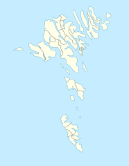
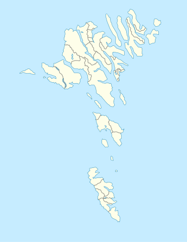
English: Location map of the Faroe Islands
Equirectangular projection, N/S stretching 213 %. Geographic limits of the map:
Deutsch: Positionskarte der Färöer
Quadratische Plattkarte, N-S-Streckung 213 %. Geographische Begrenzung der Karte:
|
| Petsa | |
| Gigikanan | Kaugalingong trabaho |
| Tagsulat | Erik Frohne |
| Other versions |
Derivative works of this file: Strandfaraskip route map.svg Municipalities of the faroe islands 2005.png |
| SVG genesis |
Pagtugot
I, the copyright holder of this work, hereby publish it under the following licenses:

|
Gitugot ang pagkopya, pag-apud-apod o/ug pag-usab ning maong dokumento ubos sa mga termino sa GNU Free Documentation License, Version 1.2 o mas bag-ong bersiyon nga gimantala sa Free Software Foundation; nga walay Invariant Sections, walay Front-Cover Texts, ug walay Back-Cover Texts. Ang kopya sa lisensiya gilakip sa bahin nga giulohang GNU Free Documentation License. |
This file is licensed under the Creative Commons Attribution-Share Alike 3.0 Unported license.
- Libre ka:
- sa pagsabwag – sa pagkopya, pag-apod-apod ug pagsabwag sa hinimo
- sa pag-remix – sa pag-adap sa binuhat
- Ubos sa mosunod nga mga kondisyon:
- atribusyon – Kinahanglan nimo nga hatagan ang angay nga kredito, maghatag usa ka link sa lisensya, ug ipakita kung adunay mga pagbag-o. Mahimo nimo kini buhaton sa bisan unsang makatarunganon nga paagi, apan dili sa bisan unsang paagi nga nagsugyot nga gi-endorso ka sa licensor o ang imong paggamit.
- share parehas – Kung imong gi-remix, gibag-o, o gibase sa materyal, kinahanglan nimo nga iapod-apod ang imong mga kontribusyon sa ilawom sa parehas o katugma nga lisensya sama sa orihinal.
You may select the license of your choice.
Kaagi sa payl
I-klik ang petsa/oras aron makit-an ang hulagway sa payl niadtong panahona.
| Petsa/Takna | Thumbnail | Mga dimensyon | Tiggamit | Komento | |
|---|---|---|---|---|---|
| kasamtangan | 13:27, 20 Disyembre 2020 | | 775 × 1,000 (63 KB) | Hanzlan | Húsar merged with Klaksvík |
| 12:58, 29 Abril 2010 |  | 775 × 1,000 (77 KB) | Erik Frohne | Removal of some borders according to http://www.us.fo/Default.aspx?ID=5497&M=News&PID=6574&NewsID=1842&CATID=29 | |
| 14:46, 7 Marso 2009 |  | 775 × 1,000 (79 KB) | Erik Frohne | {{Information |Description={{en|1=Location map of the Faroe Islands Equirectangular projection, N/S stretching 213 %. Geographic limits of the map: * N: 62.44° N * S: 61.30° N * W: 7.88° W * E: 6.00° W}} {{de|1=Positionskarte der Färöer Quadra |
Mga paggamit sa payl
More than 100 pages use this file. The following list shows the first 100 pages that use this file only. A full list is available.
- Aarberg
- Alaberg
- Blaabjerg
- Bora (pagklaro)
- Borgen
- Borá
- Buen
- Bugur
- Dala
- Dalar
- Dragin
- Gasholm
- Gulin
- Hammer
- Hamra
- Hattur
- Hornet
- Hossa
- Hove
- Husar
- Husum
- Hvidenæs
- Kambur
- Klak
- Klubben
- Kona
- Konan
- Laksa
- Laksaa
- Lambi
- Lokki
- Luka
- Mulen
- Munken
- Mykines
- Nabben
- Novin
- Nónfjall
- Núpsá
- Núpur
- Oravik
- Præstefjeld
- Ranes
- Ravan
- Risen
- Saltnes
- Sand (pagklaro)
- Sanda
- Sandur
- Sandvig
- Sandvík
- Sandá
- Sandö
- Sata
- Satan (pagklaro)
- Selnes
- Skarðsá
- Skorar
- Skálafjall
- Skálanes
- Skálavík
- Skælingur
- Sneis
- Snoppan
- Snædalur
- Snæfjall
- Solva
- Stakken
- Stakkur
- Stapi
- Steinafjall
- Stora
- Storaa
- Storavatn
- Storefjeld
- Stórafjall
- Stóragil
- Suderø
- Suggan
- Sumba (pagklaro)
- Sunda
- Svarta
- Svartá
- Sveipur
- Svina
- Svinö
- Svínadalsá
- Svíná
- Thorshavn
- Tunga (pagklaro)
- Tungá
- Tvora
- Urðarboði
- Vatnsdalsá
- Vatnsdalur
- Vatnsnes
- Vaðhorn
- Vesturdalur
- Villingadalur
- Vitin
View more links to this file.
Global nga paggamit sa payl
Kining ubang wiki naggamit ning maong payl:
- Paggamit sa af.wikipedia.org
- Paggamit sa an.wikipedia.org
- Paggamit sa ar.wikipedia.org
- Paggamit sa ast.wikipedia.org
- Paggamit sa az.wikipedia.org
- Paggamit sa ba.wikipedia.org
- Paggamit sa be-tarask.wikipedia.org
- Paggamit sa be.wikipedia.org
View more global usage of this file.