Payl:Map of South Africa with Cacadu highlighted (2011).svg

Size of this PNG preview of this SVG file: 684 x 599 ka mga piksel. Uban pang mga resoluyon: 274 x 240 ka mga piksel | 548 x 480 ka mga piksel | 876 x 768 ka mga piksel | 1,168 x 1,024 ka mga piksel | 2,337 x 2,048 ka mga piksel | 809 x 709 ka mga piksel.
Tibuok resolusyon (SVG nga payl, nominally 809 × 709 pixels, size sa payl: 498 KB)
.svg)
Mubong sugid:
| Deskripsyon |
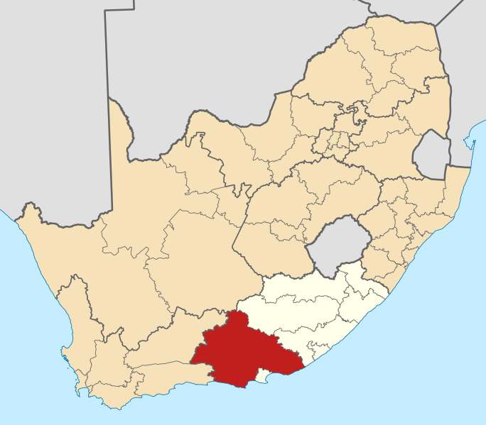
English: Map of district boundaries in South Africa, as they will be after the municipal elections of 18 May 2011, with the w:Cacadu District Municipality highlighted in red within the Eastern Cape in yellow. |
| Petsa | |
| Gigikanan | Kaugalingong trabaho |
| Tagsulat | Htonl |
Pagtugot
I, the copyright holder of this work, hereby publish it under the following licenses:

|
Gitugot ang pagkopya, pag-apud-apod o/ug pag-usab ning maong dokumento ubos sa mga termino sa GNU Free Documentation License, Version 1.2 o mas bag-ong bersiyon nga gimantala sa Free Software Foundation; nga walay Invariant Sections, walay Front-Cover Texts, ug walay Back-Cover Texts. Ang kopya sa lisensiya gilakip sa bahin nga giulohang GNU Free Documentation License. |
This file is licensed under the Creative Commons Attribution-Share Alike Attribution-Share Alike 4.0 International, 3.0 Unported, 2.5 Generic, 2.0 Generic and 1.0 Generic license.
- Libre ka:
- sa pagsabwag – sa pagkopya, pag-apod-apod ug pagsabwag sa hinimo
- sa pag-remix – sa pag-adap sa binuhat
- Ubos sa mosunod nga mga kondisyon:
- atribusyon – Kinahanglan nimo nga hatagan ang angay nga kredito, maghatag usa ka link sa lisensya, ug ipakita kung adunay mga pagbag-o. Mahimo nimo kini buhaton sa bisan unsang makatarunganon nga paagi, apan dili sa bisan unsang paagi nga nagsugyot nga gi-endorso ka sa licensor o ang imong paggamit.
- share parehas – Kung imong gi-remix, gibag-o, o gibase sa materyal, kinahanglan nimo nga iapod-apod ang imong mga kontribusyon sa ilawom sa parehas o katugma nga lisensya sama sa orihinal.
You may select the license of your choice.
Kaagi sa payl
I-klik ang petsa/oras aron makit-an ang hulagway sa payl niadtong panahona.
| Petsa/Takna | Thumbnail | Mga dimensyon | Tiggamit | Komento | |
|---|---|---|---|---|---|
| kasamtangan | 13:59, 2 Mayo 2011 | | 809 × 709 (498 KB) | Htonl | == Summary == {{Information |Description ={{en|1=Map of district boundaries in South Africa, as they will be after the municipal elections of 18 May 2011, with the w:Cacadu District Municipality highligh |
Mga paggamit sa payl
Ang mosunod nga mga panid misumpay niining payl:
Global nga paggamit sa payl
Kining ubang wiki naggamit ning maong payl:
- Paggamit sa af.wikipedia.org
- Nieu-Bethesda
- Grahamstad
- Bathurst, Oos-Kaap
- Port Alfred
- Graaff-Reinet
- Aberdeen, Oos-Kaap
- Adendorp
- Somerset-Oos
- Joubertina
- Boesmansriviermond
- Humansdorp
- Willowmore
- Pearston
- Riebeek-Oos
- Jansenville
- Steytlerville
- Hankey
- Patensie
- Kookhuis
- Jeffreysbaai
- Kareedouw
- Klipplaat
- Kirkwood
- Alicedale
- Kruisfontein
- Paterson
- Stormsrivier, Oos-Kaap
- Loerie
- Kendrew
- Kenton-on-Sea
- Alexandria, Oos-Kaap
- Stormsrivier
- Addo
- Louterwater
- Krakeelrivier (dorpie)
- Salem, Oos-Kaap
- St. Francisbaai
- Clarkson
- Thornham
- Coldstream
- Rietbron
- Misgund
- Tweeriviere
- Kaap St Francis
- Oesterbaai
- Sjabloonbespreking:Suid-Afrikaanse distriksmunisipaliteit navbox
- Cannon Rocks
- Boknesstrand
- Kasouga
- Thornhill, Kouga
View more global usage of this file.
.svg)
.svg)