Payl:Marmot-edit1.jpg

Gidak-on ning maong paunang tan-aw: 800 x 600 ka mga piksel. Uban pang mga resoluyon: 320 x 240 ka mga piksel | 640 x 480 ka mga piksel | 1,024 x 768 ka mga piksel | 1,280 x 960 ka mga piksel | 2,272 x 1,704 ka mga piksel.
Tibuok resolusyon (2,272 × 1,704 pixels, size sa payl: 1.91 MB, MIME type: image/jpeg)
Mubong sugid:
| Deskripsyon |
العربية: مرموطٌ أصفر البطن على قمَّة جبل دانا، في مُنتزه يوسيميتي الوطني في كاليفورنيا. الطريق الظاهرة في الخلفيَّة هي طريق معبر تايوگا.
Deutsch: Murmeltier auf dem Mount Dana, Yosemite, Kalifornien, USA.
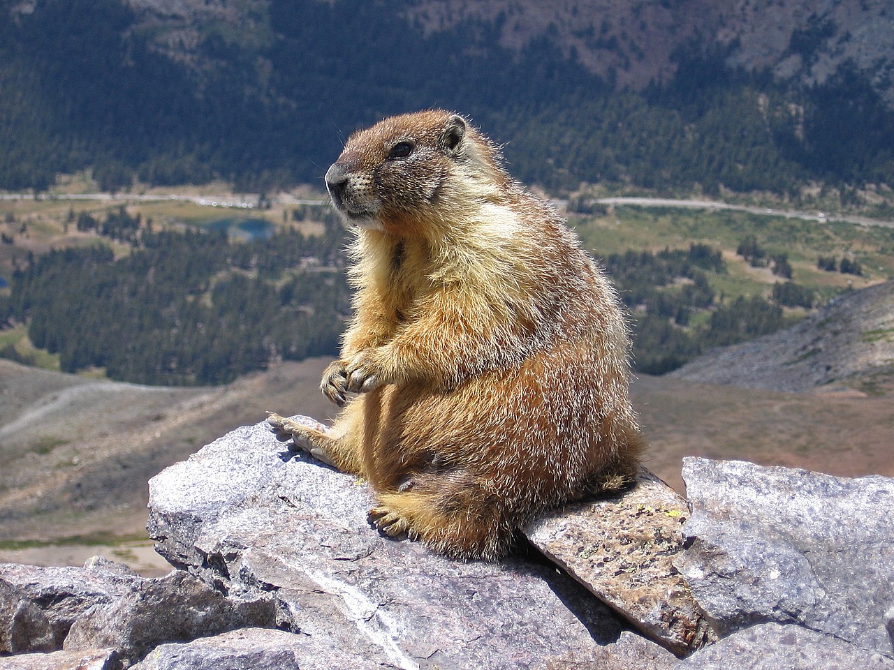
English: A marmot on top of Mount Dana, Yosemite, CA, USA. The road in the background is Tioga Pass Road.
Español: Marmota (Marmota flaviventris) en la cumbre del Monte Dana, Yosemite, California, Estados Unidos. En el fondo, la carretera a Tioga Pass.
Polski: Świstak żółtobrzuchy (Marmota flaviventris) na szczycie góry Mount Dana w Parku Narodowym Yosemite, w stanie Kalifornia, w USA. W tle widoczna jest droga Tioga Pass Road.
Čeština: Svišť žlutobřichý (Marmota flaviventris) sedící na vrcholku hory Mount Dana v Yosemitském národním parku, Kalifornie, USA.
Français : Une marmote charnue au sommet du Mont Dana, parc Yosemite, Californie, Etats-Unis. La route en fond est celle du col Tioga
Magyar: Sárgahasú mormota (Marmota flaviventris) a Mount Dana csúcsán. A háttérben a Tioga Pass Road (Yosemite Nemzeti Park, Kalifornia, Amerikai Egyesült Államok)
Italiano: Una marmotta in cima al Monte Dana, Parco nazionale di Yosemite, CA, USA. La strada sullo sfondo è la Tioga Pass Road
Македонски: Мрмот во националниот парк Јосемити, Калифорнија, САД.
Nederlands: Geelbuikmarmot (Marmota flaviventris) op de top van Mount Dana in Yosemite National Park in de Amerikaanse staat Californië
Português: Marmota (Marmota flaviventris) no cume do Monte Dana, Parque Nacional de Yosemite, Califórnia, Estados Unidos.
中文:美国加利福尼亚州约塞米蒂山达纳山上的土拨鼠。图中背景的道路是Tioga通道。 |
| Petsa | Taken on 2 Agosto 2007 |
| Gigikanan |
This file was derived from: Marmot on rocks.jpg |
| Tagsulat | |
| Other versions |
Sharpened and curve adjustment of the original: |

| Camera location | | View this and other nearby images on: OpenStreetMap |
|---|

Assessment
This image was selected as picture of the day on Wikimedia Commons for 2 February 2018. It was captioned as follows: English: A marmot seen on top of Mount Dana, Yosemite, CA, USA. The road in the background is Tioga Pass Road Other languages:
Čeština: Svišť žlutobřichý (Marmota flaviventris) sedící na vrcholku hory Mount Dana v Yosemitském národním parku, Kalifornie, USA. English: A marmot seen on top of Mount Dana, Yosemite, CA, USA. The road in the background is Tioga Pass Road Español: Marmota (Marmota flaviventris) en la cumbre del Monte Dana, Yosemite, California, Estados Unidos. En el fondo, la carretera a Tioga Pass. Français : Une marmote charnue au sommet du Mont Dana, parc Yosemite, Californie, Etats-Unis. La route en fond est celle du col Tioga Italiano: Una marmotta in cima al Monte Dana, Parco nazionale di Yosemite, CA, USA. La strada sullo sfondo è la Tioga Pass Road Magyar: Sárgahasú mormota (Marmota flaviventris) a Mount Dana csúcsán. A háttérben a Tioga Pass Road (Yosemite Nemzeti Park, Kalifornia, Amerikai Egyesült Államok) Nederlands: Geelbuikmarmot (Marmota flaviventris) op de top van Mount Dana in Yosemite National Park in de Amerikaanse staat Californië Polski: Świstak żółtobrzuchy (Marmota flaviventris) na szczycie góry Mount Dana w Parku Narodowym Yosemite, w stanie Kalifornia, w USA. W tle widoczna jest droga Tioga Pass Road. Português: Marmota (Marmota flaviventris) no cume do Monte Dana, Parque Nacional de Yosemite, Califórnia, Estados Unidos. Македонски: Мрмот во националниот парк Јосемити, Калифорнија, САД. 中文: 美国加利福尼亚州约塞米蒂山达纳山上的土拨鼠。图中背景的道路是Tioga通道。 |
|
Pagtugot
Inklein from en.wikipedia.org, the copyright holder of this work, hereby publishes it under the following license:

|
Gitugot ang pagkopya, pag-apud-apod o/ug pag-usab ning maong dokumento ubos sa mga termino sa GNU Free Documentation License, Version 1.2 o mas bag-ong bersiyon nga gimantala sa Free Software Foundation; nga walay Invariant Sections, walay Front-Cover Texts, ug walay Back-Cover Texts. Ang kopya sa lisensiya gilakip sa bahin nga giulohang GNU Free Documentation License. |
| This file is licensed under the Creative Commons Attribution-Share Alike 3.0 Unported license. | ||
| Attribution: Inklein | ||
| ||
| This licensing tag was added to this file as part of the GFDL licensing update. |
Kaagi sa payl
I-klik ang petsa/oras aron makit-an ang hulagway sa payl niadtong panahona.
| Petsa/Takna | Thumbnail | Mga dimensyon | Tiggamit | Komento | |
|---|---|---|---|---|---|
| kasamtangan | 10:07, 3 Septiyembre 2007 | | 2,272 × 1,704 (1.91 MB) | Jjron | {{Information |Description= A marmot seen on top of Mount Dana, Yosemite, CA, USA. The road in the background is Tioga Pass Road. (Edited version of original: sharpened and curve adjustment by jjron |Source= English Wikipedia |Date=2 Septe |
Mga paggamit sa payl
Ang mosunod nga 2 panid misumpay niining payl:
Global nga paggamit sa payl
Kining ubang wiki naggamit ning maong payl:
- Paggamit sa ar.wikipedia.org
- مرموط
- مرموط أصفر البطن
- ويكيبيديا:صور مختارة/حيوانات/ثدييات
- بوابة:قوارض/صورة مختارة/أرشيف
- بوابة:قوارض/صورة مختارة/12
- ويكيبيديا:ترشيحات الصور المختارة/مرموط جالس
- ويكيبيديا:صورة اليوم المختارة/أكتوبر 2019
- قالب:صورة اليوم المختارة/2019-10-19
- ويكيبيديا:صورة اليوم المختارة/أغسطس 2021
- قالب:صورة اليوم المختارة/2021-08-09
- Paggamit sa arz.wikipedia.org
- Paggamit sa ast.wikipedia.org
- Paggamit sa avk.wikipedia.org
- Paggamit sa az.wikipedia.org
- Paggamit sa be-tarask.wikipedia.org
- Paggamit sa bg.wikipedia.org
- Paggamit sa bo.wikipedia.org
- Paggamit sa br.wikipedia.org
- Paggamit sa ca.wikipedia.org
- Paggamit sa crh.wikipedia.org
- Paggamit sa cs.wikipedia.org
- Paggamit sa cv.wikipedia.org
- Paggamit sa de.wikipedia.org
- Paggamit sa de.wiktionary.org
- Paggamit sa el.wikipedia.org
- Paggamit sa en.wikipedia.org
- Ground squirrel
- Bibliography of the Sierra Nevada
- Yellow-bellied marmot
- Talk:Marmot
- User:Inklein
- User talk:Inklein
- Wikipedia:Featured pictures/Animals/Mammals
- Wikipedia:Featured pictures thumbs/08
- List of mammals of Canada
- Wikipedia:Featured picture candidates/September-2007
- Wikipedia:Featured picture candidates/Marmot
- Wikipedia:Wikipedia Signpost/2007-09-10/Features and admins
- Wikipedia:Wikipedia Signpost/2007-09-10/SPV
- User talk:Jjron/Archive 2
- Wikipedia:Picture of the day/December 2007
- Template:POTD/2007-12-26
- Portal:Mammals/Selected pictures
- Portal:Mammals/Selected pictures/9
- User:Bigfathairymarmot
- User talk:Marmy mappy
- User:Tris Wilson
View more global usage of this file.