Payl:Somalia location map.svg

Size of this PNG preview of this SVG file: 471 x 600 ka mga piksel. Uban pang mga resoluyon: 188 x 240 ka mga piksel | 377 x 480 ka mga piksel | 603 x 768 ka mga piksel | 804 x 1,024 ka mga piksel | 1,609 x 2,048 ka mga piksel | 1,051 x 1,338 ka mga piksel.
Tibuok resolusyon (SVG nga payl, nominally 1,051 × 1,338 pixels, size sa payl: 171 KB)
Mubong sugid:
| Camera location | | View this and other nearby images on: OpenStreetMap |
|---|
| Deskripsyon |
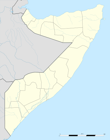
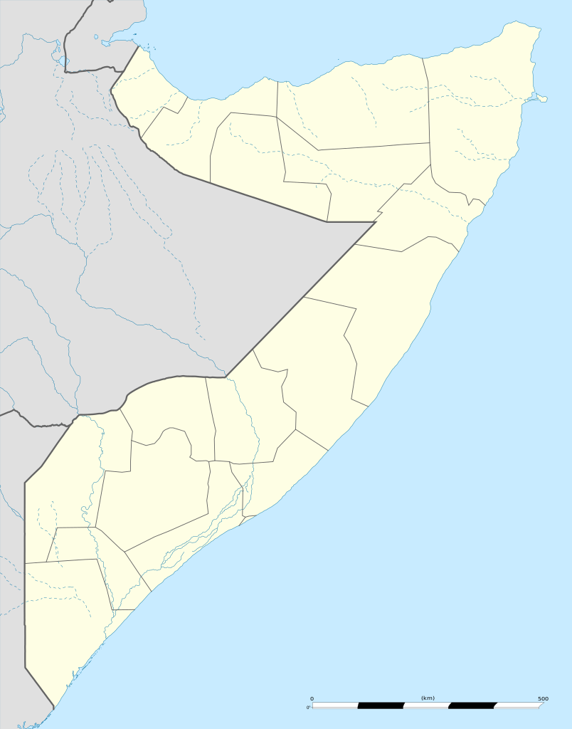
English: Blank administrative map of Somalia, for geo-location purposes.
Français : Carte administrative vierge de la Somalie, destinée à la géolocalisation. Scale: 1:4,800,000 (precision: 1,200 m)
Geographic limits of the map:
|
||
| Petsa | |||
| Gigikanan |
Kaugalingong trabaho
|
||
| Tagsulat | Eric Gaba (Sting - fr:Sting) | ||
| Pagtugot (Paggamit pag-usab niini nga file) |
|
||
| Other versions |
|

.svg)

.jpg)
Pagtugot
I, the copyright holder of this work, hereby publish it under the following licenses:
This file is licensed under the Creative Commons Attribution-Share Alike 3.0 Unported license.
- Libre ka:
- sa pagsabwag – sa pagkopya, pag-apod-apod ug pagsabwag sa hinimo
- sa pag-remix – sa pag-adap sa binuhat
- Ubos sa mosunod nga mga kondisyon:
- atribusyon – Kinahanglan nimo nga hatagan ang angay nga kredito, maghatag usa ka link sa lisensya, ug ipakita kung adunay mga pagbag-o. Mahimo nimo kini buhaton sa bisan unsang makatarunganon nga paagi, apan dili sa bisan unsang paagi nga nagsugyot nga gi-endorso ka sa licensor o ang imong paggamit.
- share parehas – Kung imong gi-remix, gibag-o, o gibase sa materyal, kinahanglan nimo nga iapod-apod ang imong mga kontribusyon sa ilawom sa parehas o katugma nga lisensya sama sa orihinal.

|
Gitugot ang pagkopya, pag-apud-apod o/ug pag-usab ning maong dokumento ubos sa mga termino sa GNU Free Documentation License, Version 1.2 o mas bag-ong bersiyon nga gimantala sa Free Software Foundation; nga walay Invariant Sections, walay Front-Cover Texts, ug walay Back-Cover Texts. Ang kopya sa lisensiya gilakip sa bahin nga giulohang GNU Free Documentation License. |
You may select the license of your choice.
Kaagi sa payl
I-klik ang petsa/oras aron makit-an ang hulagway sa payl niadtong panahona.
| Petsa/Takna | Thumbnail | Mga dimensyon | Tiggamit | Komento | |
|---|---|---|---|---|---|
| kasamtangan | 12:12, 25 Nobiyembre 2009 | | 1,051 × 1,338 (171 KB) | Sting | == {{int:filedesc}} == {{Location|5|10|30|N|46|12|00|E|scale:7000000}} <br/> {{Information |Description={{en|Blank administrative map of Somalia, for geo-location purposes.}} {{fr|Carte administrative vierge de la Somalie, |
Mga paggamit sa payl
There are no pages that use this file.
Global nga paggamit sa payl
Kining ubang wiki naggamit ning maong payl:
- Paggamit sa af.wikipedia.org
- Paggamit sa als.wikipedia.org
- Paggamit sa an.wikipedia.org
- Paggamit sa ar.wikipedia.org
- Paggamit sa ast.wikipedia.org
- Paggamit sa azb.wikipedia.org
- Paggamit sa be-tarask.wikipedia.org
- Paggamit sa be.wikipedia.org
- Paggamit sa bg.wikipedia.org
- Paggamit sa bn.wikipedia.org
- Paggamit sa bs.wikipedia.org
- Paggamit sa ca.wikipedia.org
- Paggamit sa cs.wikipedia.org
- Paggamit sa da.wikipedia.org
- Paggamit sa de.wikipedia.org
View more global usage of this file.