Payl:USA Hawaii island chain location map.svg

Tibuok resolusyon (SVG nga payl, nominally 1,476 × 837 pixels, size sa payl: 33 KB)
Mubong sugid:
| Deskripsyon |
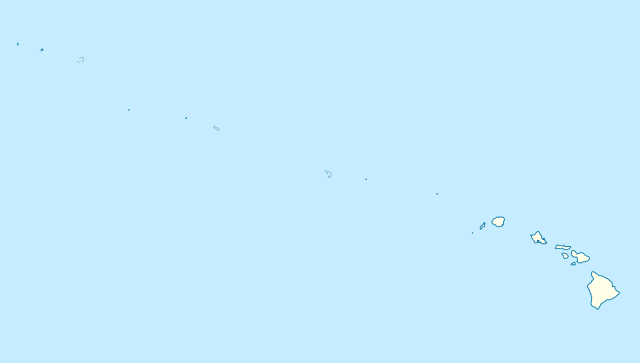
Quadratische Plattkarte, N-S-Streckung 109 %. Geographische Begrenzung der Karte:
Equirectangular projection, N/S stretching 109 %. Geographic limits of the map:
|
|
| Petsa | ||
| Gigikanan |
Kaugalingong trabaho, using
|
|
| Tagsulat | NordNordWest | |
| Pagtugot (Paggamit pag-usab niini nga file) |
This file is licensed under the Creative Commons Attribution-Share Alike 3.0 Germany license.
 This file is licensed under the Creative Commons Attribution-Share Alike 3.0 Germany license.
|


|
This map has been made or improved in the German Kartenwerkstatt (Map Lab). You can propose maps to improve as well.
|
Kaagi sa payl
I-klik ang petsa/oras aron makit-an ang hulagway sa payl niadtong panahona.
| Petsa/Takna | Thumbnail | Mga dimensyon | Tiggamit | Komento | |
|---|---|---|---|---|---|
| kasamtangan | 17:24, 14 Oktubre 2012 | | 1,476 × 837 (33 KB) | NordNordWest | Reverted to version as of 18:31, 13 November 2009; grey lines are reefs, not islands |
| 00:10, 14 Oktubre 2012 |  | 1,476 × 837 (33 KB) | Grolltech | more consistent line weights and colors | |
| 18:31, 13 Nobiyembre 2009 |  | 1,476 × 837 (33 KB) | NordNordWest | {{int:filedesc}} {{Information |Description= {{de|Positionskarte der gesamten Inselkette Hawaii, USA}} Quadratische Plattkarte, N-S-Streckung 109 %. Geographische Begrenzung der Karte: * N: 30° N * S: 17° N * W: 179° W * O: 1 |
Mga paggamit sa payl
More than 100 pages use this file. The following list shows the first 100 pages that use this file only. A full list is available.
- Kahoma Ditch
- Kahua Ditch
- Kahului Airport
- Kailua Ditch
- Kalaupapa Airport
- Kaluanui Ditch
- Kama Ditch
- Kamananui Ditch
- Kamenehune Ditch
- Kamooloa Ditch
- Kanaha Ditch
- Kaneha Ditch
- Kapahi Ditch
- Kapalua Airport
- Kapālama Drainage Canal
- Kaua‘ula Ditch
- Kauhikoa Ditch (kanal sa Tinipong Bansa, lat 20,84, long -156,37)
- Kauhikoa Ditch (kanal sa Tinipong Bansa, lat 20,86, long -156,36)
- Kawainui Canal
- Kawano Ditch
- Kawela Intake
- Ka‘ula
- Kehena Ditch
- Kekaha Airstrip
- Kekaha Ditch
- Kelana Ditch
- Kemoo Ditch Tunnel
- Keālia Ditch
- Kipapa (kanal sa Tinipong Bansa)
- Kittery Island (pulo sa Tinipong Bansa, Hawaii)
- Kohala Ditch
- Kona International Airport
- Ko‘olau Ditch (kanal sa Tinipong Bansa, Honolulu County)
- Ko‘olau Ditch (kanal sa Tinipong Bansa, Kauai County)
- Ko‘olau Ditch (kanal sa Tinipong Bansa, Maui County)
- Kuna Ditch
- Kure Atoll
- Kōke‘e Ditch
- Kōloa Ditch
- Kō‘ula Ditch
- Lahaina Pump Ditch
- Lahaina Pump Ditch 2
- Lahainaluna Ditch
- Lalakea Ditch
- Lanai Airport
- Launiupoko Ditch
- Lawrence Ditch (kanal sa Tinipong Bansa, Hawaii)
- Laysan Island
- Lihue Airport
- Lihue Ditch
- Lisianski Island
- Little North Island (pulo sa Tinipong Bansa)
- Lower Anahola Ditch
- Lower Hamakua Ditch
- Lower Līhu‘e Ditch
- Lowrie (kanal sa Tinipong Bansa, lat 20,90, long -156,23)
- Lowrie (kanal sa Tinipong Bansa, lat 20,92, long -156,27)
- Lowrie Ditch
- Maiakii Ditch
- Makaleha Ditch
- Manohua
- Manuel Luis Ditch
- Maunawili Ditch
- McCandless Ditch
- Mikilua Flume
- Millers Peak
- Mimino Ditch
- Moikeha Canal
- Molokai Airport
- Mountain View Airstrip
- Mo‘ole Ditch
- Mākila Reservoir Ditch
- Mānoa Palolo Drainage Canal
- Necker Island (pulo sa Tinipong Bansa)
- New Hāmākua Ditch
- Nihoa (pulo sa Tinipong Bansa)
- North Intake Ditch
- North Island (pulo sa Tinipong Bansa, Hawaii)
- North Kona Water System
- North Wailua Ditch
- Northwest Cape (punta sa Tinipong Bansa, Hawaii)
- Northwestern Hawaiian Islands
- Nāhiku Ditch
- Nākeiki‘elima
- Old Ahern Ditch
- Old Hamakua Ditch
- Olokele Ditch
- Olowalu Ditch
- Pahala Airstrip
- Pahoa Landing Strip
- Palolo Ditch
- Panda Airport
- Paupau Ditch
- Pearl and Hermes Atoll
- Peekauai Ditch
- Peleau Airport
- Pepeekeo Airstrip
- Piilani Ditch
- Pilani Ditch
- Poowaiomahaihai Ditch
View more links to this file.
Global nga paggamit sa payl
Kining ubang wiki naggamit ning maong payl:
- Paggamit sa ar.wikipedia.org
- Paggamit sa az.wikipedia.org
- Paggamit sa be.wikipedia.org
- Paggamit sa bn.wikipedia.org
- Paggamit sa ce.wikipedia.org
- Paggamit sa de.wikipedia.org
- Midwayinseln
- Kure-Atoll
- Nihoa
- Necker Island (Hawaii)
- Laysan
- French Frigate Shoals
- Gardner Pinnacles
- Pearl-und-Hermes-Atoll
- Lisianski
- Maro Reef
- Neva Shoals
- La Perouse Pinnacle
- Wikipedia:Kartenwerkstatt/Positionskarten/Nordamerika
- Krusenstern-Riff
- Vorlage:Positionskarte USA Hawaii gesamt
- Tanager Peak
- Green Island (Hawaii)
- East Island (Hawaii)
- Paggamit sa en.wikipedia.org
- Paggamit sa eo.wikipedia.org
- Paggamit sa fa.wikipedia.org
- Paggamit sa frr.wikipedia.org
- Paggamit sa fr.wikipedia.org
View more global usage of this file.