Broye-Vully District
Paghimo ni bot Lsjbot. |
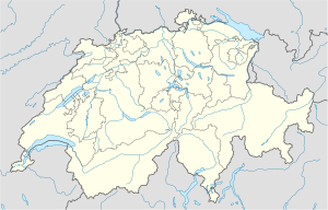
Distrito ang Broye-Vully District (Prinanses: District de la Broye-Vully) sa Nasod nga Swiss.[1] Nahimutang ni sa kanton sa Canton de Vaud, sa kasadpang bahin sa nasod, 50 km sa kasadpan sa Bern ang ulohan sa nasod. Adunay 38,418 ka molupyo.[1] Naglangkob kin og 265 ka kilometro kwadrado. Broye-Vully District mopakigbahin sa usa ka utlanan sa Jura-Nord vaudois District, Gros-de-Vaud District, ug Lavaux-Oron District.
| Broye-Vully District (District de la Broye-Vully) | |
| Distrito | |
| Nasod | |
|---|---|
| Kanton | Canton de Vaud |
| Gitas-on | 471 m (1,545 ft) |
| Tiganos | 46°46′51″N 6°54′06″E / 46.78082°N 6.90161°E |
| Area | 264.98 km2 (102 sq mi) |
| Population | 38,418 (2014-11-13) [1] |
| Density | 145 / km2 (376 / sq mi) |
| Timezone | CET (UTC+1) |
| - summer (DST) | CEST (UTC+2) |
| GeoNames | 7285002 |
Ang yuta sa Broye-Vully District kabungtoran sa habagatang-kasadpan, apan sa amihang-sidlakan nga kini mao ang patag.[saysay 1]
Broye-Vully District may sa mosunod nga mga subdibisyon:
- Avenches
- Brenles
- Bussy-sur-Moudon
- Carrouge
- Champtauroz
- Chavannes-sur-Moudon
- Chesalles-sur-Moudon
- Chevroux
- Corcelles-le-Jorat
- Corcelles-près-Payerne
- Cremin
- Cudrefin
- Curtilles
- Dompierre
- Faoug
- Forel-sur-Lucens
- Grandcour
- Henniez
- Hermenches
- Lovatens
- Lucens
- Missy
- Moudon
- Payerne
- Prévonloup
- Ropraz
- Rossenges
- Sarzens
- Syens
- Trey
- Treytorrens
- Valbroye
- Villars-le-Comte
- Villarzel
- Vucherens
- Vulliens
- Vully-les-Lacs
Ang klima hemiboreal.[3] Ang kasarangang giiniton 8 °C. Ang kinainitan nga bulan Hulyo, sa 20 °C, ug ang kinabugnawan Enero, sa −4 °C.[4] Ang kasarangang pag-ulan 1,743 milimetro matag tuig. Ang kinabasaan nga bulan Hulyo, sa 213 milimetro nga ulan, ug ang kinaugahan Marso, sa 60 milimetro.[5]
| ||||||||||||||||||||||||||||||||||||||||||||||||||||||||||||||||||||||||||||||||||||||||||||||||||||||||||||||||||||||||||||
Saysay usba
Ang mga gi basihan niini usba
- ↑ 1.0 1.1 1.2 Broye-Vully District sa GeoNames.Org (cc-by); post updated 2014-11-13; database download sa 2016-01-03
- ↑ "Viewfinder Panoramas Digital elevation Model". 2015-06-21.
- ↑ Peel, M C; Finlayson, B L. "Updated world map of the Köppen-Geiger climate classification". Hydrology and Earth System Sciences. 11: 1633–1644. doi:10.5194/hess-11-1633-2007. Retrieved 30 Enero 2016.
{{cite journal}}: CS1 maint: unflagged free DOI (link) - ↑ 4.0 4.1 "NASA Earth Observations Data Set Index". NASA. Retrieved 30 Enero 2016.
- ↑ "NASA Earth Observations: Rainfall (1 month - TRMM)". NASA/Tropical Rainfall Monitoring Mission. Retrieved 30 Enero 2016.
Gikan sa gawas nga tinubdan usba
| Aduna'y mga payl ang Wikimedia Commons nga may kalabotan sa artikulong: Broye-Vully District. |
