Lucerne-Land District : Kalainan tali sa mga rebisyon
Content deleted Content added
Paghimo ni bot Swisa |
(No difference)
|
Rebisyon niadtong 07:26, 17 Marso 2016
Paghimo ni bot Lsjbot. |
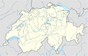
Lucerne-Land District (Inaleman: Wahlkreis Luzern-Land) maoy distrito sa Swisa.[1] Ang Lucerne-Land District nahimutang sa kanton sa Kanton Luzern, sa sentro nga bahin sa nasod, 60 km sa sidlakan sa ulohang dakbayan Bern. Adunay 97,232 ka molupyo.[1]
| Lucerne-Land District (Wahlkreis Luzern-Land) | |
| Distrito | |
| Nasod | |
|---|---|
| Kanton | Kanton Luzern |
| Gitas-on | 523 m (1,716 ft) |
| Tiganos | 47°02′26″N 8°17′34″E / 47.04046°N 8.29271°E |
| Population | 97,232 (2014-11-13) [1] |
| Timezone | CET (UTC+1) |
| - summer (DST) | CEST (UTC+2) |
| GeoNames | 8718162 |
Ang temperatura promedyo 6 °C. Ang labing mainit nga bulan mao Hulyo, sa 18 °C, ug ang labing bugnaw nga bulan mao Disyembre, sa −6 °C.[2] Ang pag-ulan promedyo 2,465 milimetro matag tuig. Ang labing ulanon nga bulan mao Nobiyembre, sa 347 milimetro sa ulan, ug ang labing uga nga bulan mao Marso, sa 113 milimetro sa ulan.[3]
Ang mga gi basihan niini
- ↑ 1.0 1.1 1.2 Lucerne-Land District sa GeoNames.Org (cc-by); post updated 2014-11-13; database download sa 2016-01-03
- ↑ "NASA Earth Observations Data Set Index". NASA. Retrieved 30 Enero 2016.
- ↑ "NASA Earth Observations: Rainfall (1 month - TRMM)". NASA/Tropical Rainfall Monitoring Mission. Retrieved 30 Enero 2016.
