Payl:Abraham Ortelius Map of Europe.jpg

Gidak-on ning maong paunang tan-aw: 800 x 584 ka mga piksel. Uban pang mga resoluyon: 320 x 234 ka mga piksel | 640 x 467 ka mga piksel | 1,024 x 748 ka mga piksel | 1,280 x 935 ka mga piksel | 2,691 x 1,965 ka mga piksel.
Tibuok resolusyon (2,691 × 1,965 pixels, size sa payl: 5.92 MB, MIME type: image/jpeg)
Mubong sugid:
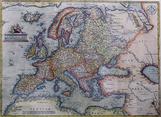
Hand-coloured copper engraving.
| Deskripsyon | Map of Europe | |||||||||||||||||||||||
| Petsa | 1570 - 1609 | |||||||||||||||||||||||
| Gigikanan | Orteliusmaps.com | |||||||||||||||||||||||
| Tagsulat |
|
|||||||||||||||||||||||
| Other versions |
Donaldheat.com Orteliusmaps.com a Orteliusmaps.com b Orteliusmaps.com c Orteliusmaps.com d Orteliusmaps.com e |
|||||||||||||||||||||||

Pagtugot
|
This is a faithful photographic reproduction of a two-dimensional, public domain work of art. The work of art itself is in the public domain for the following reason:
The official position taken by the Wikimedia Foundation is that "faithful reproductions of two-dimensional public domain works of art are public domain".
This photographic reproduction is therefore also considered to be in the public domain in the United States. In other jurisdictions, re-use of this content may be restricted; see Reuse of PD-Art photographs for details. | ||||
Kaagi sa payl
I-klik ang petsa/oras aron makit-an ang hulagway sa payl niadtong panahona.
| Petsa/Takna | Thumbnail | Mga dimensyon | Tiggamit | Komento | |
|---|---|---|---|---|---|
| kasamtangan | 00:38, 12 Agosto 2021 | | 2,691 × 1,965 (5.92 MB) | RafalZero7 | Cropped 2 % horizontally, 3 % vertically using CropTool with precise mode. |
| 09:17, 1 Abril 2011 |  | 2,749 × 2,017 (5.51 MB) | Joop Rotte | {{Information |Description= |Source= |Date= |Author= |Permission= |other_versions= }}http://www.orteliusmaps.com/highresolution/6092_96.htm | |
| 10:34, 24 Enero 2006 |  | 629 × 468 (287 KB) | AndreasPraefcke | Abraham Ortelius: Map of Europe, 1595 Hand-coloured copper engraving. {{Creator:Abraham Ortelius}} {{PD-art}} Source: http://www.donaldheald.com/ Category:Maps of Europe |
Mga paggamit sa payl
Ang mosunod nga mga panid misumpay niining payl:
Global nga paggamit sa payl
Kining ubang wiki naggamit ning maong payl:
- Paggamit sa ar.wikipedia.org
- Paggamit sa azb.wikipedia.org
- Paggamit sa az.wikipedia.org
- Paggamit sa ba.wikipedia.org
- Paggamit sa be-tarask.wikipedia.org
- Paggamit sa be.wikipedia.org
- Paggamit sa bn.wikipedia.org
- Paggamit sa bo.wikipedia.org
- Paggamit sa bs.wikipedia.org
- Paggamit sa cs.wikipedia.org
- Paggamit sa da.wikipedia.org
- Paggamit sa el.wikipedia.org
- Paggamit sa en.wikipedia.org
- Paggamit sa es.wikipedia.org
- Paggamit sa fa.wikipedia.org
- Paggamit sa fr.wikipedia.org
- Paggamit sa fy.wikipedia.org
- Paggamit sa ga.wikipedia.org
- Paggamit sa ha.wikipedia.org
- Paggamit sa hr.wikipedia.org
- Paggamit sa hy.wikipedia.org
- Paggamit sa id.wikipedia.org
- Paggamit sa it.wikipedia.org
- Paggamit sa ko.wikipedia.org
- Paggamit sa la.wikipedia.org
- Paggamit sa lv.wikipedia.org
- Paggamit sa mk.wikipedia.org
View more global usage of this file.