Payl:Adyar estuary.jpg

Gidak-on ning maong paunang tan-aw: 800 x 364 ka mga piksel. Uban pang mga resoluyon: 320 x 146 ka mga piksel | 640 x 291 ka mga piksel | 1,443 x 657 ka mga piksel.
Tibuok resolusyon (1,443 × 657 pixels, size sa payl: 249 KB, MIME type: image/jpeg)
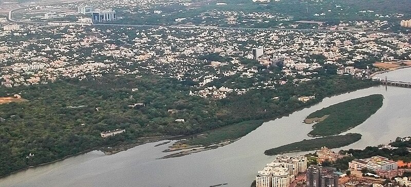
| Deskripsyon | Aerial view of the Adyar Estuary and w:Adyar. On the top ind is w:Tidel Park and the w:Chennai MRTS. The gardens belong to the w:Theosophical Society. | ||
| Petsa | 22 June 05 | ||
| Gigikanan | Kaugalingong trabaho | ||
| Tagsulat |
|
||
| Pagtugot (Paggamit pag-usab niini nga file) |
I, the copyright holder of this work, hereby publish it under the following license: This file is licensed under the Creative Commons Attribution-Share Alike 2.5 Generic license.
|
| Camera location | | View this and other nearby images on: OpenStreetMap |
|---|
Kaagi sa payl
I-klik ang petsa/oras aron makit-an ang hulagway sa payl niadtong panahona.
| Petsa/Takna | Thumbnail | Mga dimensyon | Tiggamit | Komento | |
|---|---|---|---|---|---|
| kasamtangan | 12:16, 28 Abril 2007 | | 1,443 × 657 (249 KB) | Planemad | {{Information |Description=Aerial view of the Adyar Estuary and w:Adyar. On the top ind is w:Tidel Park and the w:Chennai MRTS. |Source=own work |Date= 22 June 05 |Author= w:user:PlaneMad |Permission={{self|cc-by-sa-2.5}} |
Mga paggamit sa payl
Ang mosunod nga mga panid misumpay niining payl:
Global nga paggamit sa payl
Kining ubang wiki naggamit ning maong payl:
- Paggamit sa arz.wikipedia.org
- Paggamit sa azb.wikipedia.org
- Paggamit sa bg.wikipedia.org
- Paggamit sa bn.wikipedia.org
- Paggamit sa cs.wikipedia.org
- Paggamit sa de.wikipedia.org
- Paggamit sa en.wikipedia.org
- Paggamit sa es.wikipedia.org
- Paggamit sa fa.wikipedia.org
- Paggamit sa fi.wikipedia.org
- Paggamit sa fr.wikipedia.org
- Paggamit sa hi.wikipedia.org
- Paggamit sa id.wikipedia.org
- Paggamit sa incubator.wikimedia.org
- Paggamit sa io.wikipedia.org
- Paggamit sa it.wikipedia.org
- Paggamit sa jv.wikipedia.org
- Paggamit sa ml.wikipedia.org
- Paggamit sa nl.wikipedia.org
- Paggamit sa no.wikipedia.org
- Paggamit sa pt.wikipedia.org
- Paggamit sa ro.wikipedia.org
- Paggamit sa ru.wikipedia.org
- Paggamit sa ta.wikipedia.org
- Paggamit sa uk.wikipedia.org
- Paggamit sa ur.wikipedia.org
- Paggamit sa www.wikidata.org
- Paggamit sa zh-min-nan.wikipedia.org
- Paggamit sa zh-yue.wikipedia.org