Payl:Aerial-GoletaArea.jpg
Gidak-on ning maong paunang tan-aw: 800 x 323 ka mga piksel. Uban pang mga resoluyon: 320 x 129 ka mga piksel | 1,024 x 413 ka mga piksel.
Tibuok resolusyon (1,024 × 413 pixels, size sa payl: 109 KB, MIME type: image/jpeg)
Mubong sugid:
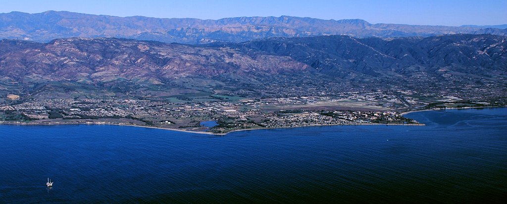
| Deskripsyon |
Aerial photo of the Goleta area, Santa Barbara County, California — from offshore.
|
| Petsa | 11am |
| Gigikanan | Kaugalingong trabaho |
| Tagsulat | John Wiley User:Jw4nvc - Santa Barbara, California |
| Pagtugot (Paggamit pag-usab niini nga file) |
*For full details on Permissions for this user's work, see: User:Jw4nvc/permission/details |
Pagtugot
I, the copyright holder of this work, hereby publish it under the following license:
This file is licensed under the Creative Commons Attribution 3.0 Unported license.
- Libre ka:
- sa pagsabwag – sa pagkopya, pag-apod-apod ug pagsabwag sa hinimo
- sa pag-remix – sa pag-adap sa binuhat
- Ubos sa mosunod nga mga kondisyon:
- atribusyon – Kinahanglan nimo nga hatagan ang angay nga kredito, maghatag usa ka link sa lisensya, ug ipakita kung adunay mga pagbag-o. Mahimo nimo kini buhaton sa bisan unsang makatarunganon nga paagi, apan dili sa bisan unsang paagi nga nagsugyot nga gi-endorso ka sa licensor o ang imong paggamit.
Kaagi sa payl
I-klik ang petsa/oras aron makit-an ang hulagway sa payl niadtong panahona.
| Petsa/Takna | Thumbnail | Mga dimensyon | Tiggamit | Komento | |
|---|---|---|---|---|---|
| kasamtangan | 22:19, 28 Enero 2009 | 1,024 × 413 (109 KB) | Jw4nvc | == Summary == {{Information |Description=Aerial photo of Goleta, California area from offshore |Source=self-made |Date=January 12, 2009 11am |Author= MyName (Jw4nvc (<span class="signature-talk">talk</span>)) |other_v |
Mga paggamit sa payl
Ang mosunod nga mga panid misumpay niining payl:
Global nga paggamit sa payl
Kining ubang wiki naggamit ning maong payl:
- Paggamit sa ar.wikipedia.org
- Paggamit sa arz.wikipedia.org
- Paggamit sa azb.wikipedia.org
- Paggamit sa bg.wikipedia.org
- Paggamit sa ce.wikipedia.org
- Paggamit sa de.wikivoyage.org
- Paggamit sa en.wikipedia.org
- Paggamit sa es.wikipedia.org
- Paggamit sa eu.wikipedia.org
- Paggamit sa fa.wikipedia.org
- Paggamit sa fr.wikipedia.org
- Paggamit sa ht.wikipedia.org
- Paggamit sa hu.wikipedia.org
- Paggamit sa it.wikipedia.org
- Paggamit sa it.wikivoyage.org
- Paggamit sa ja.wikipedia.org
- Paggamit sa lld.wikipedia.org
- Paggamit sa ml.wikipedia.org
- Paggamit sa mt.wikipedia.org
- Paggamit sa no.wikipedia.org
- Paggamit sa pl.wikipedia.org
- Paggamit sa pt.wikipedia.org
- Paggamit sa sr.wikipedia.org
- Paggamit sa sw.wikipedia.org
- Paggamit sa tr.wikipedia.org
- Paggamit sa tt.wikipedia.org
- Paggamit sa uk.wikipedia.org
- Paggamit sa ur.wikipedia.org
- Paggamit sa vo.wikipedia.org
- Paggamit sa www.wikidata.org
- Paggamit sa zh-min-nan.wikipedia.org