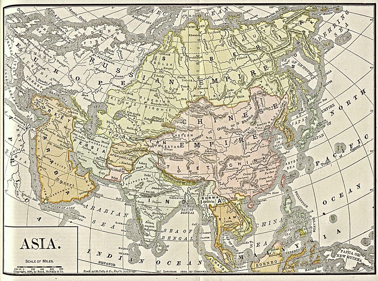
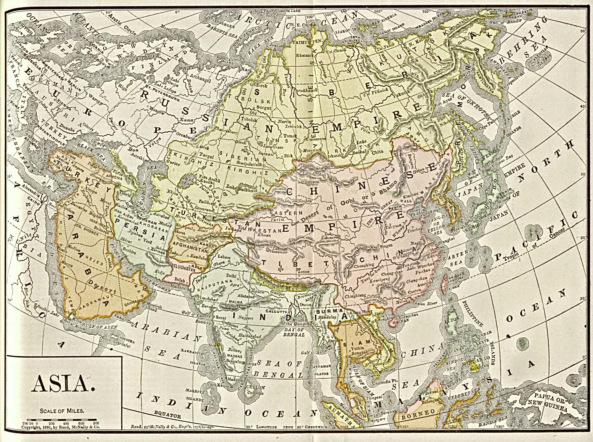
Payl:Asia 1892 amer ency brit.jpg

Tibuok resolusyon (2,072 × 1,544 pixels, size sa payl: 779 KB, MIME type: image/jpeg)

|
This map has been uploaded by Electionworld from en.wikipedia.org to enable the |
Public domain map from the University of Texas at Austin http://www.lib.utexas.edu/maps/historical/asia_1892_amer_ency_brit.jpg
Originally copyrighted in 1890 by Rand, McNally & Co.
|
This work is in the public domain in its country of origin and other countries and areas where the copyright term is the author's life plus 70 years or fewer.
| |
| This file has been identified as being free of known restrictions under copyright law, including all related and neighboring rights. | |
Kaagi sa payl
I-klik ang petsa/oras aron makit-an ang hulagway sa payl niadtong panahona.
| Petsa/Takna | Thumbnail | Mga dimensyon | Tiggamit | Komento | |
|---|---|---|---|---|---|
| kasamtangan | 09:59, 3 Disyembre 2006 | | 2,072 × 1,544 (779 KB) | Electionworld | {{ew|en|Nanshu}} Public domain map from the University of Texas at Austin http://www.lib.utexas.edu/maps/historical/asia_1892_amer_ency_brit.jpg {{PD-old}} Category:Old maps of Asia |
Mga paggamit sa payl
Ang mosunod nga mga panid misumpay niining payl:
Global nga paggamit sa payl
Kining ubang wiki naggamit ning maong payl:
- Paggamit sa ar.wikipedia.org
- Paggamit sa arz.wikipedia.org
- Paggamit sa ast.wikipedia.org
- Paggamit sa ba.wikipedia.org
- Paggamit sa bn.wikipedia.org
- Paggamit sa ca.wikipedia.org
- Paggamit sa cy.wikipedia.org
- Paggamit sa en.wikipedia.org
- Paggamit sa es.wikipedia.org
- Paggamit sa fa.wikipedia.org
- Paggamit sa gl.wikipedia.org
- Paggamit sa he.wikipedia.org
- Paggamit sa mn.wikipedia.org
- Paggamit sa pam.wikipedia.org
- Paggamit sa roa-tara.wikipedia.org
- Paggamit sa simple.wikipedia.org
- Paggamit sa th.wikipedia.org
- Paggamit sa tr.wikipedia.org
- Paggamit sa uk.wikipedia.org
- Paggamit sa vi.wikipedia.org