Payl:Austria relief location map.jpg

Gidak-on ning maong paunang tan-aw: 800 x 446 ka mga piksel. Uban pang mga resoluyon: 320 x 178 ka mga piksel | 640 x 357 ka mga piksel | 1,256 x 700 ka mga piksel.
Tibuok resolusyon (1,256 × 700 pixels, size sa payl: 677 KB, MIME type: image/jpeg)
Mubong sugid:
| Deskripsyon |
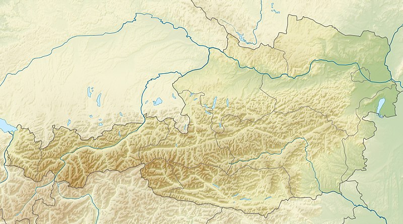
English: Location map of Austria
Equirectangular projection, N/S stretching 150 %. Geographic limits of the map:
|
| Petsa | |
| Gigikanan | Kaugalingong trabaho |
| Tagsulat | Uwe Dedering |
| Other versions |
Derivative works of this file: ÖRF 2011.png
|

Pagtugot
I, the copyright holder of this work, hereby publish it under the following licenses:
This file is licensed under the Creative Commons Attribution-Share Alike 3.0 Unported license.
- Libre ka:
- sa pagsabwag – sa pagkopya, pag-apod-apod ug pagsabwag sa hinimo
- sa pag-remix – sa pag-adap sa binuhat
- Ubos sa mosunod nga mga kondisyon:
- atribusyon – Kinahanglan nimo nga hatagan ang angay nga kredito, maghatag usa ka link sa lisensya, ug ipakita kung adunay mga pagbag-o. Mahimo nimo kini buhaton sa bisan unsang makatarunganon nga paagi, apan dili sa bisan unsang paagi nga nagsugyot nga gi-endorso ka sa licensor o ang imong paggamit.
- share parehas – Kung imong gi-remix, gibag-o, o gibase sa materyal, kinahanglan nimo nga iapod-apod ang imong mga kontribusyon sa ilawom sa parehas o katugma nga lisensya sama sa orihinal.

|
Gitugot ang pagkopya, pag-apud-apod o/ug pag-usab ning maong dokumento ubos sa mga termino sa GNU Free Documentation License, Version 1.2 o mas bag-ong bersiyon nga gimantala sa Free Software Foundation; nga walay Invariant Sections, walay Front-Cover Texts, ug walay Back-Cover Texts. Ang kopya sa lisensiya gilakip sa bahin nga giulohang GNU Free Documentation License. |
You may select the license of your choice.

|
This map image could be re-created using vector graphics as an SVG file. This has several advantages; see Commons:Media for cleanup for more information. If an SVG form of this image is available, please upload it and afterwards replace this template with
{{vector version available|new image name}}.
It is recommended to name the SVG file “Austria relief location map.svg”—then the template Vector version available (or Vva) does not need the new image name parameter. |


Kaagi sa payl
I-klik ang petsa/oras aron makit-an ang hulagway sa payl niadtong panahona.
| Petsa/Takna | Thumbnail | Mga dimensyon | Tiggamit | Komento | |
|---|---|---|---|---|---|
| kasamtangan | 09:14, 28 Hunyo 2010 | | 1,256 × 700 (677 KB) | Uwe Dedering | very little border change |
| 12:24, 26 Abril 2010 |  | 1,256 × 700 (677 KB) | Uwe Dedering | rhine | |
| 12:54, 24 Abril 2010 |  | 1,256 × 700 (676 KB) | Uwe Dedering | {{Information |Description={{en|1=Location map of Austria}} Equirectangular projection, N/S stretching 150 %. Geographic limits of the map: * N: 49.2° N * S: 46.3° N * W: 9.4° E * E: 17.2° E Made with Natural Earth. Free |
Mga paggamit sa payl
Ang mosunod nga 2 panid misumpay niining payl:
Global nga paggamit sa payl
Kining ubang wiki naggamit ning maong payl:
- Paggamit sa ab.wikipedia.org
- Paggamit sa als.wikipedia.org
- Paggamit sa am.wikipedia.org
- Paggamit sa an.wikipedia.org
- Paggamit sa ar.wikipedia.org
- Paggamit sa arz.wikipedia.org
- Paggamit sa ast.wikipedia.org
- Paggamit sa as.wikipedia.org
- Paggamit sa azb.wikipedia.org
- Paggamit sa az.wikipedia.org
- Paggamit sa ban.wikipedia.org
- Paggamit sa ba.wikipedia.org
- Paggamit sa be-tarask.wikipedia.org
- Paggamit sa be.wikipedia.org
- Paggamit sa bh.wikipedia.org
- Paggamit sa bn.wikipedia.org
View more global usage of this file.