Payl:Bhutan location map.svg

Size of this PNG preview of this SVG file: 800 x 522 ka mga piksel. Uban pang mga resoluyon: 320 x 209 ka mga piksel | 640 x 417 ka mga piksel | 1,024 x 668 ka mga piksel | 1,280 x 835 ka mga piksel | 2,560 x 1,670 ka mga piksel | 874 x 570 ka mga piksel.
Tibuok resolusyon (SVG nga payl, nominally 874 × 570 pixels, size sa payl: 124 KB)
Mubong sugid:
| Deskripsyon |
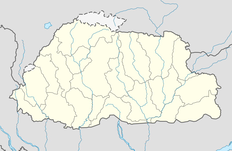
Deutsch: Positionskarte von Bhutan
Quadratische Plattkarte, N-S-Streckung 115 %. Geographische Begrenzung der Karte:
English: Location map of Bhutan
Equirectangular projection, N/S stretching 115 %. Geographic limits of the map:
|
| Petsa | |
| Gigikanan | own work, using United States National Imagery and Mapping Agency data |
| Tagsulat | NordNordWest |
| Other versions |
|


|
This map has been made or improved in the German Kartenwerkstatt (Map Lab). You can propose maps to improve as well.
|
Pagtugot
I, the copyright holder of this work, hereby publish it under the following licenses:

|
Gitugot ang pagkopya, pag-apud-apod o/ug pag-usab ning maong dokumento ubos sa mga termino sa GNU Free Documentation License, Version 1.2 o mas bag-ong bersiyon nga gimantala sa Free Software Foundation; nga walay Invariant Sections, walay Front-Cover Texts, ug walay Back-Cover Texts. Ang kopya sa lisensiya gilakip sa bahin nga giulohang GNU Free Documentation License. |
This file is licensed under the Creative Commons Attribution-Share Alike 3.0 Unported license.
- Libre ka:
- sa pagsabwag – sa pagkopya, pag-apod-apod ug pagsabwag sa hinimo
- sa pag-remix – sa pag-adap sa binuhat
- Ubos sa mosunod nga mga kondisyon:
- atribusyon – Kinahanglan nimo nga hatagan ang angay nga kredito, maghatag usa ka link sa lisensya, ug ipakita kung adunay mga pagbag-o. Mahimo nimo kini buhaton sa bisan unsang makatarunganon nga paagi, apan dili sa bisan unsang paagi nga nagsugyot nga gi-endorso ka sa licensor o ang imong paggamit.
- share parehas – Kung imong gi-remix, gibag-o, o gibase sa materyal, kinahanglan nimo nga iapod-apod ang imong mga kontribusyon sa ilawom sa parehas o katugma nga lisensya sama sa orihinal.
You may select the license of your choice.
Kaagi sa payl
I-klik ang petsa/oras aron makit-an ang hulagway sa payl niadtong panahona.
| Petsa/Takna | Thumbnail | Mga dimensyon | Tiggamit | Komento | |
|---|---|---|---|---|---|
| kasamtangan | 13:26, 24 Pebrero 2022 | | 874 × 570 (124 KB) | NordNordWest | Reverted to version as of 04:11, 5 April 2021 (UTC) |
| 13:01, 24 Pebrero 2022 |  | 874 × 570 (43 KB) | Turbo Slayer 2021 | Reverted to version as of 08:08, 15 September 2011 (UTC) | |
| 04:11, 5 Abril 2021 |  | 874 × 570 (124 KB) | C1MM | Added rivers | |
| 19:07, 2 Disyembre 2011 |  | 874 × 570 (51 KB) | NordNordWest | corr | |
| 15:28, 2 Disyembre 2011 |  | 874 × 570 (48 KB) | NordNordWest | upd | |
| 08:08, 15 Septiyembre 2011 |  | 874 × 570 (43 KB) | NordNordWest | c | |
| 17:01, 14 Septiyembre 2011 |  | 874 × 570 (42 KB) | NordNordWest | c | |
| 18:08, 31 Hulyo 2011 |  | 1,548 × 1,010 (133 KB) | JFHJr | {{Information |Description=Updates from the [http://www.election-bhutan.org.bt/index.php?option=com_content&id=132&Itemid=84 Bhutan Election and Demarcation Commissions] |Source=NordNordWest, Government of Bhutan |Date=2011 |Author=NordNordWest |P | |
| 08:22, 14 Oktubre 2008 |  | 875 × 571 (109 KB) | NordNordWest | ||
| 08:16, 14 Oktubre 2008 |  | 875 × 571 (108 KB) | NordNordWest | {{Information |Description= {{de|Positionskarte von Bhutan}} Quadratische Plattkarte, N-S-Streckung 115 %. Geographische Begrenzung der Karte: * N: 28.5° N * S: 26.4° N * W: 88.6° O * O: 92.3° O {{en|Location map of [[:en:Bhutan|Bhutan] |
Mga paggamit sa payl
More than 100 pages use this file. The following list shows the first 100 pages that use this file only. A full list is available.
- Bardo
- Bardo (gewog)
- Black Mountain
- Black Mountains
- Bod
- Bongo
- Bongo (gewog sa Bhutan)
- Chamka
- Chamka (suba sa Bhutan)
- Chirang
- Chukha
- Daga
- Daga (kapital sa distrito)
- Dagana
- Dangme Chu
- Durshingla
- Gag La
- Gang La
- Gang La (gintang sa Bhutan)
- Gasa (distrito)
- Gasa (pagklaro)
- Geylegphug
- Geylegphug (lungsod sa Bhutan)
- Ha River
- Haa
- Jaldhāka River
- Jelep La
- Jelep La (gintang sa Bhutan)
- Khar
- Khar (gewog)
- Kur
- Lajab
- Lajab (gewog sa Bhutan)
- Mangde Chhu (suba sa Bhutan)
- Mansai
- Mo (pagklaro)
- Mongar
- Nahi
- Nahi (gewog)
- Nyingsang La
- Nyingsang La (gintang, lat 26,78, long 89,58)
- Nyingsang La (gintang, lat 27,45, long 91,90)
- Pajo
- Pajo (lungsod sa Bhutan)
- Paro (pagklaro)
- Paro Chhu (suba sa Bhutan)
- Pele La (gintang sa Bhutan)
- Pemagatshel
- Pho Chhu (suba sa Bhutan)
- Pumo La (bukid sa Bhutan)
- Punakha
- Punākha (kapital sa distrito sa Bhutan)
- Ragna Khola (suba sa Bhutan)
- Rudong La (gintang sa Bhutan)
- Sage La
- Sage La (gintang sa Bhutan)
- Sama River
- Sama River (suba sa Bhutan)
- Samdrup Jongkhar
- Samtse
- Sarpang
- Sarpang (kapital sa distrito sa Bhutan)
- Sele La (gintang sa Bhutan)
- Shali
- Shali (lungsod sa Bhutan)
- Shemgang
- Shemgang (kapital sa distrito sa Bhutan)
- Sinchu La (gintang sa Bhutan)
- Sirkim La (gintang sa Bhutan)
- Tang Chu (suba sa Bhutan)
- Tarka La (gintang sa Bhutan)
- Tashi Gang Dzong
- Tashigang
- Tashigang (gewog sa Bhutan)
- Tawang Chu (suba sa Bhutan)
- Thebong La (gintang sa Bhutan)
- Thimphu
- Thimphu (ulohang dakbayan sa Bhutan)
- Thungsi La (gintang sa Bhutan)
- Tongsa
- Towang
- Trashi Yangtse (kapital sa distrito sa Bhutan)
- Trashigang
- Trashigang (kapital sa distrito sa Bhutan)
- Tremo La (gintang sa Bhutan)
- Trong
- Trong (gewog)
- Trongsa
- Trongsa (kapital sa distrito sa Bhutan)
- Tsirang
- Ura La (gintang sa Bhutan)
- Wangdue Phodrang
- Wangdue Phodrang (kapital sa distrito sa Bhutan)
- Wāgya La (gintang sa Bhutan)
- Yale La (gintang sa Bhutan)
- Yeb La (gintang sa Bhutan)
- Yembo La (gintang sa Bhutan)
- Yönpu La (gintang sa Bhutan)
- Gumagamit:Lsjbot/Duplicates/Phuntsholing (lungsod sa Bhutan)
- Gumagamit:Lsjbot/Duplicates/Tashigang (gewog sa Bhutan)
View more links to this file.
Global nga paggamit sa payl
Kining ubang wiki naggamit ning maong payl:
- Paggamit sa af.wikipedia.org
- Paggamit sa an.wikipedia.org
- Paggamit sa ar.wikipedia.org
- Paggamit sa ast.wikipedia.org
- Paggamit sa as.wikipedia.org
- Paggamit sa az.wikipedia.org
- Paggamit sa ba.wikipedia.org
- Paggamit sa be-tarask.wikipedia.org
- Paggamit sa be.wikipedia.org
- Paggamit sa bg.wikipedia.org
- Paggamit sa bn.wikipedia.org
View more global usage of this file.