Payl:Bissagos archipel-satellite.jpg
Gidak-on ning maong paunang tan-aw: 600 x 600 ka mga piksel. Uban pang mga resoluyon: 240 x 240 ka mga piksel | 480 x 480 ka mga piksel | 768 x 768 ka mga piksel | 1,024 x 1,024 ka mga piksel | 2,048 x 2,048 ka mga piksel | 5,264 x 5,264 ka mga piksel.
Tibuok resolusyon (5,264 × 5,264 pixels, size sa payl: 10.16 MB, MIME type: image/jpeg)
Mubong sugid:
| Deskripsyon |
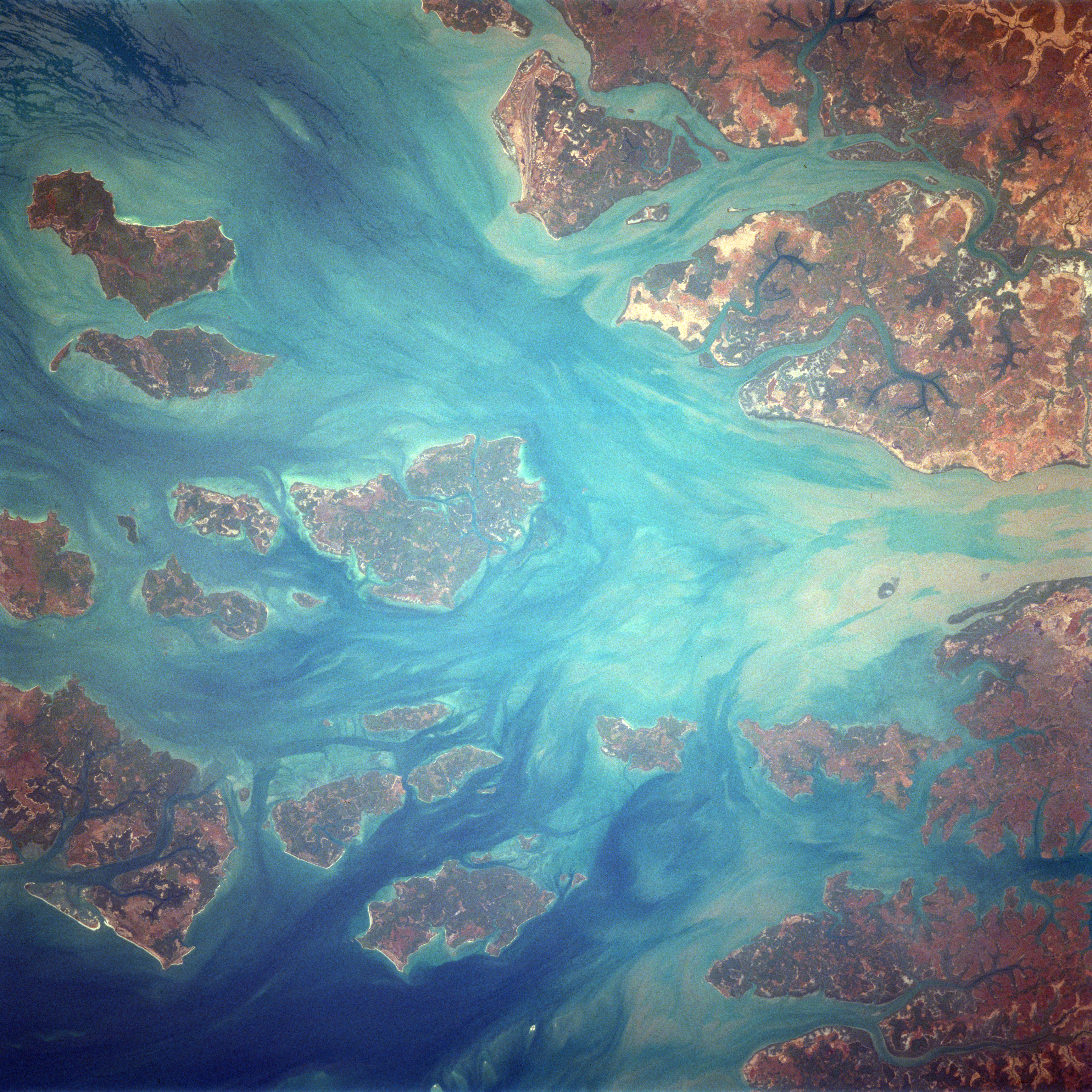
English: Bissagos Archipel
Identification Mission: STS037 Roll: 77 Frame: 71 Mission ID on the Film or image: STS37 Country or Geographic Name: GUINEA-BISSAU Features: ARQUIPELAGO DOS BIJAGOS Center Point Latitude: 11.5 Center Point Longitude: -15.9 (Negative numbers indicate south for latitude and west for longitude) |
| Petsa | Taken on 6 Abril 1991, 14:04:51 UTC |
| Gigikanan | https://eol.jsc.nasa.gov/SearchPhotos/photo.pl?mission=STS037&roll=77&frame=71 |
| Tagsulat | NASA / Crew of STS-37 |
This image or video was catalogued by Johnson Space Center of the United States National Aeronautics and Space Administration (NASA) under Photo ID: STS037-77-71. This tag does not indicate the copyright status of the attached work. A normal copyright tag is still required. See Commons:Licensing. Other languages:
|
Pagtugot
This file is in the public domain in the United States because it was created by the Image Science & Analysis Laboratory, of the NASA Johnson Space Center. NASA copyright policy states that "NASA material is not protected by copyright unless noted". (NASA media use guidelines or Conditions of Use of Astronaut Photographs).
Photo source: STS037-77-71.
|
Original upload log
Originally from de.wikipedia; description page is/was here[dead link]. (All user names refer to de.wikipedia)
- 2004-09-19 09:05 MatthiasKabel 454×458×8 (41870 bytes) Bissagos Archipel, von http://eol.jsc.nasa.gov/scripts/sseop/QuickView.pl?directory=ISD&ID=STS037-77-72, public domain
Kaagi sa payl
I-klik ang petsa/oras aron makit-an ang hulagway sa payl niadtong panahona.
| Petsa/Takna | Thumbnail | Mga dimensyon | Tiggamit | Komento | |
|---|---|---|---|---|---|
| kasamtangan | 17:30, 17 Pebrero 2018 | | 5,264 × 5,264 (10.16 MB) | Ras67 | high resolution, rotated to approximate north direction |
| 08:36, 27 Pebrero 2007 |  | 454 × 458 (41 KB) | Hardscarf | {{Information |Description=Bissagos Archipel Identification Mission: STS037 Roll: 77 Frame: 71 Mission ID on the Film or image: STS37 Country or Geographic Name: GUINEA-BISSAU Features: ARQUIPELAGO DOS BIJAGOS Center Point Latitude: 11.5 Center Point Lon |
Mga paggamit sa payl
Ang mosunod nga mga panid misumpay niining payl:
Global nga paggamit sa payl
Kining ubang wiki naggamit ning maong payl:
- Paggamit sa ca.wikipedia.org
- Paggamit sa de.wikivoyage.org
- Paggamit sa en.wikivoyage.org
- Paggamit sa he.wikivoyage.org
- Paggamit sa it.wikipedia.org
- Paggamit sa nl.wikipedia.org
- Paggamit sa pl.wikipedia.org
- Paggamit sa uk.wikipedia.org
- Paggamit sa www.wikidata.org