Payl:CamarilloCalifornia.jpg
Gidak-on ning maong paunang tan-aw: 800 x 599 ka mga piksel. Uban pang mga resoluyon: 320 x 239 ka mga piksel | 640 x 479 ka mga piksel | 1,024 x 766 ka mga piksel | 1,280 x 958 ka mga piksel | 2,288 x 1,712 ka mga piksel.
Tibuok resolusyon (2,288 × 1,712 pixels, size sa payl: 677 KB, MIME type: image/jpeg)
Mubong sugid:
| Deskripsyon |
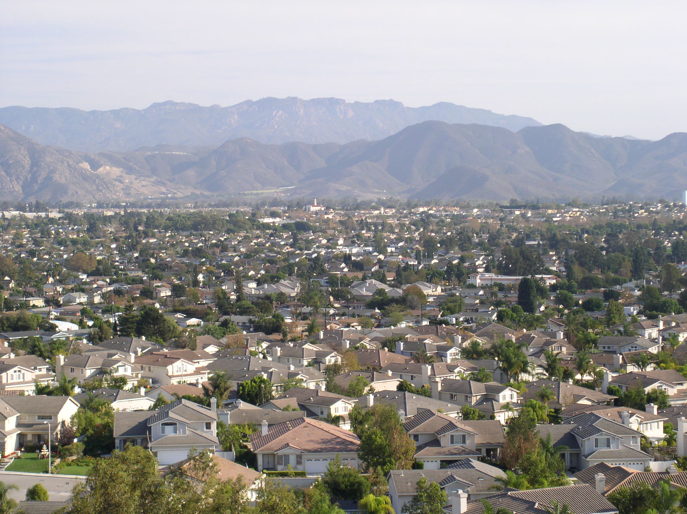
English: Image of Camarillo, California looking southeast taken from a hillside on the northwestern part of the city near Estaban Drive. |
| Petsa | |
| Gigikanan | Self-photographed |
| Tagsulat | Frantik at en.wikipedia |
| Camera location | | View this and other nearby images on: OpenStreetMap |
|---|
The geographical information in this file was retrospectively estimated.
The location may therefore be somewhat imprecise. Verifying and refining these coordinates is strongly encouraged. |
Pagtugot
Frantik at en.wikipedia, the copyright holder of this work, hereby publishes it under the following licenses:

|
Gitugot ang pagkopya, pag-apud-apod o/ug pag-usab ning maong dokumento ubos sa mga termino sa GNU Free Documentation License, Version 1.2 o mas bag-ong bersiyon nga gimantala sa Free Software Foundation; nga walay Invariant Sections, walay Front-Cover Texts, ug walay Back-Cover Texts. Ang kopya sa lisensiya gilakip sa bahin nga giulohang GNU Free Documentation License. |
This file is licensed under the Creative Commons Attribution 3.0 Unported license.
Attribution: Frantik at en.wikipedia
- Libre ka:
- sa pagsabwag – sa pagkopya, pag-apod-apod ug pagsabwag sa hinimo
- sa pag-remix – sa pag-adap sa binuhat
- Ubos sa mosunod nga mga kondisyon:
- atribusyon – Kinahanglan nimo nga hatagan ang angay nga kredito, maghatag usa ka link sa lisensya, ug ipakita kung adunay mga pagbag-o. Mahimo nimo kini buhaton sa bisan unsang makatarunganon nga paagi, apan dili sa bisan unsang paagi nga nagsugyot nga gi-endorso ka sa licensor o ang imong paggamit.
You may select the license of your choice.
Original upload log
The original description page was here. All following user names refer to en.wikipedia.
| Date | User | Size | Description |
|---|---|---|---|
| 2007-10-29 11:43 | Frantik | 2288×1712 (693498 bytes) | Looking southeast from the hills in the northwest corner of Camarillo. Image taken on October 28, 2007. |
Kaagi sa payl
I-klik ang petsa/oras aron makit-an ang hulagway sa payl niadtong panahona.
| Petsa/Takna | Thumbnail | Mga dimensyon | Tiggamit | Komento | |
|---|---|---|---|---|---|
| kasamtangan | 12:15, 23 Hunyo 2009 | | 2,288 × 1,712 (677 KB) | Jonesey | {{Information |Description={{en|Image of {{w|Camarillo, California}} looking southeast taken from a hillside on the northwestern part of the city near Estaban Drive.}} |Source=Transferred from [http://en.wikipedia.org en.wikipedia] |Date=2007-10-28 |Autho |
Mga paggamit sa payl
Ang mosunod nga mga panid misumpay niining payl:
Global nga paggamit sa payl
Kining ubang wiki naggamit ning maong payl:
- Paggamit sa ar.wikipedia.org
- Paggamit sa arz.wikipedia.org
- Paggamit sa ast.wikipedia.org
- Paggamit sa be.wikipedia.org
- Paggamit sa bg.wikipedia.org
- Paggamit sa ca.wikipedia.org
- Paggamit sa ce.wikipedia.org
- Paggamit sa de.wikipedia.org
- Paggamit sa en.wikipedia.org
- Paggamit sa es.wikipedia.org
- Paggamit sa eu.wikipedia.org
- Paggamit sa fa.wikipedia.org
- Paggamit sa fo.wikipedia.org
- Paggamit sa fr.wikipedia.org
- Paggamit sa ht.wikipedia.org
- Paggamit sa hu.wikipedia.org
- Paggamit sa it.wikipedia.org
- Paggamit sa ja.wikipedia.org
- Paggamit sa ko.wikipedia.org
- Paggamit sa lld.wikipedia.org
- Paggamit sa ml.wikipedia.org
- Paggamit sa nl.wikipedia.org
- Paggamit sa no.wikipedia.org
- Paggamit sa pl.wikipedia.org
- Paggamit sa pt.wikipedia.org
- Paggamit sa ru.wikipedia.org
- Paggamit sa sco.wikipedia.org
- Paggamit sa simple.wikipedia.org
- Paggamit sa sr.wikipedia.org
- Paggamit sa sv.wiktionary.org
- Paggamit sa szl.wikipedia.org
- Paggamit sa tr.wikipedia.org
- Paggamit sa tt.wikipedia.org
- Paggamit sa vi.wikipedia.org
- Paggamit sa vo.wikipedia.org
- Paggamit sa www.wikidata.org
- Paggamit sa zh-min-nan.wikipedia.org
- Paggamit sa zh.wikipedia.org