Payl:Cartwright Island, in 1904, USGS map.jpg

Walay mas taas nga resolusyon.
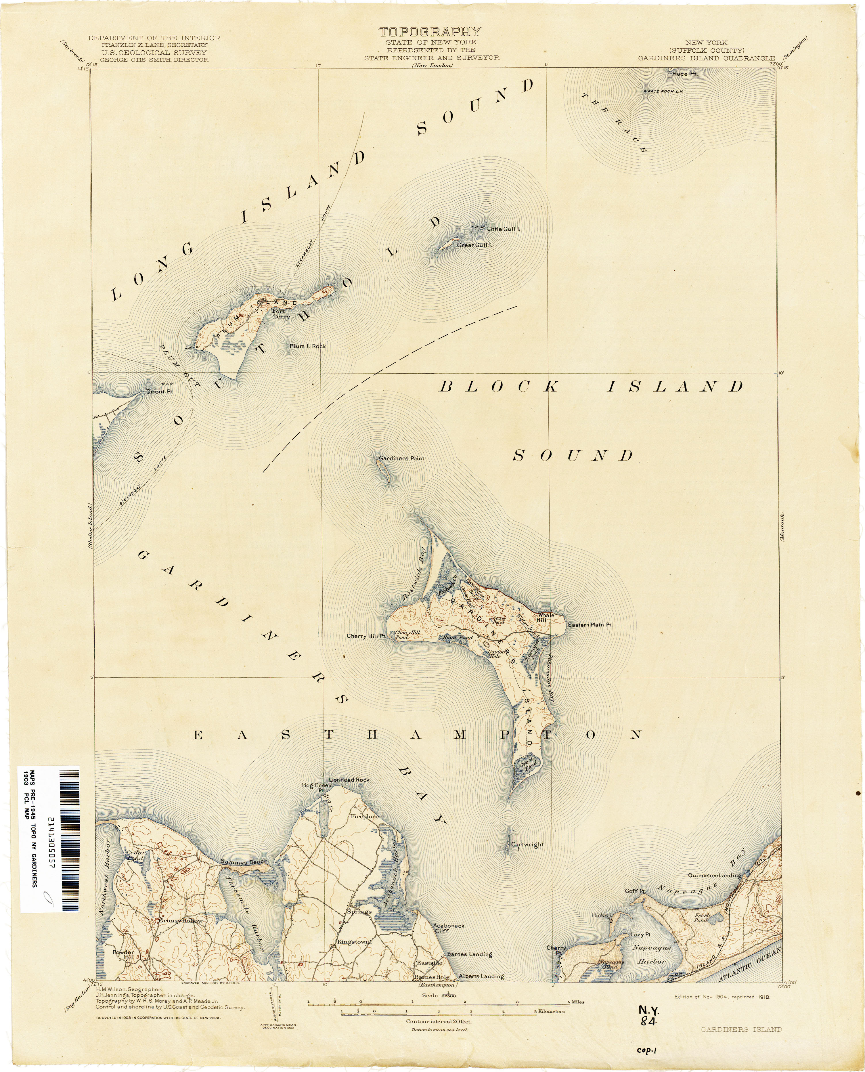
Cartwright_Island,_in_1904,_USGS_map.jpg (220 × 226 pixels, size sa payl: 45 KB, MIME type: image/jpeg)
Mubong sugid:
| Deskripsyon |
English: map of Gardiners Island, east of Long Island, New York |
| Petsa | |
| Gigikanan | http://www.lib.utexas.edu/maps/topo/new_york/txu-pclmaps-topo-ny-gardiners_island-1903.jpg |
| Tagsulat | U.S. Geological Survey |
| Other versions |


Pagtugot
This work is in the public domain in the United States because it is a work prepared by an officer or employee of the United States Government as part of that person’s official duties under the terms of Title 17, Chapter 1, Section 105 of the US Code.
Note: This only applies to original works of the Federal Government and not to the work of any individual U.S. state, territory, commonwealth, county, municipality, or any other subdivision. This template also does not apply to postage stamp designs published by the United States Postal Service since 1978. (See § 313.6(C)(1) of Compendium of U.S. Copyright Office Practices). It also does not apply to certain US coins; see The US Mint Terms of Use.
|
 | |
| This file has been identified as being free of known restrictions under copyright law, including all related and neighboring rights. | ||
Kaagi sa payl
I-klik ang petsa/oras aron makit-an ang hulagway sa payl niadtong panahona.
| Petsa/Takna | Thumbnail | Mga dimensyon | Tiggamit | Komento | |
|---|---|---|---|---|---|
| kasamtangan | 06:07, 2 Abril 2023 | | 220 × 226 (45 KB) | Geo Swan | File:Gardiners Point Island, Gardiners Island and Cartwright Island, in 1904 USGS map.jpg cropped 81 % horizontally, 87 % vertically using CropTool with precise mode. |
Mga paggamit sa payl
Ang mosunod nga mga panid misumpay niining payl:
Global nga paggamit sa payl
Kining ubang wiki naggamit ning maong payl:
- Paggamit sa www.wikidata.org