Payl:Changji.png

Gidak-on ning maong paunang tan-aw: 725 x 600 ka mga piksel. Uban pang mga resoluyon: 290 x 240 ka mga piksel | 581 x 480 ka mga piksel | 929 x 768 ka mga piksel | 1,238 x 1,024 ka mga piksel | 1,474 x 1,219 ka mga piksel.
Tibuok resolusyon (1,474 × 1,219 pixels, size sa payl: 60 KB, MIME type: image/png)
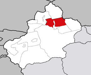
| Deskripsyon | Maps of Xinjiang Uygur Autonomous Region of China |
| Petsa | |
| Gigikanan | Kaugalingong trabaho |
| Tagsulat | Photo taken by Fanghong |

|
Gitugot ang pagkopya, pag-apud-apod o/ug pag-usab ning maong dokumento ubos sa mga termino sa GNU Free Documentation License, Version 1.2 o mas bag-ong bersiyon nga gimantala sa Free Software Foundation; nga walay Invariant Sections, walay Front-Cover Texts, ug walay Back-Cover Texts. Ang kopya sa lisensiya gilakip sa bahin nga giulohang GNU Free Documentation License. |
| This file is licensed under the Creative Commons Attribution-Share Alike 3.0 Unported license. | ||
| ||
| This licensing tag was added to this file as part of the GFDL licensing update. |
This file is licensed under the Creative Commons Attribution-Share Alike 1.0 Generic license.
- Libre ka:
- sa pagsabwag – sa pagkopya, pag-apod-apod ug pagsabwag sa hinimo
- sa pag-remix – sa pag-adap sa binuhat
- Ubos sa mosunod nga mga kondisyon:
- atribusyon – Kinahanglan nimo nga hatagan ang angay nga kredito, maghatag usa ka link sa lisensya, ug ipakita kung adunay mga pagbag-o. Mahimo nimo kini buhaton sa bisan unsang makatarunganon nga paagi, apan dili sa bisan unsang paagi nga nagsugyot nga gi-endorso ka sa licensor o ang imong paggamit.
- share parehas – If you alter, transform, or build upon this work, you must distribute the resulting work under the same license as the original.
Kaagi sa payl
I-klik ang petsa/oras aron makit-an ang hulagway sa payl niadtong panahona.
| Petsa/Takna | Thumbnail | Mga dimensyon | Tiggamit | Komento | |
|---|---|---|---|---|---|
| kasamtangan | 17:05, 14 Pebrero 2007 | | 1,474 × 1,219 (60 KB) | Croquant | Unblurred image (template: Image:Xinjiang_prefectures_template.png) |
| 03:10, 19 Oktubre 2005 |  | 1,500 × 1,200 (288 KB) | Fanghong | ||
| 01:58, 19 Oktubre 2005 |  | 1,500 × 1,200 (334 KB) | Fanghong | {{information| |Description =Maps of Xinjiang Uygur Autonomous Region of China |Source = |Date = On October 18 2005 |Author = Photo taken by Fanghong |Permission = |other_versions = }} {{GFDL}} {{cc-by-sa}} |
Mga paggamit sa payl
Ang mosunod nga mga panid misumpay niining payl:
Global nga paggamit sa payl
Kining ubang wiki naggamit ning maong payl:
- Paggamit sa fa.wikipedia.org
- Paggamit sa sv.wikipedia.org
- Paggamit sa zh-yue.wikipedia.org