Payl:Chiaves-la-florida-1584.jpg
Gidak-on ning maong paunang tan-aw: 800 x 544 ka mga piksel. Uban pang mga resoluyon: 320 x 218 ka mga piksel | 640 x 435 ka mga piksel | 1,024 x 696 ka mga piksel | 1,280 x 870 ka mga piksel | 2,748 x 1,868 ka mga piksel.
Tibuok resolusyon (2,748 × 1,868 pixels, size sa payl: 665 KB, MIME type: image/jpeg)
Mubong sugid:
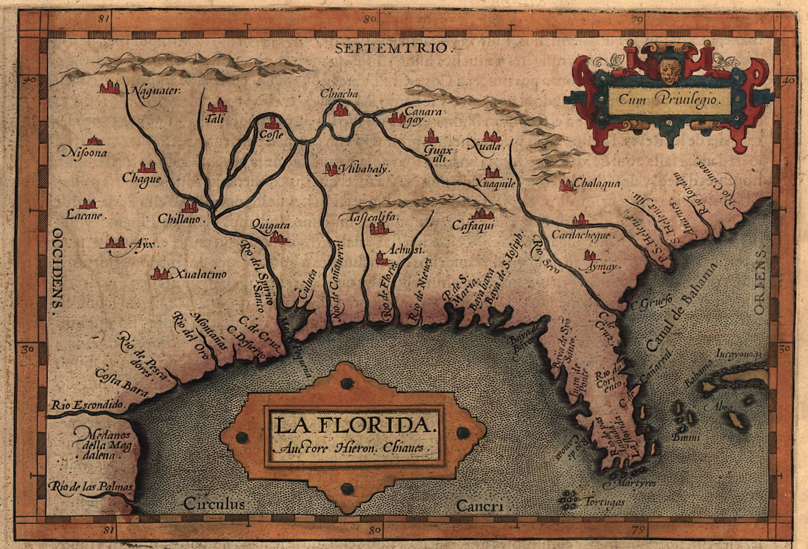
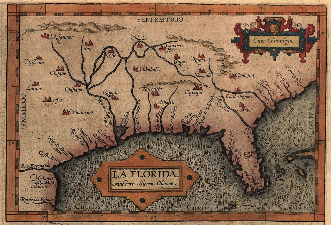
| Deskripsyon | Map of the Spanish province of "La Florida," which included most of the southeastern United States. The map was drawn by Spanish royal cartographer Geronimo Chiaves, and was probably based on accounts by members of the Hernando De Soto expedition (1539-1543). The map was originally published in Abraham Ortelius' Theatrum Orbis Terrarum in 1584. |
| Petsa | |
| Gigikanan | https://www.loc.gov/exhibits/earlyamericas/online/aftermath/aftermath2.html |
| Tagsulat | Geronimo Chiaves, Abraham Ortelius |
Pagtugot
|
This work is in the public domain in its country of origin and other countries and areas where the copyright term is the author's life plus 100 years or fewer. | |
| This file has been identified as being free of known restrictions under copyright law, including all related and neighboring rights. | |
Kaagi sa payl
I-klik ang petsa/oras aron makit-an ang hulagway sa payl niadtong panahona.
| Petsa/Takna | Thumbnail | Mga dimensyon | Tiggamit | Komento | |
|---|---|---|---|---|---|
| kasamtangan | 20:14, 24 Abril 2008 | | 2,748 × 1,868 (665 KB) | BrineStans | {{Information |Description=Map of the Spanish province of "La Florida," which included most of the southeastern United States. The map was drawn by Spanish royal cartographer Geronimo Chiaves, and was probably based on accounts by members of the Hernando |
Mga paggamit sa payl
Ang mosunod nga mga panid misumpay niining payl:
Global nga paggamit sa payl
Kining ubang wiki naggamit ning maong payl:
- Paggamit sa arz.wikipedia.org
- Paggamit sa en.wikipedia.org
- Paggamit sa id.wikipedia.org