Payl:Colombia location map.svg

Size of this PNG preview of this SVG file: 512 x 579 ka mga piksel. Uban pang mga resoluyon: 212 x 240 ka mga piksel | 424 x 480 ka mga piksel | 679 x 768 ka mga piksel | 905 x 1,024 ka mga piksel | 1,811 x 2,048 ka mga piksel.
Tibuok resolusyon (SVG nga payl, nominally 512 × 579 pixels, size sa payl: 1.07 MB)
Mubong sugid:
| Deskripsyon |
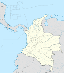
English: Location map of Colombia
Equirectangular projection. Geographic limits of the map:
|
| Petsa | |
| Gigikanan | Kaugalingong trabaho (Original text: own work, using Demis data) |
| Tagsulat | Milenioscuro |
| Other versions |
Derivative works of this file: Bajo Nuevo Colombia location.png
|
| SVG genesis | This W3C-invalid map was created with Adobe Illustrator. |


.svg)

Pagtugot
Milenioscuro, the copyright holder of this work, hereby publishes it under the following license:
This file is licensed under the Creative Commons Attribution-Share Alike 3.0 Unported license.
Attribution: Milenioscuro
- Libre ka:
- sa pagsabwag – sa pagkopya, pag-apod-apod ug pagsabwag sa hinimo
- sa pag-remix – sa pag-adap sa binuhat
- Ubos sa mosunod nga mga kondisyon:
- atribusyon – Kinahanglan nimo nga hatagan ang angay nga kredito, maghatag usa ka link sa lisensya, ug ipakita kung adunay mga pagbag-o. Mahimo nimo kini buhaton sa bisan unsang makatarunganon nga paagi, apan dili sa bisan unsang paagi nga nagsugyot nga gi-endorso ka sa licensor o ang imong paggamit.
- share parehas – Kung imong gi-remix, gibag-o, o gibase sa materyal, kinahanglan nimo nga iapod-apod ang imong mga kontribusyon sa ilawom sa parehas o katugma nga lisensya sama sa orihinal.
| Annotations | This image is annotated: View the annotations at Commons |


Kaagi sa payl
I-klik ang petsa/oras aron makit-an ang hulagway sa payl niadtong panahona.
| Petsa/Takna | Thumbnail | Mga dimensyon | Tiggamit | Komento | |
|---|---|---|---|---|---|
| kasamtangan | 20:17, 22 Pebrero 2022 | | 512 × 579 (1.07 MB) | Milenioscuro | standard colors |
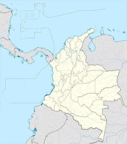
| 11:10, 1 Disyembre 2017 |  | 2,027 × 2,294 (1.37 MB) | Milenioscuro | limits | |
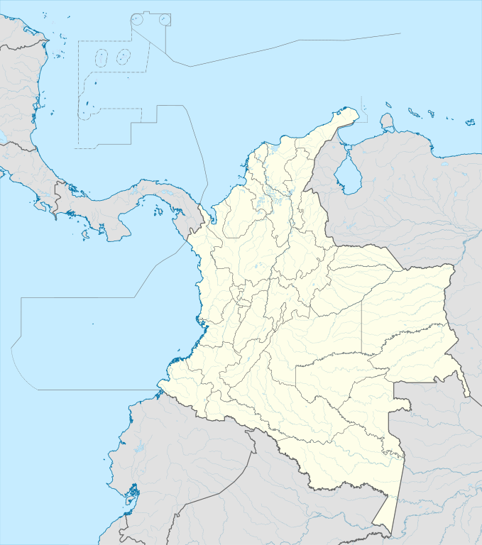
| 11:00, 1 Disyembre 2017 |  | 2,027 × 2,294 (1.37 MB) | Milenioscuro | more visible limits | |
| 05:48, 28 Enero 2014 |  | 2,027 × 2,294 (1.39 MB) | Milenioscuro | correction of departamental, international and maritime boundaries, courses of rivers, coastline, and line thickness | |
| 17:01, 29 Mayo 2012 |  | 2,007 × 2,298 (1.07 MB) | Milenioscuro | correction of some departamental borders | |
| 18:58, 26 Marso 2012 |  | 2,007 × 2,298 (1.08 MB) | Milenioscuro | correction of international borders, added layers, rivers, etc | |
| 08:12, 17 Nobiyembre 2011 |  | 2,007 × 2,298 (1.04 MB) | Milenioscuro | simplification of rivers, correction of some borders | |
| 23:48, 2 Nobiyembre 2009 |  | 2,007 × 2,298 (1.14 MB) | Milenioscuro | thick boundaries of departments | |
| 09:10, 1 Nobiyembre 2009 |  | 2,007 × 2,298 (1.15 MB) | Milenioscuro | Adjusted to match style of location maps 2008 | |
| 07:30, 26 Oktubre 2009 |  | 2,268 × 2,676 (1.4 MB) | Milenioscuro | maritime boundaries |
Mga paggamit sa payl
More than 100 pages use this file. The following list shows the first 100 pages that use this file only. A full list is available.
- Belen
- Belén
- Black Point
- Brothers
- Buenos Aires (pagklaro)
- Cerro Colorado
- Cerro El Gigante
- Cerro El Peñón
- Cerro El Volcan
- Cerro El Volcán
- Cerro Gigante
- Cerro Grande
- Cerro La Campana
- Cerro La Paloma
- Cerro Malacara
- Cerro Montoso
- Cerro Negro
- Cerro Pelon
- Cerro Pelón
- Cerro San Lorenzo
- Cerro Santa Ana
- Concepción
- Concordia
- Cota (pagklaro)
- Cotton Cay
- Crab Cay
- Dolores
- El Carmen
- El Cerro
- Gama (pagklaro)
- Isla Grande
- La Cruz
- La Paz
- Laguna Blanca
- Laguna Grande
- Laguna Seca
- Laguna Verde
- Low Cay
- Magdalena (pagklaro)
- Malaga
- Meta (pagklaro)
- Paya
- Punta Cañón
- Quebrada Grande
- Quebrada San José
- Quebrada Santa Rosa
- Quebrada Seca
- Rio Congo
- Rio Frio
- Rio Grande
- Rio Medina
- Rio Negro
- Rio Piedras
- Rio Rosario
- Rio San Antonio
- Rio San Jose
- Rio San Juan
- Rio San Lorenzo
- Rio Santa Cruz
- Rio Seco
- Rio Viejo
- Río Congo
- Río Frío
- Río Grande
- Río Hondo
- Río Medina
- Río Negro
- Río Piedras
- Río San Antonio
- Río San José
- Río San Juan
- Río San Lorenzo
- Río San Pablo
- Río Santa Clara
- Río Seco
- Río Soledad
- Río Sucio
- Río Tigre
- Río Viejo
- San Antonio
- San Carlos
- San Fernando
- San Francisco
- San Isidro
- San Jorge
- San Lorenzo (pagklaro)
- San Pedro (pagklaro)
- San Rafael
- Santa Isabel
- Santa Lucia
- Santa Lucía
- Santa Maria (pagklaro)
- Santa María (pagklaro)
- Santa Rosa
- Santo Tomas
- Santo Tomás
- South Point
- Sugar Loaf
- Toro
- Victoria
View more links to this file.
Global nga paggamit sa payl
Kining ubang wiki naggamit ning maong payl:
- Paggamit sa af.wikipedia.org
- Paggamit sa als.wikipedia.org
- Paggamit sa an.wikipedia.org
- Paggamit sa ar.wikipedia.org
- Paggamit sa ast.wikipedia.org
- Bogotá
- Cali
- Estadiu Doce de Octubre
- Puerto Colombia (Guainía)
- González (Cesar)
- Estadiu Deportivo Cali
- Módulu:Mapa de llocalización/datos/Colombia
- Ríu Magdalena
- Capitoliu Nacional de Colombia
- Comisión Colombiana del Espaciu
- Nevado del Ruiz
- Módulu:Mapa de llocalización/datos/Colombia/usu
- Barranquilla
- Cartagena de Indias
- Estadiu Metropolitanu Roberto Meléndez
- Palenque de San Basilio
- Copa América 2001
- Sierra de Chiribiquete
- Inírida
- Aeropuertu Internacional El Dorado
- Casa d'Adoración Norte del Cauca
- Aeropuertu Guaymaral
- Aeropuertu Internacional Alfonso Bonilla Aragón
- Aeropuertu Internacional Alfredo Vásquez Cobo
- Aeropuertu Internacional Camilo Daza
- Aeropuertu Internacional El Edén
- Aeropuertu Internacional Ernesto Cortissoz
- Aeropuertu Internacional Gustavo Rojas Pinilla
- Aeropuertu Internacional José María Córdova
- Aeropuertu Internacional Matecaña
View more global usage of this file.