Payl:D-A-CH location map.svg

Size of this PNG preview of this SVG file: 498 x 600 ka mga piksel. Uban pang mga resoluyon: 199 x 240 ka mga piksel | 398 x 480 ka mga piksel | 638 x 768 ka mga piksel | 850 x 1,024 ka mga piksel | 1,700 x 2,048 ka mga piksel | 1,257 x 1,514 ka mga piksel.
Tibuok resolusyon (SVG nga payl, nominally 1,257 × 1,514 pixels, size sa payl: 586 KB)
| Deskripsyon |
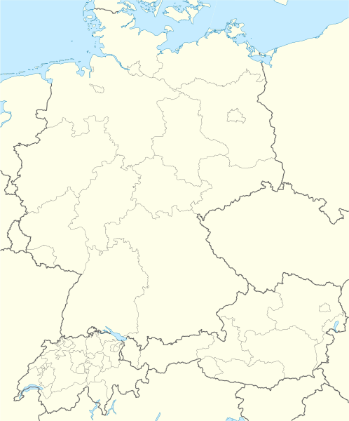
Deutsch: Positionskarte der D-A-CH-Länder
Quadratische Plattkarte, N-S-Streckung 150 %. Geographische Begrenzung der Karte:
English: Location map of German-speaking Europe (D-A-CH)
Equirectangular projection, N/S stretching 150 %. Geographic limits of the map:
|
| Petsa | |
| Gigikanan | own work, using United States National Imagery and Mapping Agency data |
| Tagsulat | NordNordWest |
| Other versions | Derivative works of this file: D-A-CH location map T(h)alheim Da(h)lheim.svg |
alheim_Da(h)lheim.svg)

|
This map has been made or improved in the German Kartenwerkstatt (Map Lab). You can propose maps to improve as well.
|
Pagtugot
I, the copyright holder of this work, hereby publish it under the following licenses:

|
Gitugot ang pagkopya, pag-apud-apod o/ug pag-usab ning maong dokumento ubos sa mga termino sa GNU Free Documentation License, Version 1.2 o mas bag-ong bersiyon nga gimantala sa Free Software Foundation; nga walay Invariant Sections, walay Front-Cover Texts, ug walay Back-Cover Texts. Ang kopya sa lisensiya gilakip sa bahin nga giulohang GNU Free Documentation License. |
This file is licensed under the Creative Commons Attribution-Share Alike 3.0 Unported license.
- Libre ka:
- sa pagsabwag – sa pagkopya, pag-apod-apod ug pagsabwag sa hinimo
- sa pag-remix – sa pag-adap sa binuhat
- Ubos sa mosunod nga mga kondisyon:
- atribusyon – Kinahanglan nimo nga hatagan ang angay nga kredito, maghatag usa ka link sa lisensya, ug ipakita kung adunay mga pagbag-o. Mahimo nimo kini buhaton sa bisan unsang makatarunganon nga paagi, apan dili sa bisan unsang paagi nga nagsugyot nga gi-endorso ka sa licensor o ang imong paggamit.
- share parehas – Kung imong gi-remix, gibag-o, o gibase sa materyal, kinahanglan nimo nga iapod-apod ang imong mga kontribusyon sa ilawom sa parehas o katugma nga lisensya sama sa orihinal.
You may select the license of your choice.
Kaagi sa payl
I-klik ang petsa/oras aron makit-an ang hulagway sa payl niadtong panahona.
| Petsa/Takna | Thumbnail | Mga dimensyon | Tiggamit | Komento | |
|---|---|---|---|---|---|
| kasamtangan | 19:28, 22 Marso 2021 | | 1,257 × 1,514 (586 KB) | Pechristener | fix of border in Lake Constanz area. Between Stein am Rhein and Constanz, there is a defined border. |
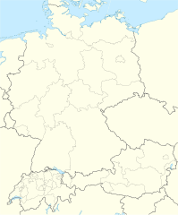
| 10:20, 7 Mayo 2009 |  | 1,257 × 1,514 (950 KB) | NordNordWest | update | |
| 21:04, 6 Mayo 2009 |  | 1,257 × 1,514 (969 KB) | NordNordWest | {{Information |Description= {{de|Positionskarte der D-A-CH-Länder}} Quadratische Plattkarte, N-S-Streckung 150 %. Geographische Begrenzung der Karte: * N: 55.1° N * S: 45.7° N * W: 5.5° O * O: 17.2° O {{en|Location map of [[:en:German- |
Mga paggamit sa payl
Ang mosunod nga mga panid misumpay niining payl:
Global nga paggamit sa payl
Kining ubang wiki naggamit ning maong payl:
- Paggamit sa ar.wikipedia.org
- Paggamit sa bs.wikipedia.org
- Paggamit sa da.wikipedia.org
- Paggamit sa de.wikipedia.org
- Tatort (Fernsehreihe)
- Technische Universität
- Nord-Süd-Leitung
- Niederschlagsradar
- Kartellverband katholischer deutscher Studentenvereine
- Soldatensender
- Liste der Mitgliedsvereine des KV
- Diskussion:Swingolf
- Wikipedia:Redaktion Chemie/Mitarbeiter
- Benutzer:Spischot/Sketchpad 3
- Liste von Apothekenmuseen
- Wikipedia:Mentorenprogramm/Treffen
- Benutzer Diskussion:PhiliM
- Wikipedia:Kartenwerkstatt/Positionskarten/Europa
- Vorlage:Positionskarte D-A-CH
- Vorlage:Karte der Mitgliedsvereine des KV
- Wikipedia:Kartenwerkstatt/Archiv/2009-05
- Wikipedia:Jungwikipedianer/Mitglieder
- Benutzer Diskussion:Kingofears/Mentees/Woltmers
- Wikipedia:Redaktion Film und Fernsehen/Redaktionstreffen
- Wikipedia:WikiCon
- Alte Buchenwälder und Buchenurwälder der Karpaten und anderer Regionen Europas
- Wikipedia:Jungwikipedianer/JWP-Karte
- Wikipedia:Redaktion Chemie/Treffen
- Wikipedia:Jungwikipedianer/Café/Archiv/2012
- Wikipedia Diskussion:Jungwikipedianer/Archiv/2012/1. Teilarchiv
- Wikipedia Diskussion:Kurier/Archiv/2013/12
- Benutzer:Gps-for-five/Spielwiese/Vorlage:Suche Poskarte
- Benutzer:Gps-for-five/Spielwiese/Vorlage:Suche Poskarte/Doku
- Vorlage:Suche Positionskarte
- Vorlage:Suche Positionskarte/Doku
- Wikipedia:AdminConvention
- Südostlink
- Wikipedia:Mentorenprogramm/Treffen/2016
- Wikipedia:Jungwikipedianer/Treffen
- Wikipedia:WikiCon 2015/Kurzkonzept
- Wikipedia:AdminConvention 2016
- Österreichische Staatsmeisterschaften im Eisschnelllauf 2016
- Wikipedia:WikiProjekt Kategorien/CatCon
- Faustball-Europacup der Männer 2010
- Reichssammelschiene
- Wikipedia:Kartenwerkstatt/Archiv/2016-09
- Wikipedia:AdminConvention 2017
- 380-kV-Leitung Wesel–Dörpen
- Wikipedia:Jungwikipedianer/Treffen/2017
- Vorlage:Interaktive Karte von Apothekenmuseen
- EFA Champions Cup der Männer 2017
View more global usage of this file.