Payl:Dardanelles landsat.jpg
Walay mas taas nga resolusyon.
Dardanelles_landsat.jpg (737 × 584 pixels, size sa payl: 593 KB, MIME type: image/jpeg)
Mubong sugid:
| Deskripsyon |
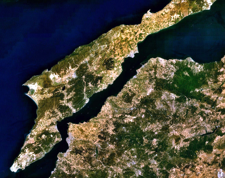
English: Landsat 7 image of the Dardanelles and Gallipoli Peninsula, Turkey. |
|||
| Petsa | ||||
| Gigikanan | Captured and cropped from NASA World Wind. | |||
| Tagsulat | NASA | |||
| Pagtugot (Paggamit pag-usab niini nga file) |
|

Kaagi sa payl
I-klik ang petsa/oras aron makit-an ang hulagway sa payl niadtong panahona.
| Petsa/Takna | Thumbnail | Mga dimensyon | Tiggamit | Komento | |
|---|---|---|---|---|---|
| kasamtangan | 03:06, 26 Septiyembre 2013 | | 737 × 584 (593 KB) | Jahoe | improved colour |
| 12:53, 17 Septiyembre 2006 |  | 737 × 584 (205 KB) | ChrisO | NASA Landsat 7 image of the Dardanelles and Gallipoli Peninsula, Turkey. Category:Satellite images of peninsulas |
Mga paggamit sa payl
Ang mosunod nga mga panid misumpay niining payl:
Global nga paggamit sa payl
Kining ubang wiki naggamit ning maong payl:
- Paggamit sa af.wikipedia.org
- Paggamit sa an.wikipedia.org
- Paggamit sa ar.wikipedia.org
- Paggamit sa arz.wikipedia.org
- Paggamit sa ast.wikipedia.org
- Paggamit sa azb.wikipedia.org
- Paggamit sa be-tarask.wikipedia.org
- Paggamit sa be.wikipedia.org
- Paggamit sa bg.wikipedia.org
- Paggamit sa bo.wikipedia.org
- Paggamit sa ca.wikipedia.org
- Paggamit sa ckb.wikipedia.org
- Paggamit sa co.wikipedia.org
- Paggamit sa cs.wikipedia.org
- Paggamit sa cy.wikipedia.org
- Paggamit sa de.wikipedia.org
- Paggamit sa el.wikipedia.org
- Paggamit sa en.wikipedia.org
- Paggamit sa eo.wikipedia.org
- Paggamit sa eo.wikiquote.org
- Paggamit sa es.wikipedia.org
- Paggamit sa eu.wikipedia.org
- Paggamit sa fa.wikipedia.org
- Paggamit sa fr.wikipedia.org
- Paggamit sa ga.wikipedia.org
- Paggamit sa gl.wikipedia.org
- Paggamit sa he.wikipedia.org
- Paggamit sa ja.wikipedia.org
- Paggamit sa kk.wikipedia.org
- Paggamit sa ku.wikipedia.org
- Paggamit sa ky.wikipedia.org
- Paggamit sa lb.wikipedia.org
- Paggamit sa nn.wikipedia.org
- Paggamit sa no.wikipedia.org
- Paggamit sa pl.wikipedia.org
- Paggamit sa pl.wiktionary.org
View more global usage of this file.