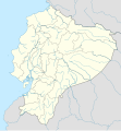
Payl:Ecuador location map.svg

Size of this PNG preview of this SVG file: 556 x 599 ka mga piksel. Uban pang mga resoluyon: 223 x 240 ka mga piksel | 445 x 480 ka mga piksel | 713 x 768 ka mga piksel | 950 x 1,024 ka mga piksel | 1,901 x 2,048 ka mga piksel | 1,535 x 1,654 ka mga piksel.
Tibuok resolusyon (SVG nga payl, nominally 1,535 × 1,654 pixels, size sa payl: 1.03 MB)
Kaagi sa payl
I-klik ang petsa/oras aron makit-an ang hulagway sa payl niadtong panahona.
| Petsa/Takna | Thumbnail | Mga dimensyon | Tiggamit | Komento | |
|---|---|---|---|---|---|
| kasamtangan | 23:57, 2 Hunyo 2023 |  | 1,535 × 1,654 (1.03 MB) | Milenioscuro | code clean |
| 23:59, 18 Abril 2023 |  | 1,535 × 1,654 (1.91 MB) | David C. S. | Límites | |
| 23:55, 18 Abril 2023 |  | 1,535 × 1,654 (1.91 MB) | David C. S. | Límites y ríos | |
| 03:30, 3 Abril 2023 |  | 1,535 × 1,654 (1.86 MB) | David C. S. | Límites | |
| 23:40, 30 Marso 2023 |  | 1,535 × 1,654 (1.79 MB) | David C. S. | Límites y ríos | |
| 23:20, 24 Marso 2023 |  | 1,535 × 1,654 (1.5 MB) | David C. S. | Límites y ríos | |
| 16:28, 13 Pebrero 2023 |  | 1,535 × 1,654 (1.37 MB) | David C. S. | Límites y ríos | |
| 21:03, 1 Mayo 2018 |  | 1,535 × 1,654 (246 KB) | Janitoalevic | Added Payana island to Ecuador color. | |
| 18:48, 20 Hunyo 2012 |  | 1,535 × 1,654 (242 KB) | NordNordWest | upd | |
| 16:28, 14 Hunyo 2012 |  | 1,535 × 1,654 (231 KB) | NordNordWest | Reverted to version as of 10:28, 14 June 2012. See your talk page. Please do not change this map again. |
Mga paggamit sa payl
More than 100 pages use this file. The following list shows the first 100 pages that use this file only. A full list is available.
- Baba
- Blue Hill
- Buenavista
- Cabo Verde (pagklaro)
- Cape Verde (pagklaro)
- Cerro Blanco
- Cerro Colorado
- Cerro El Carmen
- Cerro El Gallo
- Cerro El Picacho
- Cerro El Toro
- Cerro Grande
- Cerro La Laguna
- Cerro Negro
- Cerro Santa Ana
- Cerro Verde
- Chito
- East Rock
- El Carmen
- El Rosario
- Estero Grande
- Estero San Francisco
- Isla Santa Rosa
- Jama
- La Paz
- Laguna Grande
- Laguna Verde
- Lican (pagklaro)
- Lita
- Loma La Esperanza
- Magdalena (pagklaro)
- Pueblo Nuevo
- Punta Gorda
- Punta de Piedra
- Quebrada Arriba
- Quebrada El Rosario
- Quebrada Grande
- Quebrada La Esperanza
- Quebrada Las Canas
- Quebrada Las Cañas
- Quebrada San Antonio
- Quebrada San Jose
- Quebrada San José
- Quebrada San Juan
- Quebrada San Lorenzo
- Quebrada Santa Isabel
- Quebrada Santa Rita
- Quebrada Santa Rosa
- Quebrada Seca
- Rio Blanco
- Rio Canas
- Rio Chiquito
- Rio Congo
- Rio El Dorado
- Rio Grande
- Rio Negro
- Rio Piedras
- Rio San Antonio
- Rio San Jose
- Rio San Juan
- Rio San Lorenzo
- Rio Seco
- Rio Soledad
- Rio Sucio
- Río Blanco
- Río Cañas
- Río Chiquito
- Río Congo
- Río Frío
- Río Grande
- Río Hondo
- Río Negro
- Río Piedras
- Río San Antonio
- Río San José
- Río San Juan
- Río San Lorenzo
- Río San Pablo
- Río Santa Ana
- Río Santa Clara
- Río Seco
- Río Sucio
- Río Tigre
- Río del Medio
- San Antonio
- San Carlos
- San Fernando
- San Francisco
- San Isidro
- San Lorenzo (pagklaro)
- San Lucas
- San Nicolás
- San Pedro (pagklaro)
- San Rafael
- Santa Isabel
- Santa Lucia
- Santa Lucía
- Santa Rosa
- Santo Domingo
- Victoria
View more links to this file.
Global nga paggamit sa payl
Kining ubang wiki naggamit ning maong payl:
- Paggamit sa af.wikipedia.org
- Paggamit sa an.wikipedia.org
- Paggamit sa ar.wikipedia.org
- Paggamit sa ast.wikipedia.org
- Quitu
- Volcán Chimborazo
- Palaciu Llexislativu d'Ecuador
- Volcán Cotopaxi
- Módulu:Mapa de llocalización/datos/Ecuador
- Campeonatu Suramericanu 1947
- Copa América 1993
- Universidá Central del Ecuador
- Aeropuertu Chachoan - Ambato
- Aeropuertu Francisco de Orellana
- Aeropuertu General Manuel Serrano - Machala
- Aeropuertu Internacional Mariscal Sucre
- Aeropuertu José María Velasco Ibarra - Macará
- Aeropuertu Jumandy
- Aeropuertu Mayor Galo de la Torre
- Aeropuertu Río Amazonas
- Aeropuertu de Lago Agrio
- Antiguu Aeropuertu Internacional Mariscal Sucre
- Puertu de Manta
- Módulu:Mapa de llocalización/datos/Ecuador/usu
- Golfu de Guayaquil
- Paggamit sa az.wikipedia.org
- Paggamit sa ban.wikipedia.org
- Paggamit sa be-tarask.wikipedia.org
- Paggamit sa be.wikipedia.org
View more global usage of this file.

