Payl:EspañaLoc.svg

Size of this PNG preview of this SVG file: 800 x 457 ka mga piksel. Uban pang mga resoluyon: 320 x 183 ka mga piksel | 640 x 366 ka mga piksel | 1,024 x 585 ka mga piksel | 1,280 x 731 ka mga piksel | 2,560 x 1,462 ka mga piksel | 3,300 x 1,885 ka mga piksel.
Tibuok resolusyon (SVG nga payl, nominally 3,300 × 1,885 pixels, size sa payl: 1.9 MB)
Mubong sugid:
| Deskripsyon |
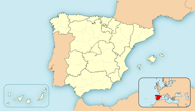
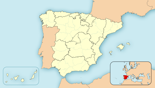
English: Location map of Spain
Equirectangular projection, N/S stretching 130 %. Geographic limits of the map:
Español: Mapa de localización de España
Proyección cilíndrica equidistante, N/S estirada 130 %. Límites geográficos del mapa:
|
|
| Petsa | ||
| Gigikanan | Kaugalingong trabaho | |
| Tagsulat | HansenBCN | |
| Other versions |
Derivative works of this file: |
|
| SVG genesis | This locator map was created with Inkscape.
|


Pagtugot
| I, the copyright holder of this work, release this work into the public domain. This applies worldwide. In some countries this may not be legally possible; if so: I grant anyone the right to use this work for any purpose, without any conditions, unless such conditions are required by law. |
Kaagi sa payl
I-klik ang petsa/oras aron makit-an ang hulagway sa payl niadtong panahona.
| Petsa/Takna | Thumbnail | Mga dimensyon | Tiggamit | Komento | |
|---|---|---|---|---|---|
| kasamtangan | 12:22, 8 Disyembre 2010 | | 3,300 × 1,885 (1.9 MB) | Miguillen | quito bordes |
| 14:33, 24 Nobiyembre 2010 |  | 3,300 × 1,885 (1.9 MB) | Miguillen | no se ve. y abriendo la imagen en inkscape veo que se ha vandalizado | |
| 14:23, 24 Nobiyembre 2010 |  | 3,300 × 1,885 (777 KB) | Mutxamel | Borders | |
| 01:28, 15 Pebrero 2010 |  | 3,300 × 1,885 (1.9 MB) | Miguillen | Reverted to version as of 09:28, 27 April 2008 | |
| 15:50, 13 Pebrero 2010 |  | 3,300 × 1,885 (1.63 MB) | Malus Catulus | Removed fancy shadow effect which is un-standard | |
| 09:28, 27 Abril 2008 |  | 3,300 × 1,885 (1.9 MB) | HansenBCN | Sombreado de agua - desplazado - y fronteras provinciales más tenues | |
| 19:23, 26 Abril 2008 |  | 3,300 × 1,885 (1.89 MB) | HansenBCN | +fronteras provinciales | |
| 14:39, 26 Abril 2008 |  | 3,300 × 1,885 (967 KB) | HansenBCN | Bordes | |
| 14:34, 26 Abril 2008 |  | 3,300 × 1,885 (967 KB) | HansenBCN | == Summary == {{Information |Description=Spain Location Map |Source=self-made |Date=26/april/2008 |Author= HansenBCN |Permission= |other_versions=50px }} == Licensing == {{PD-self}} |
Mga paggamit sa payl
There are no pages that use this file.
Global nga paggamit sa payl
Kining ubang wiki naggamit ning maong payl:
- Paggamit sa ar.wikipedia.org
- Paggamit sa arz.wikipedia.org
- Paggamit sa azb.wikipedia.org
- Paggamit sa br.wikipedia.org
- Paggamit sa ca.wikipedia.org
- Paggamit sa cbk-zam.wikipedia.org
- Paggamit sa eml.wikipedia.org
- Paggamit sa en.wikipedia.org
- Paggamit sa eo.wikipedia.org
- Paggamit sa es.wikipedia.org
View more global usage of this file.