Payl:Falkland Islands location map.svg

Size of this PNG preview of this SVG file: 737 x 600 ka mga piksel. Uban pang mga resoluyon: 295 x 240 ka mga piksel | 590 x 480 ka mga piksel | 944 x 768 ka mga piksel | 1,258 x 1,024 ka mga piksel | 2,516 x 2,048 ka mga piksel | 1,134 x 923 ka mga piksel.
Tibuok resolusyon (SVG nga payl, nominally 1,134 × 923 pixels, size sa payl: 138 KB)
Mubong sugid:
| Description |
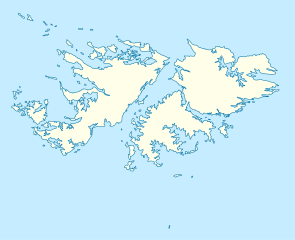
Deutsch: Positionskarte der Falklandinseln
Quadratische Plattkarte, N-S-Streckung 155 %. Geographische Begrenzung der Karte:
English: Location map of the Falkland Islands
Equirectangular projection, N/S stretching 155 %. Geographic limits of the map:
|
|||||||||
| Petsa | ||||||||||
| Gigikanan | own work, using United States National Imagery and Mapping Agency data | |||||||||
| Creator | ||||||||||
| Geotemporal data | ||||||||||
| Bounding box |
|
|||||||||
| Georeferencing | If inappropriate please set warp_status = skip to hide. | |||||||||
| Other versions |
Derivative works of this file: |
|||||||||

|
This map has been made or improved in the German Kartenwerkstatt (Map Lab). You can propose maps to improve as well.
|
Pagtugot
I, the copyright holder of this work, hereby publish it under the following licenses:

|
Gitugot ang pagkopya, pag-apud-apod o/ug pag-usab ning maong dokumento ubos sa mga termino sa GNU Free Documentation License, Version 1.2 o mas bag-ong bersiyon nga gimantala sa Free Software Foundation; nga walay Invariant Sections, walay Front-Cover Texts, ug walay Back-Cover Texts. Ang kopya sa lisensiya gilakip sa bahin nga giulohang GNU Free Documentation License. |
This file is licensed under the Creative Commons Attribution 3.0 Unported license.
- Libre ka:
- sa pagsabwag – sa pagkopya, pag-apod-apod ug pagsabwag sa hinimo
- sa pag-remix – sa pag-adap sa binuhat
- Ubos sa mosunod nga mga kondisyon:
- atribusyon – Kinahanglan nimo nga hatagan ang angay nga kredito, maghatag usa ka link sa lisensya, ug ipakita kung adunay mga pagbag-o. Mahimo nimo kini buhaton sa bisan unsang makatarunganon nga paagi, apan dili sa bisan unsang paagi nga nagsugyot nga gi-endorso ka sa licensor o ang imong paggamit.
You may select the license of your choice.
Kaagi sa payl
I-klik ang petsa/oras aron makit-an ang hulagway sa payl niadtong panahona.
| Petsa/Takna | Thumbnail | Mga dimensyon | Tiggamit | Komento | |
|---|---|---|---|---|---|
| kasamtangan | 12:00, 15 Marso 2009 | | 1,134 × 923 (138 KB) | NordNordWest | {{Information |Description= {{de|Positionskarte der Falklandinseln}} Quadratische Plattkarte, N-S-Streckung 155 %. Geographische Begrenzung der Karte: * N: 50.9° S * S: 53.0° S * W: 61.5° W * O: 57.5° W {{en|Location map of the |
Mga paggamit sa payl
More than 100 pages use this file. The following list shows the first 100 pages that use this file only. A full list is available.
- Beaver Island
- Bird Island
- Black Point
- Black Rock
- Black Rocks
- Bluff Island
- Bluff Point
- Boat Rock
- Boulder Point
- Broken Island
- Brown Point
- Castle Hill
- Castle Rock
- Centre Island
- Channel Rock
- Creek Point
- Dog Point
- Dyke Point
- Eagle Rock
- East Point
- Elephant Bay
- Fish Creek
- George Island
- Goat Point
- Green Island
- Green Islet
- Green Point
- High Island
- High Rock
- Hill Island
- Hog Island
- Hope Point
- Hospital Point
- Hut Point
- Isla Baja
- Isla Grande
- Island Harbour
- Knob Point
- Little Island
- Long Island
- Low Bay
- Low Island
- Low Point
- Margaret Hill
- Middle Island
- Middle Point
- Monkey Point
- Mount Misery
- Mount Pleasant
- North Beach
- North Creek
- North Point
- Outer Island
- Penguin Island
- Penguin Point
- Platt Point
- Pond Bay
- Prong Point
- Punta Dick
- Punta Águila
- Rabbit Island
- Rat Island
- Red Point
- Reef Harbour
- Roca Blanca
- Roca Negra
- Rock Point
- Rookery Island
- Round Mountain
- Round Point
- Saddle Hill
- Saddle Island
- Sail Rock
- Sandy Island
- Sapper Hill
- Scott Island
- Seal Island
- Seal Point
- Seal Rocks
- Shag Point
- Shag Rock
- Sharp Peak
- Sisters
- Sound Point
- South Head
- South West Point
- Spring Point
- Stanley
- Sugar Loaf
- Swan Point
- Table Point
- The Bluff
- West Point
- Whale Point
- White Bluff
- White Island
- White Point
- White Rock
- William Point
- Wolf Rock
View more links to this file.
Global nga paggamit sa payl
Kining ubang wiki naggamit ning maong payl:
- Paggamit sa af.wikipedia.org
- Paggamit sa an.wikipedia.org
- Paggamit sa ar.wikipedia.org
- Paggamit sa ast.wikipedia.org
- Paggamit sa az.wikipedia.org
- Paggamit sa ba.wikipedia.org
- Paggamit sa be-tarask.wikipedia.org
- Paggamit sa be.wikipedia.org
- Paggamit sa bg.wikipedia.org
- Paggamit sa bn.wikipedia.org
- Paggamit sa ca.wikipedia.org
- Paggamit sa cs.wikipedia.org
- Paggamit sa da.wikipedia.org
- Paggamit sa de.wikipedia.org
- Paggamit sa de.wikivoyage.org
- Paggamit sa el.wikipedia.org
- Paggamit sa en.wikipedia.org
View more global usage of this file.