Payl:Fogama'a Crater.jpg
Walay mas taas nga resolusyon.
Fogama'a_Crater.jpg (300 × 225 pixels, size sa payl: 30 KB, MIME type: image/jpeg)
Mubong sugid:
| Camera location | | View this and other nearby images on: OpenStreetMap |
|---|
| Deskripsyon |
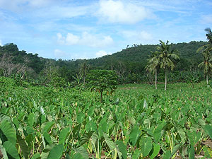
English: Fogama'a Crater National Natural Landmark, Tutuila, American Samoa |
| Petsa | Unknown date |
| Gigikanan | http://www.nature.nps.gov/nnl/site.cfm?Site=FOCR-AS |
| Tagsulat | Unknown author |
Pagtugot
| This image or media file contains material based on a work of a National Park Service employee, created as part of that person's official duties. As a work of the U.S. federal government, such work is in the public domain in the United States. See the NPS website and NPS copyright policy for more information. |
Kaagi sa payl
I-klik ang petsa/oras aron makit-an ang hulagway sa payl niadtong panahona.
| Petsa/Takna | Thumbnail | Mga dimensyon | Tiggamit | Komento | |
|---|---|---|---|---|---|
| kasamtangan | 15:43, 19 Marso 2012 | | 300 × 225 (30 KB) | Deor |
Mga paggamit sa payl
Ang mosunod nga 3 panid misumpay niining payl:
Global nga paggamit sa payl
Kining ubang wiki naggamit ning maong payl:
- Paggamit sa en.wikipedia.org
- Paggamit sa it.wikipedia.org
- Paggamit sa pl.wikipedia.org
- Paggamit sa sm.wikipedia.org
- Paggamit sa www.wikidata.org