Payl:Fort Bragg California aerial view.jpg
Gidak-on ning maong paunang tan-aw: 800 x 533 ka mga piksel. Uban pang mga resoluyon: 320 x 213 ka mga piksel | 640 x 427 ka mga piksel | 1,024 x 683 ka mga piksel | 1,500 x 1,000 ka mga piksel.
Tibuok resolusyon (1,500 × 1,000 pixels, size sa payl: 724 KB, MIME type: image/jpeg)
| Deskripsyon |
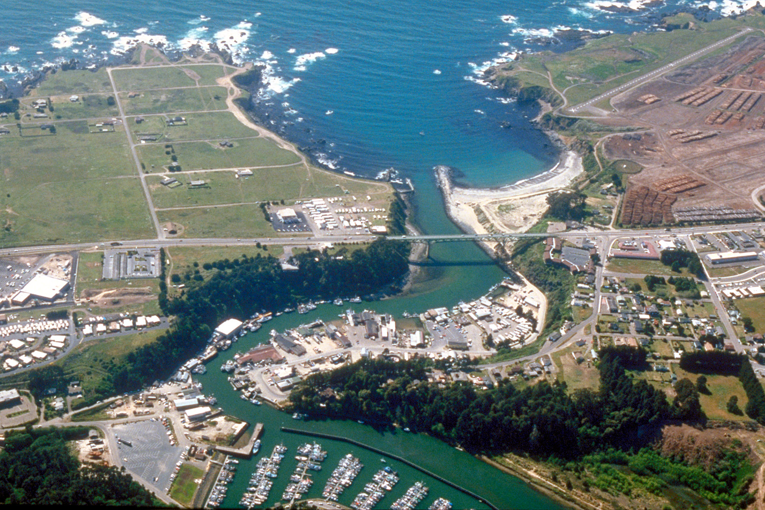
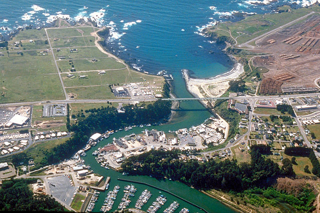
English: Aerial view of the mouth of the Noyo River on the Pacific Ocean at Fort Bragg, Mendocino County, California, USA. California State Route 1 (Main Street in Fort Bragg) crosses the river at the outlet. View is to the west.
Coordinates: 39°25′38.37″N 123°48′24.63″W / 39.427325°N 123.8068417°W |
||
| Petsa | not specified or unknown, 2007 or before, but judging by the view and visual of the photo, it appears to be from the mid-late 1990s. | ||
| Gigikanan |
U.S. Army Corps of Engineers Digital Visual Library Image page Image description page Digital Visual Library home page |
||
| Tagsulat | Robert Campbell | ||
| Pagtugot (Paggamit pag-usab niini nga file) |
This file is licensed under the Creative Commons Attribution-Share Alike 3.0 Unported license.
|
||
| Location | Fort Bragg, Mendocino County, California, USA |

| Camera location | | View this and other nearby images on: OpenStreetMap |
|---|
Kaagi sa payl
I-klik ang petsa/oras aron makit-an ang hulagway sa payl niadtong panahona.
| Petsa/Takna | Thumbnail | Mga dimensyon | Tiggamit | Komento | |
|---|---|---|---|---|---|
| kasamtangan | 03:20, 3 Mayo 2007 | | 1,500 × 1,000 (724 KB) | DanMS | {{Information | Description = {{en|Aerial view of the mouth of the Noyo River on the Pacific Ocean at Fort Bragg, Mendocino County, California, USA. California State Route 1 (Main Street in Fort Bragg) crosses the river at the outlet. View is to the we |
Mga paggamit sa payl
Ang mosunod nga 3 panid misumpay niining payl:
Global nga paggamit sa payl
Kining ubang wiki naggamit ning maong payl:
- Paggamit sa ar.wikipedia.org
- Paggamit sa arz.wikipedia.org
- Paggamit sa az.wikipedia.org
- Paggamit sa be.wikipedia.org
- Paggamit sa bg.wikipedia.org
- Paggamit sa ca.wikipedia.org
- Paggamit sa ce.wikipedia.org
- Paggamit sa cs.wikipedia.org
- Paggamit sa cy.wikipedia.org
- Paggamit sa de.wikipedia.org
- Paggamit sa de.wikivoyage.org
- Paggamit sa en.wikipedia.org
- Paggamit sa en.wikivoyage.org
- Paggamit sa eo.wikipedia.org
- Paggamit sa es.wikipedia.org
- Paggamit sa eu.wikipedia.org
- Paggamit sa fa.wikipedia.org
- Paggamit sa fi.wikipedia.org
- Paggamit sa fr.wikipedia.org
- Paggamit sa ga.wikipedia.org
- Paggamit sa gl.wikipedia.org
- Paggamit sa he.wikivoyage.org
- Paggamit sa ht.wikipedia.org
- Paggamit sa hu.wikipedia.org
- Paggamit sa hy.wikipedia.org
- Paggamit sa it.wikipedia.org
- Paggamit sa ko.wikipedia.org
- Paggamit sa la.wikipedia.org
- Paggamit sa lld.wikipedia.org
- Paggamit sa ml.wikipedia.org
View more global usage of this file.