Payl:GediminasCastle002.jpg

Gidak-on ning maong paunang tan-aw: 608 x 600 ka mga piksel. Uban pang mga resoluyon: 243 x 240 ka mga piksel | 486 x 480 ka mga piksel | 754 x 744 ka mga piksel.
Tibuok resolusyon (754 × 744 pixels, size sa payl: 62 KB, MIME type: image/jpeg)
| Camera location | | View this and other nearby images on: OpenStreetMap |
|---|
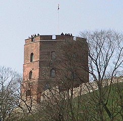
Gediminas Castle n Vilnius
| I, the copyright holder of this work, release this work into the public domain. This applies worldwide. In some countries this may not be legally possible; if so: I grant anyone the right to use this work for any purpose, without any conditions, unless such conditions are required by law. |
Kaagi sa payl
I-klik ang petsa/oras aron makit-an ang hulagway sa payl niadtong panahona.
| Petsa/Takna | Thumbnail | Mga dimensyon | Tiggamit | Komento | |
|---|---|---|---|---|---|
| kasamtangan | 09:23, 1 Mayo 2005 | | 754 × 744 (62 KB) | Knutux | Gediminas Castle n Vilnius {{PD-self}} |
Mga paggamit sa payl
Ang mosunod nga mga panid misumpay niining payl:
Global nga paggamit sa payl
Kining ubang wiki naggamit ning maong payl:
- Paggamit sa ay.wikipedia.org
- Paggamit sa bat-smg.wikipedia.org
- Paggamit sa ca.wikipedia.org
- Paggamit sa da.wikipedia.org
- Paggamit sa de.wikipedia.org
- Paggamit sa es.wikipedia.org
- Paggamit sa gag.wikipedia.org
- Paggamit sa ja.wikipedia.org
- Paggamit sa ka.wikipedia.org
- Paggamit sa lmo.wikipedia.org
- Paggamit sa lv.wikipedia.org
- Paggamit sa ne.wikipedia.org
- Paggamit sa oc.wikipedia.org
- Paggamit sa sw.wikipedia.org
- Paggamit sa tk.wikipedia.org