Payl:Havré 101220 (1).JPG

Gidak-on ning maong paunang tan-aw: 800 x 533 ka mga piksel. Uban pang mga resoluyon: 320 x 213 ka mga piksel | 640 x 427 ka mga piksel | 1,024 x 683 ka mga piksel | 1,280 x 853 ka mga piksel | 2,560 x 1,707 ka mga piksel | 3,888 x 2,592 ka mga piksel.
Tibuok resolusyon (3,888 × 2,592 pixels, size sa payl: 3.68 MB, MIME type: image/jpeg)
Mubong sugid:
| Deskripsyon |
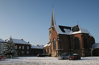
Français : Havré (Belgique), l’église Saint-Martin (XVI siècle).
English: Havré (Belgium), the Saint Martin’s church (XVIth century).
Nederlands: Havré (België), de Sint-Martinuskerk (XVIde eeuw).
Walon : Avré (Bèljike), l’èglîje Sint-Maurtin (XVIin.me sièke). |
||
| Petsa | |||
| Gigikanan | Kaugalingong trabaho | ||
| Tagsulat | Jean-Pol GRANDMONT | ||
| Pagtugot (Paggamit pag-usab niini nga file) |
|


.JPG)
.JPG)
| Camera location | | View this and other nearby images on: OpenStreetMap |
|---|
.JPG¶ms=050.464167_N_0004.044722_E_globe:Earth_type:camera_type:landmark_region:BE_scale:1000_&language=ceb)
Pagtugot
I, the copyright holder of this work, hereby publish it under the following licenses:

|
Gitugot ang pagkopya, pag-apud-apod o/ug pag-usab ning maong dokumento ubos sa mga termino sa GNU Free Documentation License, Version 1.2 o mas bag-ong bersiyon nga gimantala sa Free Software Foundation; nga walay Invariant Sections, walay Front-Cover Texts, ug walay Back-Cover Texts. Ang kopya sa lisensiya gilakip sa bahin nga giulohang GNU Free Documentation License. |
This file is licensed under the Creative Commons Attribution 3.0 Unported license.
- Libre ka:
- sa pagsabwag – sa pagkopya, pag-apod-apod ug pagsabwag sa hinimo
- sa pag-remix – sa pag-adap sa binuhat
- Ubos sa mosunod nga mga kondisyon:
- atribusyon – Kinahanglan nimo nga hatagan ang angay nga kredito, maghatag usa ka link sa lisensya, ug ipakita kung adunay mga pagbag-o. Mahimo nimo kini buhaton sa bisan unsang makatarunganon nga paagi, apan dili sa bisan unsang paagi nga nagsugyot nga gi-endorso ka sa licensor o ang imong paggamit.
You may select the license of your choice.
Kaagi sa payl
I-klik ang petsa/oras aron makit-an ang hulagway sa payl niadtong panahona.
| Petsa/Takna | Thumbnail | Mga dimensyon | Tiggamit | Komento | |
|---|---|---|---|---|---|
| kasamtangan | 09:40, 24 Disyembre 2010 | | 3,888 × 2,592 (3.68 MB) | Jean-Pol GRANDMONT | {{Information |Description={{fr|1='''Havré''' (Belgique), l’église Saint-Martin (XVI siècle).}} {{en|1='''Havré''' (Belgium), the Saint Martin’s church (XVIth century).}} {{nl|1='''Havré''' (België |
Mga paggamit sa payl
Ang mosunod nga mga panid misumpay niining payl:
Global nga paggamit sa payl
Kining ubang wiki naggamit ning maong payl:
- Paggamit sa ca.wikipedia.org
- Paggamit sa en.wikipedia.org
- Paggamit sa fr.wikipedia.org
- Paggamit sa it.wikipedia.org
- Paggamit sa nl.wikipedia.org
- Paggamit sa pcd.wikipedia.org
- Paggamit sa www.wikidata.org
.JPG)