Payl:Hurricane Canal into cliff.jpg

Gidak-on ning maong paunang tan-aw: 800 x 557 ka mga piksel. Uban pang mga resoluyon: 320 x 223 ka mga piksel | 640 x 445 ka mga piksel | 1,024 x 712 ka mga piksel | 1,280 x 891 ka mga piksel | 2,560 x 1,781 ka mga piksel | 4,647 x 3,233 ka mga piksel.
Tibuok resolusyon (4,647 × 3,233 pixels, size sa payl: 2.32 MB, MIME type: image/jpeg)
|
This is an image of a place or building that is listed on the National Register of Historic Places in the United States of America. Its reference number is 77001324. |
| Deskripsyon |
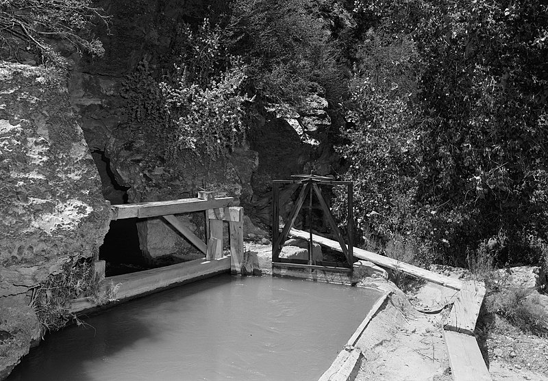
English: Along the Hurricane Canal east of Hurricane in Washington County, Utah, United States. At this point, the canal is going through a hole in a cliff. Built in 1904, the canal is listed on the National Register of Historic Places. |
|||||||||||||||||||||||||
| Petsa | ||||||||||||||||||||||||||
| Gigikanan | Library of Congress, Prints and Photograph Division HAER: UTAH,27-HURI,1-7 | |||||||||||||||||||||||||
| Tagsulat |
|
|||||||||||||||||||||||||
| Pagtugot (Paggamit pag-usab niini nga file) |
|
|||||||||||||||||||||||||
| Object location | | View this and other nearby images on: OpenStreetMap |
|---|

|
This image is available from the United States Library of Congress's Prints and Photographs division
under the digital ID hhh.ut0130. This tag does not indicate the copyright status of the attached work. A normal copyright tag is still required. See Commons:Licensing.
|
Kaagi sa payl
I-klik ang petsa/oras aron makit-an ang hulagway sa payl niadtong panahona.
| Petsa/Takna | Thumbnail | Mga dimensyon | Tiggamit | Komento | |
|---|---|---|---|---|---|
| kasamtangan | 18:04, 23 Mayo 2009 | | 4,647 × 3,233 (2.32 MB) | Cropbot | upload cropped version, operated by User:Finavon. Summary: border cropped |
| 17:39, 23 Mayo 2009 |  | 5,000 × 3,548 (2.54 MB) | Nyttend | {{Information |Description={{en|Along the {{w|Hurricane Canal}} east of {{w|Hurricane, Utah|Hurricane}} in {{w|Washington County, Utah|Washington County}}, {{w|Utah}}, {{w|United States}}. Note that the canal, at this point, is going through a hole in a |
Mga paggamit sa payl
Ang mosunod nga mga panid misumpay niining payl:
Global nga paggamit sa payl
Kining ubang wiki naggamit ning maong payl:
- Paggamit sa en.wikipedia.org
- Paggamit sa www.wikidata.org