Payl:Iyo-Aoshima Island Aerial photograph.jpg
Gidak-on ning maong paunang tan-aw: 800 x 580 ka mga piksel. Uban pang mga resoluyon: 320 x 232 ka mga piksel | 640 x 464 ka mga piksel | 1,024 x 743 ka mga piksel | 1,280 x 929 ka mga piksel | 2,531 x 1,836 ka mga piksel.
Tibuok resolusyon (2,531 × 1,836 pixels, size sa payl: 1.09 MB, MIME type: image/jpeg)
Mubong sugid:
| Deskripsyon |
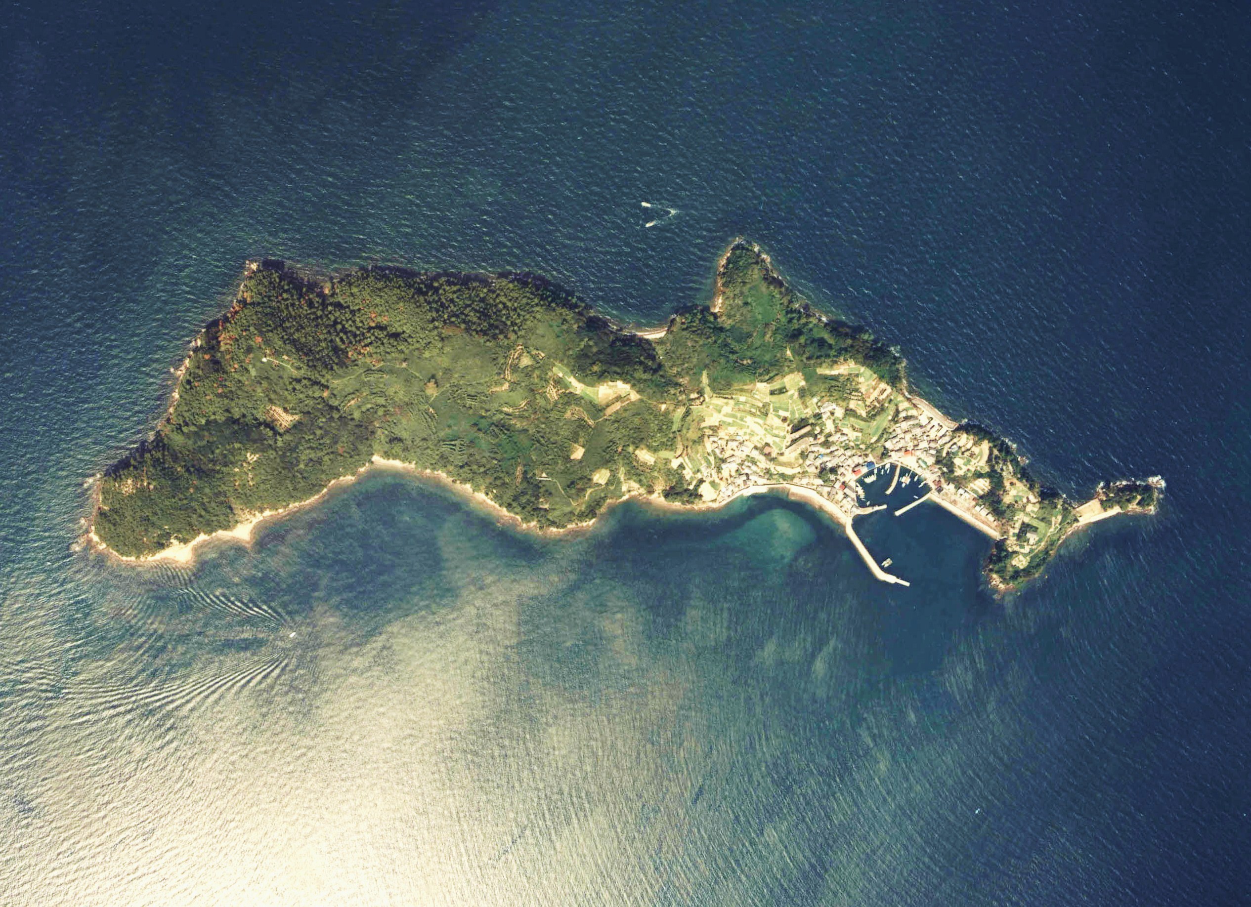
English: Iyo-Aoshima Island Aerial photograph
日本語: 伊予青島付近の空中写真(愛媛県大洲市)。ccg-81-3_c48_2を利用。 |
| Petsa | |
| Gigikanan | 国土情報ウェブマッピングシステム |
| Tagsulat | 国土交通省 |
Pagtugot

|
The copyright holder of this file, the Ministry of Land, Infrastructure, Transport and Tourism of Japan, allows anyone to use it for any purpose, provided that the copyright holder is properly attributed. Redistribution, derivative work, commercial use, and all other use is permitted. |
Attribution:
Copyright © National Land Image Information (Color Aerial Photographs), Ministry of Land, Infrastructure, Transport and Tourism
|
 |
This image is copyrighted by the Ministry of Land, Infrastructure, Transport and Tourism of Japan. For terms of use, see the stipulation to use of National Land Information (in Japanese) and message from MLIT (in Japanese and English). When you display this image on an article, include the following phrase in the description: "Made based on National Land Image Information (Color Aerial Photographs), Ministry of Land, Infrastructure, Transport and Tourism".
|
Kaagi sa payl
I-klik ang petsa/oras aron makit-an ang hulagway sa payl niadtong panahona.
| Petsa/Takna | Thumbnail | Mga dimensyon | Tiggamit | Komento | |
|---|---|---|---|---|---|
| kasamtangan | 06:43, 12 Nobiyembre 2012 | | 2,531 × 1,836 (1.09 MB) | さかおり | {{Information |Description ={{en|1=Iyo-Aoshima Island Aerial photograph}} {{ja|1=伊予青島付近の空中写真(愛媛県大洲市)。ccg-81-3_c48_2を利用。}} |Source =国土情報ウェブマッピングシステム |Author ... |
Mga paggamit sa payl
There are no pages that use this file.
Global nga paggamit sa payl
Kining ubang wiki naggamit ning maong payl:
- Paggamit sa az.wikipedia.org
- Paggamit sa ca.wikipedia.org
- Paggamit sa de.wikipedia.org
- Paggamit sa en.wikipedia.org
- Paggamit sa et.wikipedia.org
- Paggamit sa fr.wikipedia.org
- Paggamit sa id.wikipedia.org
- Paggamit sa it.wikipedia.org
- Paggamit sa ja.wikipedia.org
- Paggamit sa ko.wikipedia.org
- Paggamit sa pt.wikipedia.org
- Paggamit sa ru.wikipedia.org
- Paggamit sa sv.wikipedia.org
- Paggamit sa tr.wikipedia.org
- Paggamit sa vi.wikipedia.org
- Paggamit sa www.wikidata.org