Payl:JKRUK 20090428 PIŃCZÓW PANORAMA KOŚCIÓŁ RYNEK NIDA IMG 5909 H1000.jpg
Gidak-on ning maong paunang tan-aw: 800 x 429 ka mga piksel. Uban pang mga resoluyon: 320 x 172 ka mga piksel | 640 x 344 ka mga piksel | 1,024 x 550 ka mga piksel | 1,863 x 1,000 ka mga piksel.
Tibuok resolusyon (1,863 × 1,000 pixels, size sa payl: 636 KB, MIME type: image/jpeg)
Mubong sugid:
| Deskripsyon |
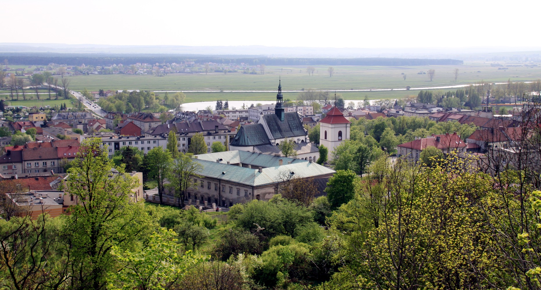
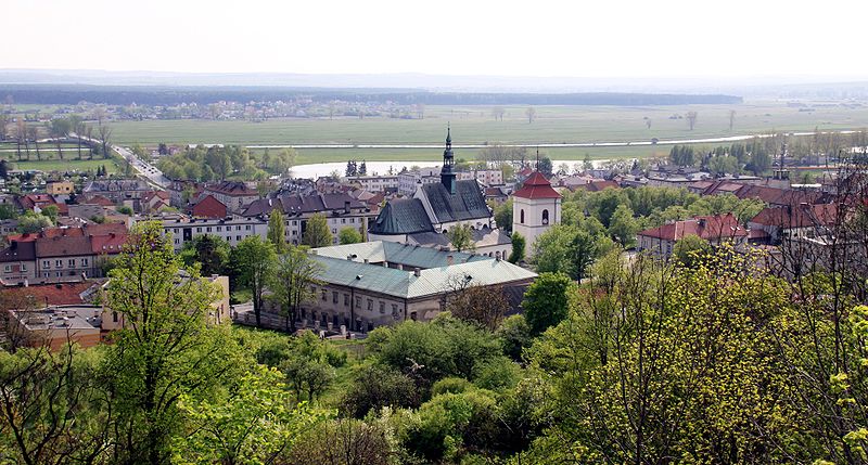
English: Pińczów, view from Mount St. Anne - city center with St. John the Evangelist Church and the valley of Nida River.
Polski: Pińczów, widok z Góry Św.Anny - centrum, kościół farny pw. św. Jana Ewangelisty i zabudowania dawnego klasztoru paulinów, dziś Pińczowskie Samorządowe Centrum Kultury |
|||||||||
| Petsa | ||||||||||
| Gigikanan | Kaugalingong trabaho | |||||||||
| Tagsulat |
|
| Camera location | | View this and other nearby images on: OpenStreetMap |
|---|
Pagtugot
I, the copyright holder of this work, hereby publish it under the following licenses:

|
Gitugot ang pagkopya, pag-apud-apod o/ug pag-usab ning maong dokumento ubos sa mga termino sa GNU Free Documentation License, Version 1.2 o mas bag-ong bersiyon nga gimantala sa Free Software Foundation; nga walay Invariant Sections, walay Front-Cover Texts, ug walay Back-Cover Texts. Ang kopya sa lisensiya gilakip sa bahin nga giulohang GNU Free Documentation License. |
This file is licensed under the Creative Commons Attribution-Share Alike 4.0 International, 3.0 Unported, 2.5 Generic, 2.0 Generic and 1.0 Generic license.
- Libre ka:
- sa pagsabwag – sa pagkopya, pag-apod-apod ug pagsabwag sa hinimo
- sa pag-remix – sa pag-adap sa binuhat
- Ubos sa mosunod nga mga kondisyon:
- atribusyon – Kinahanglan nimo nga hatagan ang angay nga kredito, maghatag usa ka link sa lisensya, ug ipakita kung adunay mga pagbag-o. Mahimo nimo kini buhaton sa bisan unsang makatarunganon nga paagi, apan dili sa bisan unsang paagi nga nagsugyot nga gi-endorso ka sa licensor o ang imong paggamit.
- share parehas – Kung imong gi-remix, gibag-o, o gibase sa materyal, kinahanglan nimo nga iapod-apod ang imong mga kontribusyon sa ilawom sa parehas o katugma nga lisensya sama sa orihinal.
You may select the license of your choice.
Kaagi sa payl
I-klik ang petsa/oras aron makit-an ang hulagway sa payl niadtong panahona.
| Petsa/Takna | Thumbnail | Mga dimensyon | Tiggamit | Komento | |
|---|---|---|---|---|---|
| kasamtangan | 12:09, 30 Hulyo 2009 | | 1,863 × 1,000 (636 KB) | Jrkruk | {{Information |Description={{en|1=Pińczów, view from Mount St. Anne - city center with St. John the Evangelist Church and the valley of Nida River. }} {{pl|1=Pińczów, widok z Góry Św.Anny - centrum, kościół farny pw. św. Jana Ewangelisty i zabu |
Mga paggamit sa payl
Ang mosunod nga mga panid misumpay niining payl:
Global nga paggamit sa payl
Kining ubang wiki naggamit ning maong payl:
- Paggamit sa be.wikipedia.org
- Paggamit sa bg.wikipedia.org
- Paggamit sa de.wikipedia.org
- Paggamit sa de.wikivoyage.org
- Paggamit sa eo.wikipedia.org
- Paggamit sa es.wikipedia.org
- Paggamit sa fr.wikipedia.org
- Paggamit sa gv.wikipedia.org
- Paggamit sa hak.wikipedia.org
- Paggamit sa it.wikipedia.org
- Paggamit sa lt.wikipedia.org
- Paggamit sa pl.wikipedia.org
- Paggamit sa pt.wikipedia.org
- Paggamit sa ro.wikipedia.org
- Paggamit sa ru.wikipedia.org
- Paggamit sa simple.wikipedia.org
- Paggamit sa sk.wikipedia.org
- Paggamit sa sr.wikipedia.org
- Paggamit sa szl.wikipedia.org
- Paggamit sa vi.wikipedia.org
- Paggamit sa www.wikidata.org