Payl:Kampala District Uganda.png

Gidak-on ning maong paunang tan-aw: 528 x 600 ka mga piksel. Uban pang mga resoluyon: 211 x 240 ka mga piksel | 422 x 480 ka mga piksel | 661 x 751 ka mga piksel.
Tibuok resolusyon (661 × 751 pixels, size sa payl: 31 KB, MIME type: image/png)
| Deskripsyon |
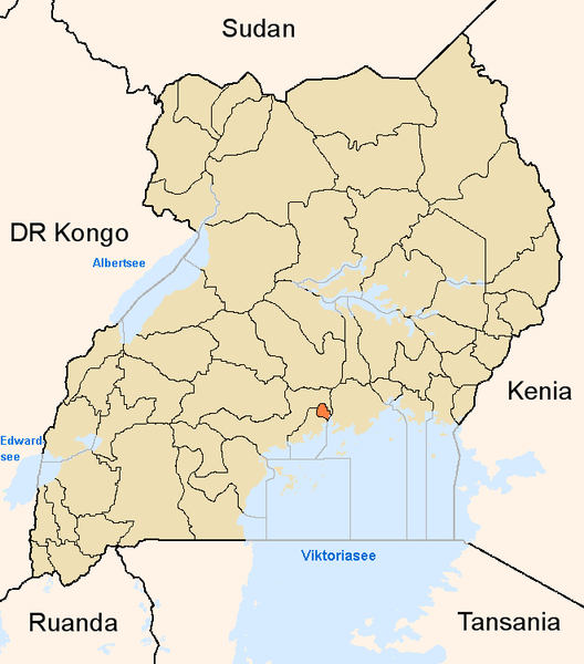
English: Map showing the position of the district Kampala in Uganda.
Deutsch: Karte, die die Position des Distriktes Kampala in Uganda anzeigt.
Plattdüütsch: Koort, de de Positschoon vun’n Distrikt Kampala in Uganda wiest. |
||
| Gigikanan | Kaugalingong trabaho | ||
| Tagsulat | |||
| Pagtugot (Paggamit pag-usab niini nga file) |
|
Kaagi sa payl
I-klik ang petsa/oras aron makit-an ang hulagway sa payl niadtong panahona.
| Petsa/Takna | Thumbnail | Mga dimensyon | Tiggamit | Komento | |
|---|---|---|---|---|---|
| kasamtangan | 17:03, 8 Hunyo 2005 | | 661 × 751 (31 KB) | Slomox | Map showing the position of the district Kampala in Uganda. {{GFDL}} Category:Maps of Ugandan districts |
Mga paggamit sa payl
Ang mosunod nga mga panid misumpay niining payl:
Global nga paggamit sa payl
Kining ubang wiki naggamit ning maong payl:
- Paggamit sa ar.wikipedia.org
- Paggamit sa en.wikipedia.org
- Paggamit sa fa.wikipedia.org
- Paggamit sa fi.wikipedia.org
- Paggamit sa fo.wikipedia.org
- Paggamit sa fr.wikinews.org
- Paggamit sa gl.wikipedia.org
- Paggamit sa ha.wikipedia.org
- Paggamit sa ig.wikipedia.org
- Paggamit sa is.wikipedia.org
- Paggamit sa ja.wikipedia.org
- Paggamit sa ko.wikipedia.org
- Paggamit sa mi.wikipedia.org
- Paggamit sa nds.wikipedia.org
- Paggamit sa oc.wikipedia.org
- Paggamit sa pl.wiktionary.org
- Paggamit sa ps.wikipedia.org
- Paggamit sa pt.wikipedia.org
- Paggamit sa qu.wikipedia.org
- Paggamit sa sw.wikipedia.org
- Paggamit sa ts.wikipedia.org
- Paggamit sa ur.wikipedia.org
- Paggamit sa vo.wikipedia.org
- Paggamit sa www.wikidata.org
- Paggamit sa yo.wikipedia.org
- Paggamit sa zh.wikipedia.org
- Paggamit sa zu.wikipedia.org