Payl:Kayseri (tr).svg

Size of this PNG preview of this SVG file: 624 x 600 ka mga piksel. Uban pang mga resoluyon: 250 x 240 ka mga piksel | 500 x 480 ka mga piksel | 799 x 768 ka mga piksel | 1,066 x 1,024 ka mga piksel | 2,131 x 2,048 ka mga piksel | 641 x 616 ka mga piksel.
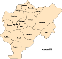
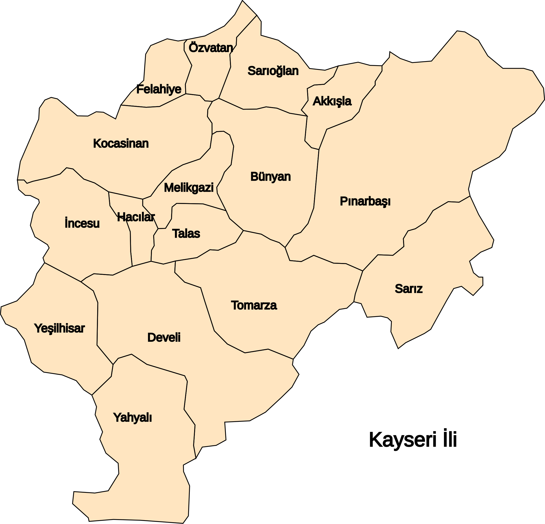
Tibuok resolusyon (SVG nga payl, nominally 641 × 616 pixels, size sa payl: 36 KB)
.svg)
Kayseri il haritası / map of province Kayseri
| This work has been released into the public domain by its author, katpatuka. This applies worldwide. In some countries this may not be legally possible; if so: |
Kaagi sa payl
I-klik ang petsa/oras aron makit-an ang hulagway sa payl niadtong panahona.
| Petsa/Takna | Thumbnail | Mga dimensyon | Tiggamit | Komento | |
|---|---|---|---|---|---|
| kasamtangan | 11:46, 10 Nobiyembre 2006 | | 641 × 616 (36 KB) | Katpatuka | Kayseri il haritası / map of province Kayseri {{PD-user|katpatuka}} Category:SVG maps of Turkey |
Mga paggamit sa payl
Ang mosunod nga mga panid misumpay niining payl:
Global nga paggamit sa payl
Kining ubang wiki naggamit ning maong payl:
- Paggamit sa ar.wikipedia.org
- Paggamit sa az.wikipedia.org
- Paggamit sa ca.wikipedia.org
- Paggamit sa cs.wikipedia.org
- Paggamit sa de.wikipedia.org
- Paggamit sa diq.wikipedia.org
- Paggamit sa eo.wikipedia.org
- Paggamit sa es.wikipedia.org
- Paggamit sa eu.wikipedia.org
- Paggamit sa hy.wikipedia.org
- Paggamit sa ku.wikipedia.org
- Paggamit sa mzn.wikipedia.org
- Paggamit sa no.wikipedia.org
- Paggamit sa ro.wikipedia.org
- Paggamit sa ru.wikipedia.org
- Paggamit sa sr.wikipedia.org
- Paggamit sa tg.wikipedia.org
- Paggamit sa tr.wikipedia.org
- Paggamit sa uk.wikipedia.org
- Paggamit sa www.wikidata.org
.svg)