Payl:Khmelnytsky province physical map.svg

Size of this PNG preview of this SVG file: 329 x 599 ka mga piksel. Uban pang mga resoluyon: 132 x 240 ka mga piksel | 263 x 480 ka mga piksel | 421 x 768 ka mga piksel | 562 x 1,024 ka mga piksel | 1,124 x 2,048 ka mga piksel | 532 x 969 ka mga piksel.
Tibuok resolusyon (SVG nga payl, nominally 532 × 969 pixels, size sa payl: 710 KB)
Mubong sugid:
| Deskripsyon |
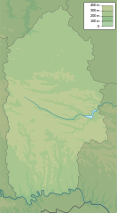
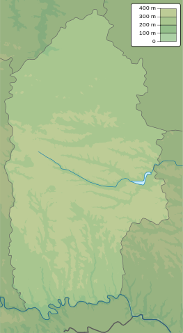
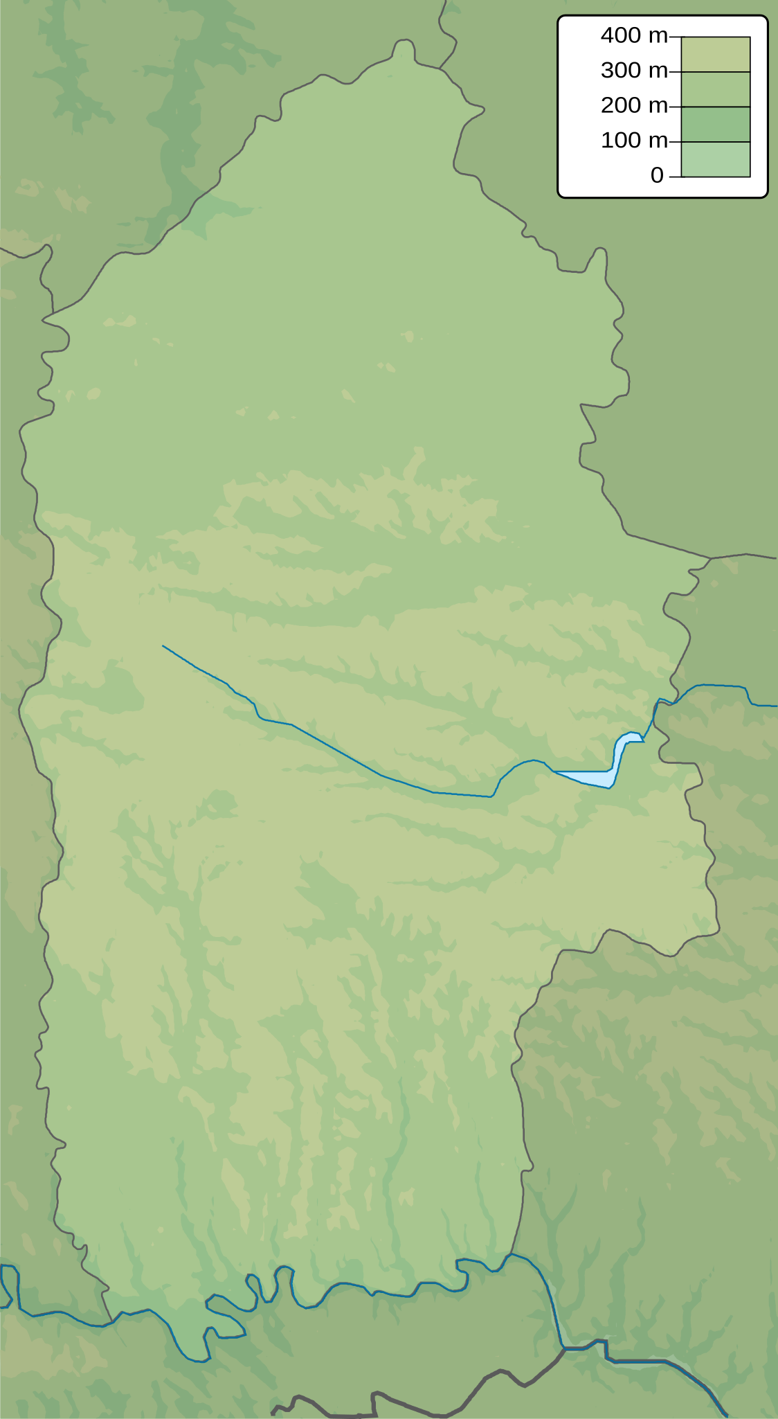
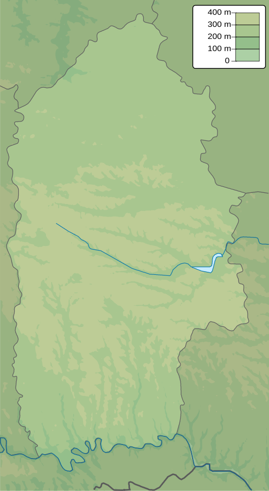
English: Physical map of Khmelnytsky province, Ukraine
Русский: Физическая карта Хмельницкой области, Украина |
| Petsa | |
| Gigikanan | Kaugalingong trabaho |
| Tagsulat | Urutseg |
Pagtugot
| I, the copyright holder of this work, release this work into the public domain. This applies worldwide. In some countries this may not be legally possible; if so: I grant anyone the right to use this work for any purpose, without any conditions, unless such conditions are required by law. |
Kaagi sa payl
I-klik ang petsa/oras aron makit-an ang hulagway sa payl niadtong panahona.
| Petsa/Takna | Thumbnail | Mga dimensyon | Tiggamit | Komento | |
|---|---|---|---|---|---|
| kasamtangan | 18:05, 22 Disyembre 2010 | | 532 × 969 (710 KB) | Urutseg |
Mga paggamit sa payl
Ang mosunod nga mga panid misumpay niining payl:
Global nga paggamit sa payl
Kining ubang wiki naggamit ning maong payl:
- Paggamit sa ar.wikipedia.org
- Paggamit sa be.wikipedia.org
- Paggamit sa bg.wikipedia.org
- Paggamit sa ce.wikipedia.org
- Paggamit sa da.wikipedia.org
- Paggamit sa de.wikipedia.org
- Paggamit sa en.wikipedia.org
- Paggamit sa eo.wikipedia.org
- Paggamit sa es.wikipedia.org
- Paggamit sa fa.wikipedia.org
- Paggamit sa fi.wikipedia.org
- Paggamit sa fr.wikipedia.org
- Khmelnytskyï
- Slavouta
- Kamianets-Podilskyï
- Starokostiantyniv
- Horodok (oblast de Khmelnytskyï)
- Sataniv
- Chepetivka
- Dounaïvtsi
- Derajnia
- Iziaslav
- Krassyliv
- Netichyn
- Polonne
- Volotchysk
- Iampil (oblast de Khmelnytskyï)
- Zbryj
- Medjybij
- Antoniny
- Modèle:Géolocalisation/Oblast de Khmelnytskyï
- Letytchiv
- Bilogorodka
View more global usage of this file.