Payl:La Réunion department location map.svg

Size of this PNG preview of this SVG file: 645 x 600 ka mga piksel. Uban pang mga resoluyon: 258 x 240 ka mga piksel | 516 x 480 ka mga piksel | 826 x 768 ka mga piksel | 1,102 x 1,024 ka mga piksel | 2,203 x 2,048 ka mga piksel | 1,037 x 964 ka mga piksel.
Tibuok resolusyon (SVG nga payl, nominally 1,037 × 964 pixels, size sa payl: 113 KB)
Mubong sugid:
| Camera location | | View this and other nearby images on: OpenStreetMap |
|---|
| Deskripsyon |
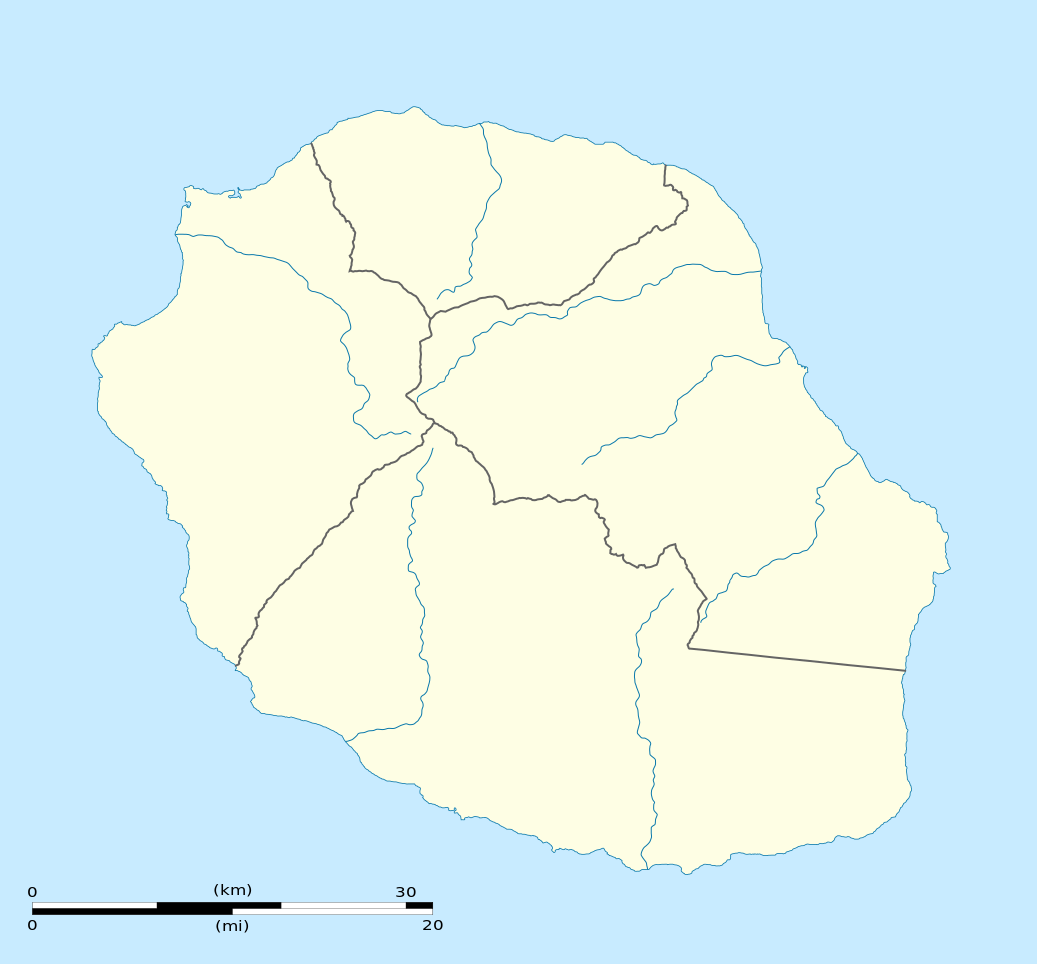
English: Blank physical map of the region and department of Réunion, France, for geo-location purpose.
Français : Carte physique vierge de la région et département de La Réunion, France, destinée à la géolocalisation. Scale: 1:300,000 (precision: 75 m)
Geographic limits of the map:
|
||
| Petsa | |||
| Gigikanan |
Kaugalingong trabaho
|
||
| Tagsulat | Eric Gaba (Sting - fr:Sting) | ||
| Pagtugot (Paggamit pag-usab niini nga file) |
|
||
| Other versions |
|

Pagtugot
I, the copyright holder of this work, hereby publish it under the following licenses:
This file is licensed under the Creative Commons Attribution-Share Alike 3.0 Unported license.
- Libre ka:
- sa pagsabwag – sa pagkopya, pag-apod-apod ug pagsabwag sa hinimo
- sa pag-remix – sa pag-adap sa binuhat
- Ubos sa mosunod nga mga kondisyon:
- atribusyon – Kinahanglan nimo nga hatagan ang angay nga kredito, maghatag usa ka link sa lisensya, ug ipakita kung adunay mga pagbag-o. Mahimo nimo kini buhaton sa bisan unsang makatarunganon nga paagi, apan dili sa bisan unsang paagi nga nagsugyot nga gi-endorso ka sa licensor o ang imong paggamit.
- share parehas – Kung imong gi-remix, gibag-o, o gibase sa materyal, kinahanglan nimo nga iapod-apod ang imong mga kontribusyon sa ilawom sa parehas o katugma nga lisensya sama sa orihinal.

|
Gitugot ang pagkopya, pag-apud-apod o/ug pag-usab ning maong dokumento ubos sa mga termino sa GNU Free Documentation License, Version 1.2 o mas bag-ong bersiyon nga gimantala sa Free Software Foundation; nga walay Invariant Sections, walay Front-Cover Texts, ug walay Back-Cover Texts. Ang kopya sa lisensiya gilakip sa bahin nga giulohang GNU Free Documentation License. |
You may select the license of your choice.
Kaagi sa payl
I-klik ang petsa/oras aron makit-an ang hulagway sa payl niadtong panahona.
| Petsa/Takna | Thumbnail | Mga dimensyon | Tiggamit | Komento | |
|---|---|---|---|---|---|
| kasamtangan | 15:09, 23 Marso 2009 | | 1,037 × 964 (113 KB) | Sting | == Summary == {{Location|21|07|30|S|55|31|30|E|scale:500000}} <br/> {{Information |Description={{en|Blank administrative map of the department of Réunion, France, for geo-location purpose.}} { |
Mga paggamit sa payl
More than 100 pages use this file. The following list shows the first 100 pages that use this file only. A full list is available.
- Arrondissement de Saint-Denis
- Arrondissement de Saint-Pierre
- Bayonne (pagklaro)
- Bory
- Bras du Milieu
- Cap Noir
- Cap des Gouffres
- Découverte
- Eden
- Grand Bassin
- Grand Fond
- Grand Étang
- Grande Découverte
- Grande Mare
- Grande Montagne
- Grande Rade
- Grande Ravine
- Gros Morne
- Gros Piton
- L'Eperon
- L'Ilet
- L'Éperon
- L'Îlet
- La Fenêtre
- La Glacière
- La Petite Ile
- Lac des Merles
- Le Grand Bras
- Le Grand Etang
- Le Petit Bras
- Le Piton
- Le Port
- Les Bras
- Les Cascades
- Les Deux Mamelles
- Liberia (pagklaro)
- L’Îlet
- Maduran
- Mare Sèche
- Mascarenhas
- Mazarin
- Morne de l'Étang
- Morne de l’Étang
- Petite Ile
- Petite Île
- Piton Lacroix
- Piton Rouge
- Piton Vincendo
- Piton de Sainte-Rose
- Piton de Villers
- Piton des Roches
- Plate
- Plateau Wickers
- Pointe Rouge
- Pointe Saint-Joseph
- Pointe de l'Etang
- Pointe de l'Étang
- Pointe de la Rivière
- Pointe de l’Étang
- Pointe des Aigrettes
- Pointe des Cascades
- Pointe des Châteaux
- Pointe du Bambou
- Pointe du Piton
- Pointe du Portail
- Pointe du Sel
- Pointe à Vincendo
- Port (pagklaro)
- Possession
- Ravine Blanche
- Ravine Fontaine
- Ravine Jean Louis
- Ravine Lacroix
- Ravine Seche
- Ravine Sèche
- Riviere Sainte-Marie
- Riviere de l'Est
- Rivière Saint-Denis
- Rivière Sainte-Anne
- Rivière Sainte-Marie
- Rivière Sèche
- Rivière de l'Est
- Rivière de l’Est
- Rivière des Français
- Rivière des Galets
- Rivière des Roches
- Ruisseau Blanc
- Saint-Andre
- Saint-André (pagklaro)
- Saint-Benoit
- Saint-Denis (pagklaro)
- Saint-Joseph (pagklaro)
- Saint-Leu
- Saint-Louis (pagklaro)
- Saint-Pierre (pagklaro)
- Saint Paul Bay
- Sainte-Marie (pagklaro)
- Sainte-Rose (pagklaro)
- Sainte-Suzanne (pagklaro)
- Table Point
View more links to this file.
Global nga paggamit sa payl
Kining ubang wiki naggamit ning maong payl:
- Paggamit sa af.wikipedia.org
- Paggamit sa als.wikipedia.org
- Paggamit sa an.wikipedia.org
- Paggamit sa ar.wikipedia.org
- Paggamit sa az.wikipedia.org
- Paggamit sa be-tarask.wikipedia.org
- Paggamit sa be.wikipedia.org
- Paggamit sa bg.wikipedia.org
- Paggamit sa bs.wikipedia.org
- Paggamit sa ce.wikipedia.org
- АнтгӀ-Де
- БгӀа-Панон
- Ла-Плен-де-Пальмист
- Ла-Поссесьйон
- Ле-ПогӀ (ГӀеуьньон)
- Ле-Тампон
- Лез-АвигӀон
- Л'Етан-Сале
- Петит-Иль
- Салази
- Сен-Бенуа (ГӀеуьньон)
- Сен-Дени (ГӀеуьньон)
- Сен-Жозеф (ГӀеуьньон)
- Сен-Ле (ГӀеуьньон)
- Сен-Луи (ГӀеуьньон)
- Сен-ПьегӀгӀ (ГӀеуьньон)
- Сен-Поль (ГӀеуьньон)
- Сен-Филипп (ГӀеуьньон)
- Сент-АндгӀе (ГӀеуьньон)
- Сент-МагӀи (ГӀеуьньон)
- Сент-ГӀоз (ГӀеуьньон)
- Сент-Сузанн (ГӀеуьньон)
- Силао
- ТгӀуа-Бассен
- Кеп:Меттиган карта Франци Реуьньон
- Кеп:Меттиган карта Франци ГӀеуьньон
- Paggamit sa ckb.wikipedia.org
- Paggamit sa cs.wikipedia.org
- Paggamit sa da.wikipedia.org
- Paggamit sa de.wikipedia.org
View more global usage of this file.