Payl:Laimont Villers-aux-Vents (55 Meuse) voie romaine Reims Toul.jpg

Gidak-on ning maong paunang tan-aw: 450 x 600 ka mga piksel. Uban pang mga resoluyon: 180 x 240 ka mga piksel | 360 x 480 ka mga piksel | 576 x 768 ka mga piksel | 768 x 1,024 ka mga piksel | 1,536 x 2,048 ka mga piksel | 3,000 x 4,000 ka mga piksel.
Tibuok resolusyon (3,000 × 4,000 pixels, size sa payl: 1.73 MB, MIME type: image/jpeg)
_voie_romaine_Reims_Toul.jpg)
Mubong sugid:
| Deskripsyon |
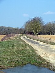
Français : A la limite entre les communes de Laimont et Villers-aux-Vents (55 Meuse) l'ancienne voie romaine Reims Toul à l'endroit où elle rejoint l'actuelle route départementale D75. |
| Petsa | 1/4/2013 à 10:43 |
| Gigikanan | Kaugalingong trabaho |
| Tagsulat | Utilisateur:Djampa - User:Djampa |
| Camera location | | View this and other nearby images on: OpenStreetMap |
|---|
_voie_romaine_Reims_Toul.jpg¶ms=048.846248_N_0005.012122_E_globe:Earth_type:camera_Heading:WNW_&language=ceb)
Pagtugot
I, the copyright holder of this work, hereby publish it under the following licenses:

|
Gitugot ang pagkopya, pag-apud-apod o/ug pag-usab ning maong dokumento ubos sa mga termino sa GNU Free Documentation License, Version 1.2 o mas bag-ong bersiyon nga gimantala sa Free Software Foundation; nga walay Invariant Sections, walay Front-Cover Texts, ug walay Back-Cover Texts. Ang kopya sa lisensiya gilakip sa bahin nga giulohang GNU Free Documentation License. |
This file is licensed under the Creative Commons Attribution-Share Alike 4.0 International, 3.0 Unported, 2.5 Generic, 2.0 Generic and 1.0 Generic license.
- Libre ka:
- sa pagsabwag – sa pagkopya, pag-apod-apod ug pagsabwag sa hinimo
- sa pag-remix – sa pag-adap sa binuhat
- Ubos sa mosunod nga mga kondisyon:
- atribusyon – Kinahanglan nimo nga hatagan ang angay nga kredito, maghatag usa ka link sa lisensya, ug ipakita kung adunay mga pagbag-o. Mahimo nimo kini buhaton sa bisan unsang makatarunganon nga paagi, apan dili sa bisan unsang paagi nga nagsugyot nga gi-endorso ka sa licensor o ang imong paggamit.
- share parehas – Kung imong gi-remix, gibag-o, o gibase sa materyal, kinahanglan nimo nga iapod-apod ang imong mga kontribusyon sa ilawom sa parehas o katugma nga lisensya sama sa orihinal.
You may select the license of your choice.
Kaagi sa payl
I-klik ang petsa/oras aron makit-an ang hulagway sa payl niadtong panahona.
| Petsa/Takna | Thumbnail | Mga dimensyon | Tiggamit | Komento | |
|---|---|---|---|---|---|
| kasamtangan | 14:21, 15 Oktubre 2013 | | 3,000 × 4,000 (1.73 MB) | Djampa | lumière |
| 13:15, 4 Abril 2013 |  | 3,000 × 4,000 (1.55 MB) | Rotatebot | Bot: Image rotated by 270° (EXIF-Orientation set from 6 to 1, rotated 0°) | |
| 12:18, 4 Abril 2013 |  | 4,000 × 3,000 (1.55 MB) | Djampa | {{Information |Description ={{fr|1=Laimont Villers-aux-Vents (55 Meuse) voie romaine Reims Toul}} |Source =Own work - Travail personnel |Author =Utilisateur:Djampa - User:Djampa |Date ... |
Mga paggamit sa payl
Ang mosunod nga mga panid misumpay niining payl:
Global nga paggamit sa payl
Kining ubang wiki naggamit ning maong payl:
- Paggamit sa ast.wikipedia.org
- Paggamit sa ca.wikipedia.org
- Paggamit sa ce.wikipedia.org
- Paggamit sa de.wikipedia.org
- Paggamit sa diq.wikipedia.org
- Paggamit sa es.wikipedia.org
- Paggamit sa eu.wikipedia.org
- Paggamit sa fi.wikipedia.org
- Paggamit sa fr.wikipedia.org
- Paggamit sa hu.wikipedia.org
- Paggamit sa it.wikipedia.org
- Paggamit sa ku.wikipedia.org
- Paggamit sa la.wikipedia.org
- Paggamit sa ms.wikipedia.org
- Paggamit sa nl.wikipedia.org
- Paggamit sa no.wikipedia.org
- Paggamit sa pl.wikipedia.org
- Paggamit sa pt.wikipedia.org
- Paggamit sa ro.wikipedia.org
- Paggamit sa sk.wikipedia.org
- Paggamit sa sv.wikipedia.org
- Paggamit sa tt.wikipedia.org
- Paggamit sa uk.wikipedia.org
- Paggamit sa uz.wikipedia.org
- Paggamit sa vec.wikipedia.org
- Paggamit sa www.wikidata.org
View more global usage of this file.
_voie_romaine_Reims_Toul.jpg)
_voie_romaine_Reims_Toul.jpg)