Payl:Lobsterponds.jpg
Walay mas taas nga resolusyon.
Lobsterponds.jpg (640 × 480 pixels, size sa payl: 145 KB, MIME type: image/jpeg)
Mubong sugid:
| Deskripsyon |
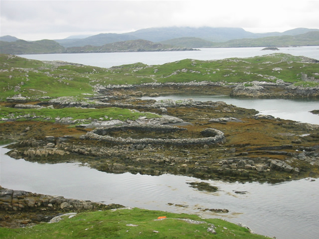
w:Great Bernera, w:Outer Hebrides, Scotland. Lobster ponds Huge stone lobster ponds, as viewed from the footpath from Bhalasaigh to Bostadh. |
||
| Petsa | See image source page. | ||
| Gigikanan |
This image was taken from the Geograph project collection. See this photograph's page on the Geograph website for the photographer's contact details. The copyright on this image is owned by Graham Orriss and is licensed for reuse under the Creative Commons Attribution-ShareAlike 2.0 license.
This file is licensed under the Creative Commons Attribution-Share Alike 2.0 Generic license. Attribution: Graham Orriss
|
||
| Tagsulat | See above. | ||
| Pagtugot (Paggamit pag-usab niini nga file) |
See above. |

| Camera location | | View this and other nearby images on: OpenStreetMap |
|---|
| Object location | | View this and other nearby images on: OpenStreetMap |
|---|
_region:GB-GBN_heading:202.00&language=ceb)
Pagtugot
This file is licensed under the Creative Commons Attribution-Share Alike 2.0 Generic license.
- Libre ka:
- sa pagsabwag – sa pagkopya, pag-apod-apod ug pagsabwag sa hinimo
- sa pag-remix – sa pag-adap sa binuhat
- Ubos sa mosunod nga mga kondisyon:
- atribusyon – Kinahanglan nimo nga hatagan ang angay nga kredito, maghatag usa ka link sa lisensya, ug ipakita kung adunay mga pagbag-o. Mahimo nimo kini buhaton sa bisan unsang makatarunganon nga paagi, apan dili sa bisan unsang paagi nga nagsugyot nga gi-endorso ka sa licensor o ang imong paggamit.
- share parehas – Kung imong gi-remix, gibag-o, o gibase sa materyal, kinahanglan nimo nga iapod-apod ang imong mga kontribusyon sa ilawom sa parehas o katugma nga lisensya sama sa orihinal.
Kaagi sa payl
I-klik ang petsa/oras aron makit-an ang hulagway sa payl niadtong panahona.
| Petsa/Takna | Thumbnail | Mga dimensyon | Tiggamit | Komento | |
|---|---|---|---|---|---|
| kasamtangan | 12:51, 7 Hulyo 2008 | | 640 × 480 (145 KB) | MacRusgail | == Summary == {{Information| |Description=w:Great Bernera, w:Outer Hebrides, Scotland. Lobster ponds Huge stone lobster ponds, as viewed from the footpath from Bhalasaigh to Bostadh. |Source=This image was taken from the Geograph project c |
Mga paggamit sa payl
Ang mosunod nga mga panid misumpay niining payl:
Global nga paggamit sa payl
Kining ubang wiki naggamit ning maong payl:
- Paggamit sa ast.wikipedia.org
- Paggamit sa br.wikipedia.org
- Paggamit sa ca.wikipedia.org
- Paggamit sa cy.wikipedia.org
- Paggamit sa da.wikipedia.org
- Paggamit sa de.wikipedia.org
- Paggamit sa de.wikivoyage.org
- Paggamit sa en.wikipedia.org
- Paggamit sa es.wikipedia.org
- Paggamit sa eu.wikipedia.org
- Paggamit sa ga.wikipedia.org
- Paggamit sa gd.wikipedia.org
- Paggamit sa gl.wikipedia.org
- Paggamit sa gv.wikipedia.org
- Paggamit sa it.wikipedia.org
- Paggamit sa kw.wikipedia.org
- Paggamit sa nds.wikipedia.org
- Paggamit sa nl.wikipedia.org
- Paggamit sa pl.wikipedia.org
- Paggamit sa simple.wikipedia.org
- Paggamit sa sv.wikipedia.org
- Paggamit sa uk.wikipedia.org
- Paggamit sa www.wikidata.org