Payl:LocationKiribati.png
Walay mas taas nga resolusyon.
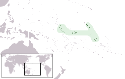
LocationKiribati.png (248 × 156 pixels, size sa payl: 7 KB, MIME type: image/png)
Author: User:Vardion Describtion: Location map for Kiribati
| |
This work has been released into the public domain by its author, Vardion, at the English Wikipedya project. This applies worldwide. In case this is not legally possible: |
Kaagi sa payl
I-klik ang petsa/oras aron makit-an ang hulagway sa payl niadtong panahona.
| Petsa/Takna | Thumbnail | Mga dimensyon | Tiggamit | Komento | |
|---|---|---|---|---|---|
| kasamtangan | 15:51, 4 Disyembre 2010 | | 248 × 156 (7 KB) | Beao | Transparent. |
| 15:46, 15 Agosto 2010 |  | 248 × 156 (3 KB) | Ras67 | cropped | |
| 13:21, 6 Pebrero 2006 |  | 250 × 158 (3 KB) | Quadell | Switched from truecolor to palette-based encoding to losslessly shrink the file size by 53%. (This change was previously made on en-wikipedia by User:Riumplus | |
| 06:28, 4 Abril 2005 |  | 250 × 158 (6 KB) | Knutux | Location map for Kiribati {{CopyrightedFreeUse}} {{GFDL}} en:Image:LocationKiribati.png |
Mga paggamit sa payl
Ang mosunod nga mga panid misumpay niining payl:
Global nga paggamit sa payl
Kining ubang wiki naggamit ning maong payl:
- Paggamit sa af.wikipedia.org
- Paggamit sa ar.wikipedia.org
- Paggamit sa ban.wikipedia.org
- Paggamit sa ba.wikipedia.org
- Paggamit sa be.wikipedia.org
- Paggamit sa bg.wikipedia.org
- Paggamit sa bo.wikipedia.org
- Paggamit sa bpy.wikipedia.org
- Paggamit sa bs.wikipedia.org
- Paggamit sa ca.wikipedia.org
- Paggamit sa chr.wikipedia.org
- Paggamit sa ckb.wikipedia.org
- Paggamit sa crh.wikipedia.org
- Paggamit sa cs.wikipedia.org
- Paggamit sa cu.wikipedia.org
- Paggamit sa da.wikipedia.org
- Paggamit sa de.wikipedia.org
- Paggamit sa de.wiktionary.org
- Paggamit sa el.wiktionary.org
- Paggamit sa en.wikipedia.org
- Paggamit sa en.wikivoyage.org
- Paggamit sa es.wikipedia.org
- Paggamit sa es.wikinews.org
- Paggamit sa ext.wikipedia.org
- Paggamit sa fa.wikipedia.org
- Paggamit sa fiu-vro.wikipedia.org
- Paggamit sa frp.wikipedia.org
- Paggamit sa fr.wikipedia.org
- Paggamit sa fy.wikipedia.org
- Paggamit sa gv.wikipedia.org
- Paggamit sa he.wikivoyage.org
- Paggamit sa hif.wikipedia.org
- Paggamit sa hi.wikipedia.org
- Paggamit sa hr.wikipedia.org
View more global usage of this file.