Payl:Location map Guernsey.png

Gidak-on ning maong paunang tan-aw: 800 x 582 ka mga piksel. Uban pang mga resoluyon: 320 x 233 ka mga piksel | 640 x 466 ka mga piksel | 1,024 x 745 ka mga piksel | 1,175 x 855 ka mga piksel.
Tibuok resolusyon (1,175 × 855 pixels, size sa payl: 465 KB, MIME type: image/png)
| Deskripsyon |
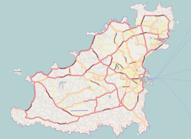
English: Map of Guernsey
Geographic limits of the map:
This file is licensed under the Creative Commons Attribution-Share Alike 2.0 Generic license.
|
| Gigikanan | Maps for Free/OpenStreetMap |
| Tagsulat | Dr. Blofeld |
Kaagi sa payl
I-klik ang petsa/oras aron makit-an ang hulagway sa payl niadtong panahona.
| Petsa/Takna | Thumbnail | Mga dimensyon | Tiggamit | Komento | |
|---|---|---|---|---|---|
| kasamtangan | 16:18, 3 Septiyembre 2011 | | 1,175 × 855 (465 KB) | Blofeld Dr. | {{Information |Description ={{en|1=l}} |Source =l |Author =l |Date =l |Permission = |other_versions = }} |
Mga paggamit sa payl
More than 100 pages use this file. The following list shows the first 100 pages that use this file only. A full list is available.
- Alderney
- Alderney Harbour
- Baie de Port Grat
- Baleine
- Baleine Bay
- Black Rock
- Cambridge Park
- Castel
- Cats Bay
- Channel Islands
- Cobo Bay
- Conchée
- Corbet
- Creve Coeur
- Crève Coeur
- Delancey Park
- Forest
- Fourquie
- Godin
- Goulet
- Grosnez Point
- Grosse Rock
- Guernsey
- Gull Rock
- Herm (pagklaro)
- Hogsback
- Hommes (pagklaro)
- Homptole
- La Capelle (pagklaro)
- La Conchée
- La Corbière (pagklaro)
- La Coupée
- La Forêt
- La Grune
- La Platte
- La Pointe de Pleinmont
- La Tour (pagklaro)
- La Vieille
- Ladies Bay
- Le Gouffre
- Le Gros Rocher
- Le Nez
- Le Perron (pagklaro)
- Les Brayes
- Les Burons
- Les Dents
- Les Fontaines
- Les Fourquies
- Les Jumelles
- Lihou Island
- Lion Rock
- Longue Pierre
- Moulière
- Mount Hale
- Mount Hubert
- Ninepin
- Nipple Rock
- North Beach
- Oyster Rock
- Pembroke Bay
- Platte Rock
- Pleinmont Point
- Point La Moye
- Point Robert
- Portinfer Bay
- Pot Bay
- Raz Island
- Red Rock
- Rocquaine Bay
- Rousse Point
- Rousset (pagklaro)
- Saint's Bay
- Saint-Martin (pagklaro)
- Saint-Sauveur (pagklaro)
- Saint Anne
- Saint Annes
- Saint Martin's Point
- Saint Martin (pagklaro)
- Saint Martin Point
- Saint Peter Port
- Saint Peter Port (ulohang dakbayan)
- Saint Pierre
- Saint Sampson (lungsod)
- Saint Saviour
- Saline Bay
- Saline Bay (luuk sa Gernsiy, lat 49,48, long -2,59)
- Sark
- Saumarez Park
- South Beach
- South Beach (lapyahan sa Gernsiy)
- Spur Point
- St. Andrew
- St. Martin
- St. Sampson
- Statue Menhir
- Telegraph Bay
- The Knife
- The Pot
- Vale
- Vazon Bay
View more links to this file.
Global nga paggamit sa payl
Kining ubang wiki naggamit ning maong payl:
- Paggamit sa ar.wikipedia.org
- Paggamit sa bg.wikipedia.org
- Paggamit sa de.wikipedia.org
- Paggamit sa de.wikivoyage.org
- Paggamit sa el.wikipedia.org
- Paggamit sa en.wikipedia.org
- Paggamit sa fr.wikipedia.org
- Paggamit sa hr.wikipedia.org
- Paggamit sa hu.wikipedia.org
- Paggamit sa it.wikivoyage.org
- Paggamit sa ja.wikipedia.org
- Paggamit sa kn.wikipedia.org
- Paggamit sa nl.wikipedia.org
- Paggamit sa pl.wikipedia.org
- Saint Peter Port
- St Sampson’s
- Vale (Guernsey)
- St Andrew’s
- St Martin’s (Guernsey)
- Castel (Guernsey)
- St Saviour's
- St Peter’s (Guernsey)
- Forest (Guernsey)
- Torteval
- Port lotniczy Guernsey
- Hauteville House
- Operacja Ambassador
- Szablon:Państwo dane Guernsey
- The Corbet Field
- Footes Lane
- Moduł:Mapa/dane/Guernsey
- Moduł:Mapa/dane/GGY
- Paggamit sa pl.wikibooks.org
- Paggamit sa si.wikipedia.org
- Paggamit sa sq.wikipedia.org
View more global usage of this file.