Payl:Locator Kota Tangerang Selatan.png
Gidak-on ning maong paunang tan-aw: 800 x 577 ka mga piksel. Uban pang mga resoluyon: 320 x 231 ka mga piksel | 640 x 462 ka mga piksel | 801 x 578 ka mga piksel.
Tibuok resolusyon (801 × 578 pixels, size sa payl: 48 KB, MIME type: image/png)
Mubong sugid:
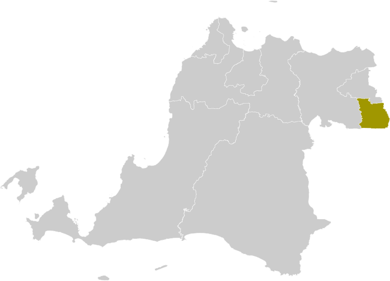
| Deskripsyon | Locator map of South Tangerang Municipality |
| Petsa | (UTC) |
| Gigikanan |
This file was derived from: Locator Kabupaten Serang.png: |
| Tagsulat |
|
| Other versions |
Derivative works of this file: |
| This is a retouched picture, which means that it has been digitally altered from its original version. Modifications: new municipal border added. The original can be viewed here: Locator Kabupaten Serang.png:
|
Pagtugot
I, the copyright holder of this work, hereby publish it under the following license:
This file is licensed under the Creative Commons Attribution-Share Alike 3.0 Unported license.
- Libre ka:
- sa pagsabwag – sa pagkopya, pag-apod-apod ug pagsabwag sa hinimo
- sa pag-remix – sa pag-adap sa binuhat
- Ubos sa mosunod nga mga kondisyon:
- atribusyon – Kinahanglan nimo nga hatagan ang angay nga kredito, maghatag usa ka link sa lisensya, ug ipakita kung adunay mga pagbag-o. Mahimo nimo kini buhaton sa bisan unsang makatarunganon nga paagi, apan dili sa bisan unsang paagi nga nagsugyot nga gi-endorso ka sa licensor o ang imong paggamit.
- share parehas – Kung imong gi-remix, gibag-o, o gibase sa materyal, kinahanglan nimo nga iapod-apod ang imong mga kontribusyon sa ilawom sa parehas o katugma nga lisensya sama sa orihinal.
Original upload log
This image is a derivative work of the following images:
- File:Locator_Kabupaten_Serang.png licensed with Cc-by-sa-3.0
- 2012-10-11T00:48:45Z OgreBot 245x161 (4306 Bytes) (BOT): Reverting to most recent version before archival
- 2012-10-11T00:48:41Z OgreBot 245x161 (4223 Bytes) (BOT): Uploading old version of file from en.wikipedia; originally uploaded on 2011-12-12 11:03:22 by [[en:User:Doseiai2|Doseiai2]]
- 2012-10-11T00:48:36Z OgreBot 245x161 (4176 Bytes) (BOT): Uploading old version of file from en.wikipedia; originally uploaded on 2011-12-12 10:42:58 by [[en:User:Doseiai2|Doseiai2]]
- 2012-10-10T23:17:44Z File Upload Bot (Magnus Manske) 245x161 (4306 Bytes) Transfered from en.wikipedia by [[User:Topographie]] using CommonsHelper
Uploaded with derivativeFX
Kaagi sa payl
I-klik ang petsa/oras aron makit-an ang hulagway sa payl niadtong panahona.
| Petsa/Takna | Thumbnail | Mga dimensyon | Tiggamit | Komento | |
|---|---|---|---|---|---|
| kasamtangan | 09:17, 20 Marso 2022 | | 801 × 578 (48 KB) | Afrogindahood | Graphical improvement |
| 18:41, 11 Oktubre 2012 |  | 245 × 161 (4 KB) | Topographie | == {{int:filedesc}} == {{Information |Description=Locator map of South Tangerang Municipality |Source={{Derived from|Locator_Kabupaten_Serang.png|display=50}} |Date=2012-10-11 18:39 (UTC) |Author=*File:Locator_Kabupaten_Serang.png: {{user at proj... |
Mga paggamit sa payl
Ang mosunod nga mga panid misumpay niining payl:
Global nga paggamit sa payl
Kining ubang wiki naggamit ning maong payl:
- Paggamit sa af.wikipedia.org
- Paggamit sa ar.wikipedia.org
- Paggamit sa ban.wikipedia.org
- Paggamit sa de.wikipedia.org
- Paggamit sa en.wikipedia.org
- Paggamit sa eo.wikipedia.org
- Paggamit sa fa.wikipedia.org
- Paggamit sa fr.wikipedia.org
- Paggamit sa gor.wikipedia.org
- Paggamit sa id.wikipedia.org
- Paggamit sa it.wikipedia.org
- Paggamit sa ja.wikipedia.org
- Paggamit sa jv.wikipedia.org
- Paggamit sa min.wikipedia.org
- Paggamit sa ml.wikipedia.org
- Paggamit sa ms.wikipedia.org
- Paggamit sa nl.wikipedia.org
- Paggamit sa ro.wikipedia.org
- Paggamit sa su.wikipedia.org
- Paggamit sa tr.wikipedia.org
- Paggamit sa tt.wikipedia.org
- Paggamit sa uk.wikipedia.org
- Paggamit sa www.wikidata.org
- Paggamit sa zh-min-nan.wikipedia.org