Payl:Lombardy Provinces.png
Walay mas taas nga resolusyon.
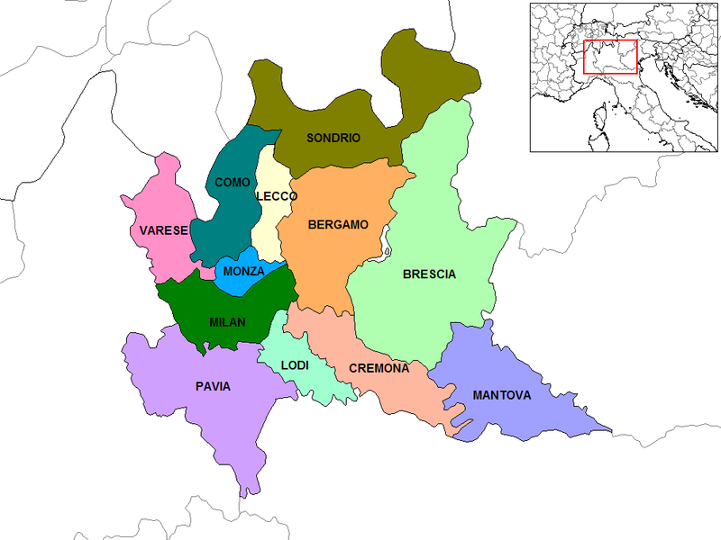
Lombardy_Provinces.png (800 × 600 pixels, size sa payl: 145 KB, MIME type: image/png)

|
File:Map of region of Lombardy, Italy, with provinces-en.svg is a vector version of this file. It should be used in place of this PNG file when not inferior.
File:Lombardy Provinces.png → File:Map of region of Lombardy, Italy, with provinces-en.svg
For more information, see Help:SVG. |
 |
Map of the provinces of the Lombardy region of Italy. Created by Rarelibra for public domain use. Created using MapInfo Professional v7.5 and various mapping resources.
Other versions: File:Lombardy Provinces-el.png Ελληνικά
Author: Rarelibra
Link: http://en.wikipedia.org/wiki/Image:Lombardy_Provinces.png
| This work has been released into the public domain by its author, Rarelibra at English Wikipedya. This applies worldwide. In some countries this may not be legally possible; if so: Rarelibra grants anyone the right to use this work for any purpose, without any conditions, unless such conditions are required by law. |
Kaagi sa payl
I-klik ang petsa/oras aron makit-an ang hulagway sa payl niadtong panahona.
| Petsa/Takna | Thumbnail | Mga dimensyon | Tiggamit | Komento | |
|---|---|---|---|---|---|
| kasamtangan | 08:22, 13 Marso 2010 | | 800 × 600 (145 KB) | Gigillo83 | Correzione confine MB |
| 23:25, 16 Oktubre 2009 |  | 988 × 741 (34 KB) | ZooFari | Trimmed off border | |
| 11:03, 1 Mayo 2006 |  | 1,056 × 816 (38 KB) | Mortadelo2005 | Author: Rarelibra Link: http://en.wikipedia.org/wiki/Image:Lombardy_Provinces.png {{PD-user|Rarelibra}} Category:Maps of Italy |
Mga paggamit sa payl
Ang mosunod nga mga panid misumpay niining payl:
Global nga paggamit sa payl
Kining ubang wiki naggamit ning maong payl:
- Paggamit sa an.wikipedia.org
- Paggamit sa ar.wikipedia.org
- Paggamit sa arz.wikipedia.org
- Paggamit sa ast.wikipedia.org
- Paggamit sa bcl.wikipedia.org
- Paggamit sa ca.wikipedia.org
- Paggamit sa cs.wikipedia.org
- Paggamit sa de.wikipedia.org
- Paggamit sa eml.wikipedia.org
- Paggamit sa en.wikipedia.org
- Paggamit sa en.wikivoyage.org
- Paggamit sa es.wikipedia.org
- Paggamit sa es.wikiversity.org
- Paggamit sa et.wikipedia.org
- Paggamit sa fa.wikipedia.org
- Paggamit sa fi.wikipedia.org
- Paggamit sa gl.wikipedia.org
- Paggamit sa hr.wikipedia.org
- Paggamit sa hu.wikipedia.org
- Paggamit sa hy.wikipedia.org
- Paggamit sa id.wikipedia.org
- Paggamit sa it.wikipedia.org
- Paggamit sa ja.wikipedia.org
- Paggamit sa la.wikipedia.org
- Paggamit sa lt.wikipedia.org
- Paggamit sa ms.wikipedia.org
View more global usage of this file.