Payl:Malta location map.svg

Size of this PNG preview of this SVG file: 645 x 600 ka mga piksel. Uban pang mga resoluyon: 258 x 240 ka mga piksel | 516 x 480 ka mga piksel | 826 x 768 ka mga piksel | 1,101 x 1,024 ka mga piksel | 2,202 x 2,048 ka mga piksel | 773 x 719 ka mga piksel.
Tibuok resolusyon (SVG nga payl, nominally 773 × 719 pixels, size sa payl: 141 KB)
Mubong sugid:
| Deskripsyon |
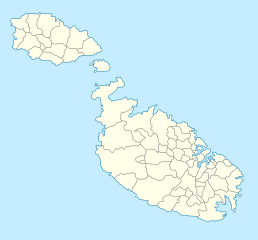
Deutsch: Positionskarte von Malta
Quadratische Plattkarte. Geographische Begrenzung der Karte:
English: Location map of Malta
Equirectangular projection. Geographic limits of the map:
|
||
| Petsa | 5 Septiyembre 2008 (upload date) | ||
| Gigikanan | own work, using Fgura-map.svg by William Shewring | ||
| Tagsulat | Maximilian Dörrbecker (Chumwa) | ||
| Pagtugot (Paggamit pag-usab niini nga file) |
I, the copyright holder of this work, hereby publish it under the following licenses:
This file is licensed under the Creative Commons Attribution-Share Alike 3.0 Unported license.
You may select the license of your choice. |


|
This map has been made or improved in the German Kartenwerkstatt (Map Lab). You can propose maps to improve as well.
|
Kaagi sa payl
I-klik ang petsa/oras aron makit-an ang hulagway sa payl niadtong panahona.
| Petsa/Takna | Thumbnail | Mga dimensyon | Tiggamit | Komento | |
|---|---|---|---|---|---|
| kasamtangan | 04:57, 5 Septiyembre 2008 | | 773 × 719 (141 KB) | Chumwa | Karte etwas in N/S-Richtung gestreckt |
| 04:44, 5 Septiyembre 2008 |  | 773 × 565 (141 KB) | Chumwa | == Beschreibung == {{Information |Description= {{de|Positionskarte von Malta}} Quadratische Plattkarte. Geographische Begrenzung der Karte: * N: 36.06° N * S: 35.47° N * W: 14.10° O * O: 14.36° O {{en|Location map of Malta} |
Mga paggamit sa payl
More than 100 pages use this file. The following list shows the first 100 pages that use this file only. A full list is available.
- Calcara
- Comino
- Fanal
- Fontana
- Gargur
- Gharb
- Golden Bay
- Gozo
- Haz-Zebbug
- Hospital Point
- Il-Mosta
- Il-Munxar
- Il-Qala
- Imdina
- Imsida
- Imtarfa
- Imġarr
- In-Nadur
- Ir-Rabat
- Isla (pagklaro)
- Iż-Żebbuġ
- Kala
- Kaura
- Kaura Point
- L-Imqabba
- L-Imġarr
- La Valeta
- La Valette (pagklaro)
- Lia
- Magazine Point
- Malta (pagklaro)
- Malta Channel
- Marsa (pagklaro)
- Marsa Scirocco
- Marsa Shlok
- Marsaxlokk
- Masta
- Melita (pagklaro)
- Mellieħa
- Mosta
- Munxar
- Musta
- Mġarr
- Nadur
- Nashar
- Naxxar
- North Channel
- North Point
- Paola
- Paula
- Pembroke
- Pieta
- Pietà
- Qala
- Qormi
- Qrendi
- Rabat
- Ras il-Bajjada
- Roman Villa
- Safi
- Saint George’s Bay
- Saint John
- Saint Julian
- Saint Lawrence
- Saint Lucia (pagklaro)
- Saint Paul’s Bay
- Saint Thomas Bay
- San Lawrenz
- San Pawl il-Baħar
- San Ġiljan
- Sannat (pagklaro)
- Santa Lucia
- Santa Luċija
- Santa Maria Reservoir
- Santa Venera
- Siġġiewi
- Sliema
- South Channel
- South Point
- Stork Rock
- Sultan Rock
- Tal-Gawwija
- Tal-Pietà
- Tarxien
- Ta’ Xbiex
- Valletta
- Victoria
- Victoria Town
- Vittoria
- Wied il-Għajn
- Wied tal-Qlejgħa
- Xagħra
- Xewkija
- Xgħajra
- Zebbuj
- Zeitun
- Ħal Safi
- Żabbar
- Żebbuġ
- Żejtun
View more links to this file.
Global nga paggamit sa payl
Kining ubang wiki naggamit ning maong payl:
- Paggamit sa af.wikipedia.org
- Paggamit sa als.wikipedia.org
- Paggamit sa an.wikipedia.org
- Paggamit sa ar.wikipedia.org
- Paggamit sa ast.wikipedia.org
- Paggamit sa az.wikipedia.org
- Paggamit sa ba.wikipedia.org
- Paggamit sa be-tarask.wikipedia.org
View more global usage of this file.