Payl:Map of Boston and Cambridge.png

Gidak-on ning maong paunang tan-aw: 800 x 600 ka mga piksel. Uban pang mga resoluyon: 320 x 240 ka mga piksel | 640 x 480 ka mga piksel | 1,024 x 768 ka mga piksel | 1,280 x 960 ka mga piksel | 1,600 x 1,200 ka mga piksel.
Tibuok resolusyon (1,600 × 1,200 pixels, size sa payl: 1.98 MB, MIME type: image/png)
Mubong sugid:
| Deskripsyon |
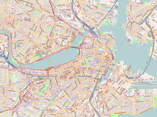
English: Map of the central area of Boston and Cambridge, exported from OpenStreetMap.
日本語: ボストン中心部及びケンブリッジの地図。オープン・ストリート・マップから作成。 |
||||||||||||
| Petsa | |||||||||||||
| Gigikanan | http://openstreetmap.org/ | ||||||||||||
| Tagsulat | OpenStreetMap contributors | ||||||||||||
| Pagtugot (Paggamit pag-usab niini nga file) |
|

|
This complex map image could be re-created using vector graphics as an SVG file. This has several advantages; see Commons:Media for cleanup for more information. If an SVG form of this image is available, please upload it and afterwards replace this template with
{{vector version available|new image name}}.Note: Existing vector data is available from osmwiki:SVG. It is recommended to name the SVG file “Map of Boston and Cambridge.svg”—then the template Vector version available (or Vva) does not need the new image name parameter. |
Maps of Cambridge
Pagtugot
This file is licensed under the Creative Commons Attribution-Share Alike 2.0 Generic license.
- Libre ka:
- sa pagsabwag – sa pagkopya, pag-apod-apod ug pagsabwag sa hinimo
- sa pag-remix – sa pag-adap sa binuhat
- Ubos sa mosunod nga mga kondisyon:
- atribusyon – Kinahanglan nimo nga hatagan ang angay nga kredito, maghatag usa ka link sa lisensya, ug ipakita kung adunay mga pagbag-o. Mahimo nimo kini buhaton sa bisan unsang makatarunganon nga paagi, apan dili sa bisan unsang paagi nga nagsugyot nga gi-endorso ka sa licensor o ang imong paggamit.
- share parehas – Kung imong gi-remix, gibag-o, o gibase sa materyal, kinahanglan nimo nga iapod-apod ang imong mga kontribusyon sa ilawom sa parehas o katugma nga lisensya sama sa orihinal.
Kaagi sa payl
I-klik ang petsa/oras aron makit-an ang hulagway sa payl niadtong panahona.
| Petsa/Takna | Thumbnail | Mga dimensyon | Tiggamit | Komento | |
|---|---|---|---|---|---|
| kasamtangan | 00:01, 19 Hunyo 2009 | | 1,600 × 1,200 (1.98 MB) | Goyaz | {{Information |Description={{en|1=Map of the centeral area of Boston and Cambridge, exported from OpenStreetMap.}} {{ja|1=ボストン中心部及びケンブリッジの地図。[[w:ja:オープン・ストリート・マップ|オープン・スト� |
Mga paggamit sa payl
Ang mosunod nga mga panid misumpay niining payl:
Global nga paggamit sa payl
Kining ubang wiki naggamit ning maong payl:
- Paggamit sa ar.wikipedia.org
- Paggamit sa bg.wikipedia.org
- Paggamit sa cs.wikipedia.org
- Paggamit sa en.wikipedia.org
- USS Constitution
- Battle of Bunker Hill
- Cocoanut Grove fire
- Wang Theatre
- Isabella Stewart Gardner Museum
- Ether Dome
- South End, Boston
- John Hancock Tower
- Back Bay, Boston
- TD Garden
- Faneuil Hall
- Beacon Hill, Boston
- Old South Meeting House
- Park Street Church
- Trinity Church (Boston)
- Bunker Hill Monument
- Museum of Fine Arts, Boston
- Quincy Market
- North–South Rail Link
- Old State House (Boston)
- John Joseph Moakley United States Courthouse
- Boston African American National Historic Site
- Tremont Street subway
- Harrison Gray Otis House
- Improv Asylum
- Peabody Museum of Archaeology and Ethnology
- Old City Hall (Boston)
- Landmark Center (Boston)
- Harvard Museum of Natural History
- Abbey Lounge
- Gibson House Museum
- The Club of Odd Volumes
- Boston Emergency Medical Services
- Nathan Appleton Residence
- Charles Street Jail
- Old Corner Bookstore
- Our Lady of Mount Carmel Church (East Boston, Massachusetts)
- Morse Auditorium
- Chester Harding House
- Vilna Shul
- William C. Nell House
- Charles Sumner House
- Copp's Hill Burying Ground
- Boston Young Men's Christian Union
View more global usage of this file.