Payl:Map of Illinois highlighting LaSalle County.svg

Size of this PNG preview of this SVG file: 336 x 599 ka mga piksel. Uban pang mga resoluyon: 134 x 240 ka mga piksel | 269 x 480 ka mga piksel | 430 x 768 ka mga piksel | 574 x 1,024 ka mga piksel | 1,148 x 2,048 ka mga piksel | 3,453 x 6,157 ka mga piksel.
Tibuok resolusyon (SVG nga payl, nominally 3,453 × 6,157 pixels, size sa payl: 85 KB)
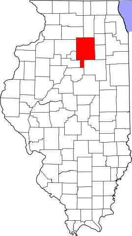
This is a locator map showing LaSalle County in Illinois.
David Benbennick made this map. For more information, see Commons:United States county locator maps.
| I, the copyright holder of this work, release this work into the public domain. This applies worldwide. In some countries this may not be legally possible; if so: I grant anyone the right to use this work for any purpose, without any conditions, unless such conditions are required by law. |
Kaagi sa payl
I-klik ang petsa/oras aron makit-an ang hulagway sa payl niadtong panahona.
| Petsa/Takna | Thumbnail | Mga dimensyon | Tiggamit | Komento | |
|---|---|---|---|---|---|
| kasamtangan | 13:26, 5 Abril 2007 | | 3,453 × 6,157 (85 KB) | Ruhrfisch | This is a locator map showing La Salle County in Illinois. David Benbennick made this map. For more information, see Commons:United States county locator maps. {{PD-self}} [[Category:La Salle Count |
Mga paggamit sa payl
Ang mosunod nga mga panid misumpay niining payl:
Global nga paggamit sa payl
Kining ubang wiki naggamit ning maong payl:
- Paggamit sa ar.wikipedia.org
- مقاطعة لاسال (إلينوي)
- نورث يوتيكا (إلينوي)
- دالزل (إلينوي)
- كانغلي (إلينوي)
- ليونوري (إلينوي)
- نابلت (إلينوي)
- سينيسا (إلينوي)
- تروي غروف (إلينوي)
- سيدار بوينت (إلينوي)
- دانا (إلينوي)
- غراند ريدج (إلينوي)
- ليلاند (إلينوي)
- لوستانت (إلينوي)
- أوتاوا (إلينوي)
- سترتور
- بيرو (إلينوي)
- لاسال
- مرسيليا (إلينوي)
- إيرلفيل
- ميندوتا
- أوغلسبي
- وينونا
- ميلينغتون (إلينوي)
- رانسوم (إلينوي)
- روتلاند (إلينوي)
- شريدان (إلينوي)
- سوموناك (إلينوي)
- تونيكا (إلينوي)
- قالب:مقاطعة لاسال (إلينوي)
- Paggamit sa bg.wikipedia.org
- Paggamit sa ca.wikipedia.org
- Llista de comtats d'Illinois
- Cedar Point (Illinois)
- Dalzell (Illinois)
- Dana (Illinois)
- Earlville (Illinois)
- Grand Ridge (Illinois)
- Kangley
- La Salle (Illinois)
- Leland (Illinois)
- Leonore (Illinois)
- Lostant
- Marseilles (Illinois)
- Mendota (Illinois)
- Millington (Illinois)
- Naplate
- North Utica
- Oglesby (Illinois)
- Ottawa (Illinois)
View more global usage of this file.