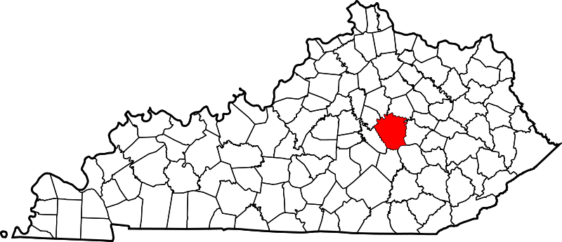
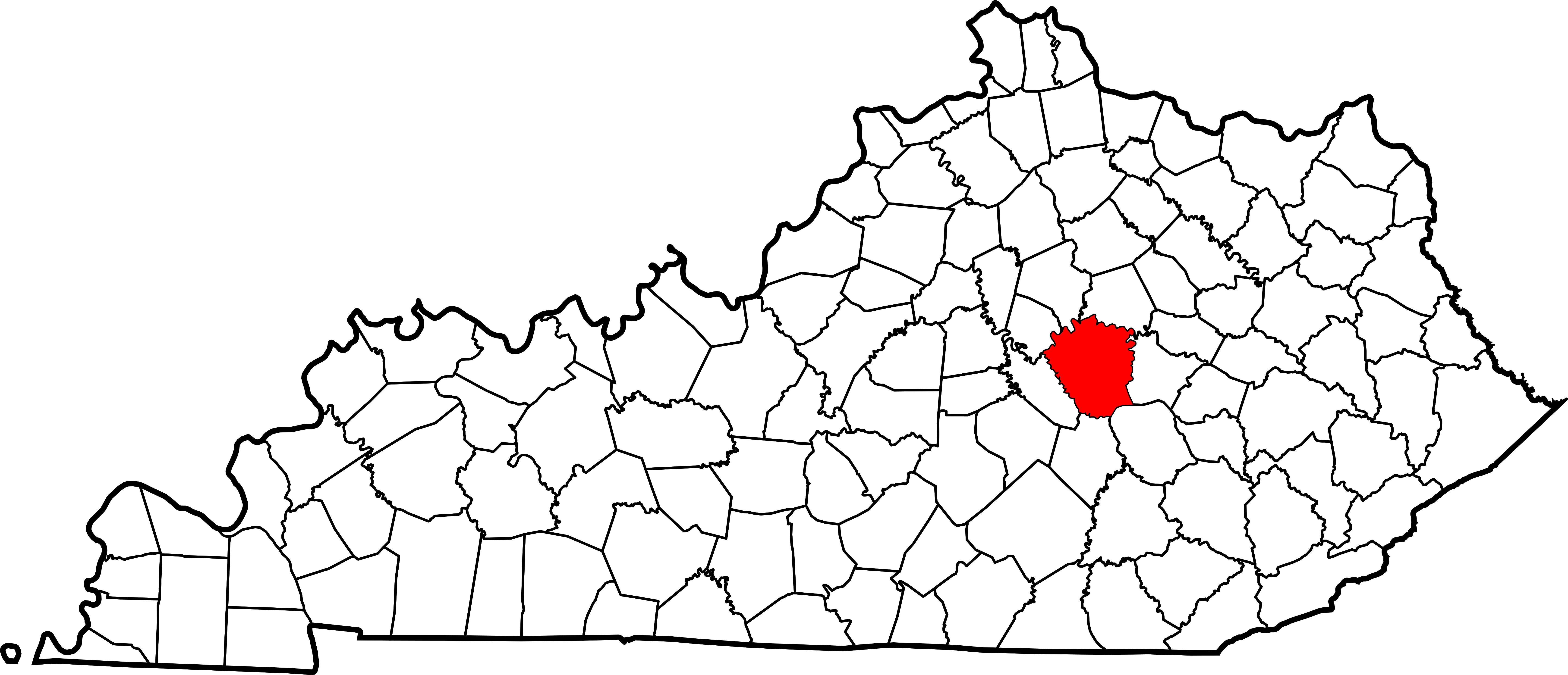
Payl:Map of Kentucky highlighting Madison County.svg

Size of this PNG preview of this SVG file: 800 x 345 ka mga piksel. Uban pang mga resoluyon: 320 x 138 ka mga piksel | 640 x 276 ka mga piksel | 1,024 x 441 ka mga piksel | 1,280 x 551 ka mga piksel | 2,560 x 1,103 ka mga piksel | 6,770 x 2,916 ka mga piksel.
Tibuok resolusyon (SVG nga payl, nominally 6,770 × 2,916 pixels, size sa payl: 127 KB)
Mubong sugid:
| Deskripsyon |
English: This is a locator map showing Madison County in Kentucky. For more information, see Commons:United States county locator maps. |
| Petsa | |
| Gigikanan |
Kaugalingong trabaho: English: The maps use data from nationalatlas.gov, specifically countyp020.tar.gz on the Raw Data Download page. The maps also use state outline data from statesp020.tar.gz. The Florida maps use hydrogm020.tar.gz to display Lake Okeechobee. |
| Tagsulat | David Benbennick |
Pagtugot
| I, the copyright holder of this work, release this work into the public domain. This applies worldwide. In some countries this may not be legally possible; if so: I grant anyone the right to use this work for any purpose, without any conditions, unless such conditions are required by law. |
Kaagi sa payl
I-klik ang petsa/oras aron makit-an ang hulagway sa payl niadtong panahona.
| Petsa/Takna | Thumbnail | Mga dimensyon | Tiggamit | Komento | |
|---|---|---|---|---|---|
| kasamtangan | 12:23, 12 Pebrero 2006 | | 6,770 × 2,916 (127 KB) | David Benbennick | {{subst:User:Dbenbenn/clm|county=Madison County|state=Kentucky}} |
Mga paggamit sa payl
Ang mosunod nga mga panid misumpay niining payl:
Global nga paggamit sa payl
Kining ubang wiki naggamit ning maong payl:
- Paggamit sa ar.wikipedia.org
- Paggamit sa bg.wikipedia.org
- Paggamit sa bpy.wikipedia.org
- Paggamit sa cdo.wikipedia.org
- Paggamit sa ce.wikipedia.org
- Paggamit sa cs.wikipedia.org
- Paggamit sa cy.wikipedia.org
- Paggamit sa de.wikipedia.org
- Paggamit sa en.wikipedia.org
- Madison County, Kentucky
- Berea, Kentucky
- Richmond, Kentucky
- Boonesborough, Kentucky
- List of counties in Kentucky
- Silver Creek (Kentucky)
- Waco, Kentucky
- Wilgreen Lake
- Template:Madison County, Kentucky
- Valley View, Kentucky
- Bybee, Kentucky
- Bighill, Kentucky
- Kirksville, Kentucky
- User:Nyttend/County templates/KY/2
- Round Hill, Kentucky
- National Register of Historic Places listings in Madison County, Kentucky
- College Hill, Kentucky
- Category:Populated places in Madison County, Kentucky
- Buggytown, Kentucky
- Moberly, Kentucky
- Baldwin, Kentucky
- Ruthton, Kentucky
- Speedwell, Kentucky
- Template:MadisonCountyKY-geo-stub
- Dreaming Creek (Kentucky)
- Million, Kentucky
- Bobtown, Kentucky
- Kingston, Kentucky
- Redhouse, Kentucky
- Newby, Kentucky
- Union City, Kentucky
- Paggamit sa es.wikipedia.org
View more global usage of this file.