Payl:Mount Baker 22101.JPG

Gidak-on ning maong paunang tan-aw: 800 x 600 ka mga piksel. Uban pang mga resoluyon: 320 x 240 ka mga piksel | 640 x 480 ka mga piksel | 1,024 x 768 ka mga piksel | 1,280 x 960 ka mga piksel | 2,560 x 1,920 ka mga piksel.
Tibuok resolusyon (2,560 × 1,920 pixels, size sa payl: 1.84 MB, MIME type: image/jpeg)
Mubong sugid:
| Deskripsyon |
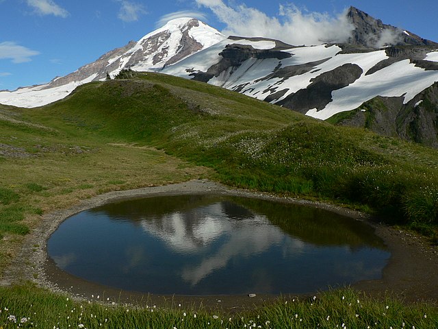
English: Mount Baker (10,781 feet, 3286 meters); Lincoln Peak (9080 ft, 2768 m, right); unnamed tarn (5709 ft, 1740 m, foreground) |
| Petsa | 13 Agosto 2007, 17:48:37 −07:00 |
| Gigikanan | Kaugalingong trabaho |
| Tagsulat | Walter Siegmund (talk) |
| Camera location | | View this and other nearby images on: OpenStreetMap |
|---|
- Location Datum: WGS84
- Viewpoint location: Grouse Ridge Mount Baker Wilderness
- Viewpoint elevation: 1743 meter (5717 ft)
- View direction: East
- Camera: Panasonic DMC-FZ5
- Exposure Time: 1/640
- F Number: f/5.6
- Focal Length: 6.0
- Focal Length In 35mm Film: 36
- ISO Speed Rating: 80
©2007 Walter Siegmund
Pagtugot
I, the copyright holder of this work, hereby publish it under the following licenses:

|
Gitugot ang pagkopya, pag-apud-apod o/ug pag-usab ning maong dokumento ubos sa mga termino sa GNU Free Documentation License, Version 1.2 o mas bag-ong bersiyon nga gimantala sa Free Software Foundation; nga walay Invariant Sections, walay Front-Cover Texts, ug walay Back-Cover Texts. Ang kopya sa lisensiya gilakip sa bahin nga giulohang GNU Free Documentation License. |
| This file is licensed under the Creative Commons Attribution-Share Alike 3.0 Unported license. | ||
| ||
| This licensing tag was added to this file as part of the GFDL licensing update. |
This file is licensed under the Creative Commons Attribution 2.5 Generic license.
- Libre ka:
- sa pagsabwag – sa pagkopya, pag-apod-apod ug pagsabwag sa hinimo
- sa pag-remix – sa pag-adap sa binuhat
- Ubos sa mosunod nga mga kondisyon:
- atribusyon – Kinahanglan nimo nga hatagan ang angay nga kredito, maghatag usa ka link sa lisensya, ug ipakita kung adunay mga pagbag-o. Mahimo nimo kini buhaton sa bisan unsang makatarunganon nga paagi, apan dili sa bisan unsang paagi nga nagsugyot nga gi-endorso ka sa licensor o ang imong paggamit.
You may select the license of your choice.
Kaagi sa payl
I-klik ang petsa/oras aron makit-an ang hulagway sa payl niadtong panahona.
| Petsa/Takna | Thumbnail | Mga dimensyon | Tiggamit | Komento | |
|---|---|---|---|---|---|
| kasamtangan | 05:08, 15 Disyembre 2007 | | 2,560 × 1,920 (1.84 MB) | Wsiegmund | {{Information |Description = {{en|Mount Baker (10,781 feet, 3286 meters); Lincoln Peak (9080 ft, 2768 m, right); unnamed tarn (foreground)}} |Source = Own work |Date = 2007:08:13T17:48:37-7.00 |Author = [[User:Wsiegmund|Walter Siegmun |
Mga paggamit sa payl
Ang mosunod nga mga panid misumpay niining payl:
Global nga paggamit sa payl
Kining ubang wiki naggamit ning maong payl:
- Paggamit sa arz.wikipedia.org
- Paggamit sa en.wikivoyage.org
- Paggamit sa eo.wikipedia.org
- Paggamit sa es.wikivoyage.org
- Paggamit sa eu.wikipedia.org
- Paggamit sa fr.wikipedia.org
- Paggamit sa hr.wikipedia.org
- Paggamit sa it.wikivoyage.org
- Paggamit sa ja.wikipedia.org
- Paggamit sa ms.wikipedia.org
- Paggamit sa nl.wikipedia.org
- Paggamit sa no.wikipedia.org
- Paggamit sa sh.wikipedia.org
- Paggamit sa sr.wikipedia.org
- Paggamit sa sv.wikipedia.org
- Paggamit sa www.wikidata.org