Payl:Aerial view of the U.S. Naval Air Station Cubi Point, Philippines, on 6 February 1988 (6482943).jpg
Gidak-on ning maong paunang tan-aw: 799 x 600 ka mga piksel. Uban pang mga resoluyon: 320 x 240 ka mga piksel | 640 x 480 ka mga piksel | 1,023 x 768 ka mga piksel | 1,280 x 961 ka mga piksel | 2,560 x 1,922 ka mga piksel | 3,000 x 2,252 ka mga piksel.
Tibuok resolusyon (3,000 × 2,252 pixels, size sa payl: 2.2 MB, MIME type: image/jpeg)
.jpg)
Mubong sugid:
| Deskripsyon |
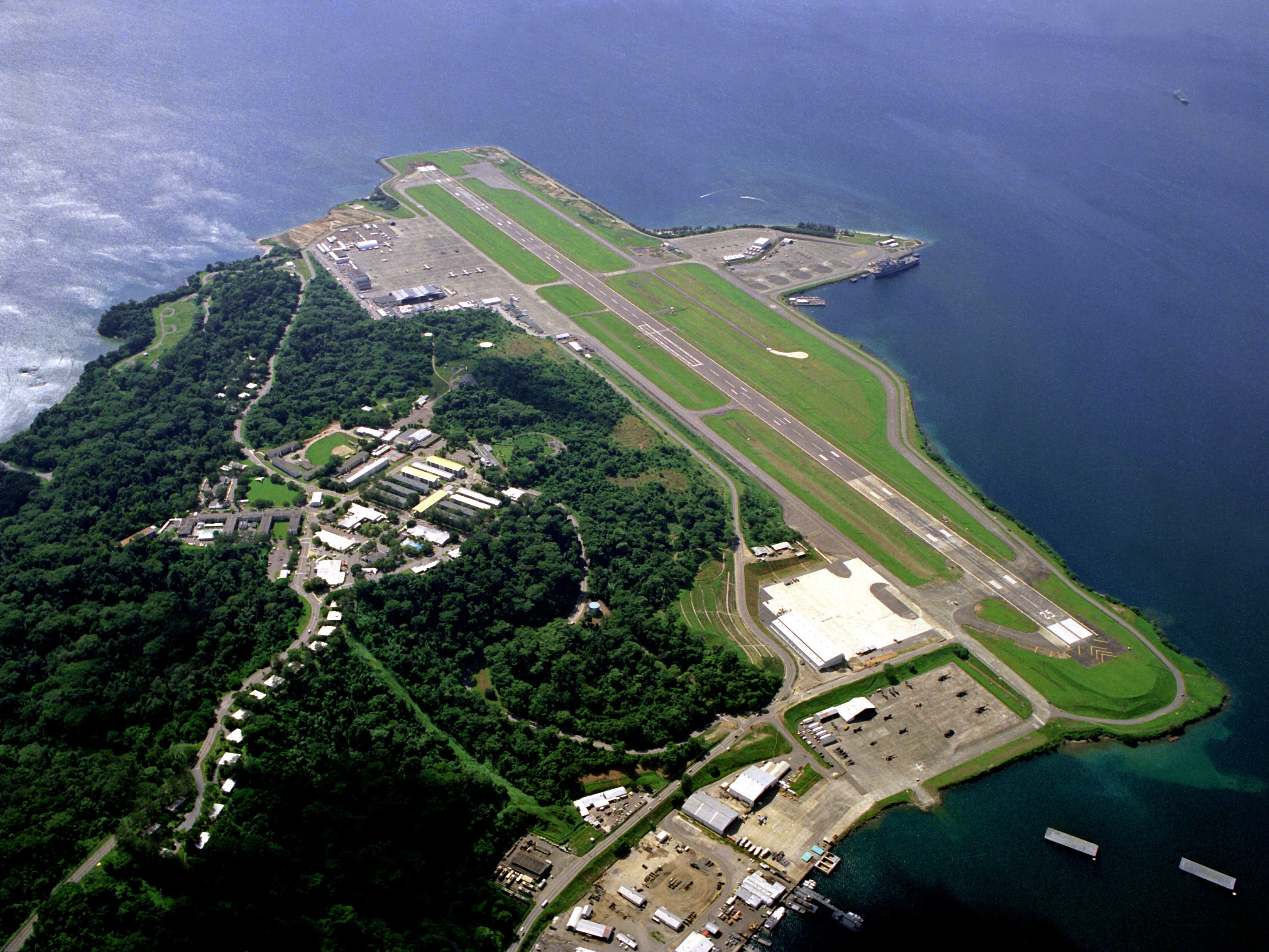
English: An aerial view of the runway and flight line of the U.S. Naval Air Station Cubi Point, Philippines, on 6 February 1988. |
|||
| Petsa | ||||
| Gigikanan |
|
|||
| Tagsulat | PH2(NAC) David Sanner, U.S. Navy |
| Camera location | | View this and other nearby images on: OpenStreetMap |
|---|
.jpg¶ms=014.794880_N_0120.272230_E_globe:Earth_type:camera__&language=ceb)
Pagtugot
This file is a work of a sailor or employee of the U.S. Navy, taken or made as part of that person's official duties. As a work of the U.S. federal government, it is in the public domain in the United States.
|
 | |
| This file has been identified as being free of known restrictions under copyright law, including all related and neighboring rights. | ||
Original upload log
The original description page was here. All following user names refer to en.wikipedia.
- 2006-08-25 12:43 SunKing 3000×2252× (2304748 bytes) ID: DNSC9300780 Service Depicted: Navy An aerial view of the runway and flight line. Location: NAVAL AIR STATION, CUBI POINT, LUZON PHILIPPINES (PHL) Camera Operator: PH2(NAC) DAVID SANNER Date Shot: 6 Feb 1988 {{PD-USGov-Military-Navy}}
Kaagi sa payl
I-klik ang petsa/oras aron makit-an ang hulagway sa payl niadtong panahona.
| Petsa/Takna | Thumbnail | Mga dimensyon | Tiggamit | Komento | |
|---|---|---|---|---|---|
| kasamtangan | 11:50, 5 Hunyo 2011 | | 3,000 × 2,252 (2.2 MB) | File Upload Bot (Magnus Manske) | {{BotMoveToCommons|en.wikipedia|year={{subst:CURRENTYEAR}}|month={{subst:CURRENTMONTHNAME}}|day={{subst:CURRENTDAY}}}} {{Information |Description={{en|ID: DNSC9300780 Service Depicted: Navy An aerial view of the runway and flight line. Location: NAVA |
Mga paggamit sa payl
Ang mosunod nga 2 panid misumpay niining payl:
Global nga paggamit sa payl
Kining ubang wiki naggamit ning maong payl:
- Paggamit sa en.wikipedia.org
- Paggamit sa es.wikipedia.org
- Paggamit sa eu.wikipedia.org
- Paggamit sa fa.wikipedia.org
- Paggamit sa fr.wikipedia.org
- Paggamit sa hu.wikipedia.org
- Paggamit sa id.wikipedia.org
- Paggamit sa it.wikipedia.org
- Paggamit sa ja.wikipedia.org
- Paggamit sa ms.wikipedia.org
- Paggamit sa nl.wikipedia.org
- Paggamit sa pl.wikipedia.org
- Paggamit sa ro.wikipedia.org
- Paggamit sa sv.wikipedia.org
- Paggamit sa th.wikipedia.org
- Paggamit sa tl.wikipedia.org
- Paggamit sa vi.wikipedia.org
- Paggamit sa www.wikidata.org
.jpg)